Cape Raoul - The Third Cape
/
Introduction
When you book the Three Capes Track 4 day walk, in SE Tasmania, you are actually only getting two capes for your money – Cape Pillar and Cape Hauy. This isn’t to say that it isn’t a fabulous experience – it is. The trail takes you along some of Australia’s most spectacular coast and cliffs. But if you want your full complement of capes then you need do a separate additional day walk to nearby Cape Raoul.
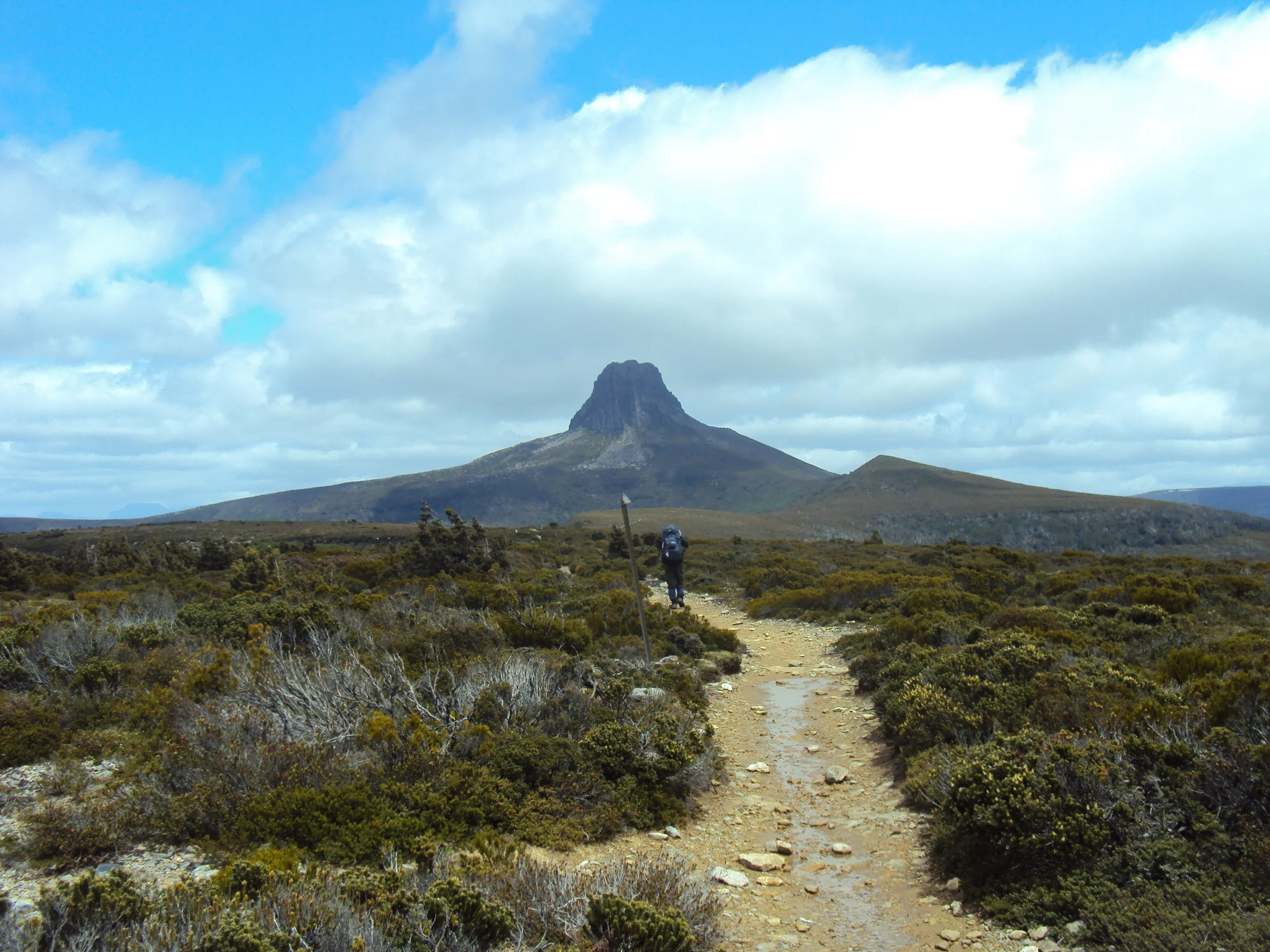
approaching cape raoul
As part of the development of the Three Capes Track the trail to Cape Raoul has been upgraded. This post describes our recent visit to Cape Raoul, our first since the track work was done.
The Walk
The Cape Raoul track starts on the Tasman Peninsula, just out of the town of Nubeena, at the end of Stormlea Road. The first part of the track is also the beginning of the track to Shipstern Bluff – Tasmania’s most famous big surf spot. Click here to read about our walk to Shippies.

From the recently enlarged car park the trail starts with an information booth with maps of the region.

Adjacent to the booth is a phytophthora cleaning station. Phytophthora is a root rot disease which can be easily spread on walkers’ boots, so cleaning them at the station provided prior to commencing the walk, is very important.

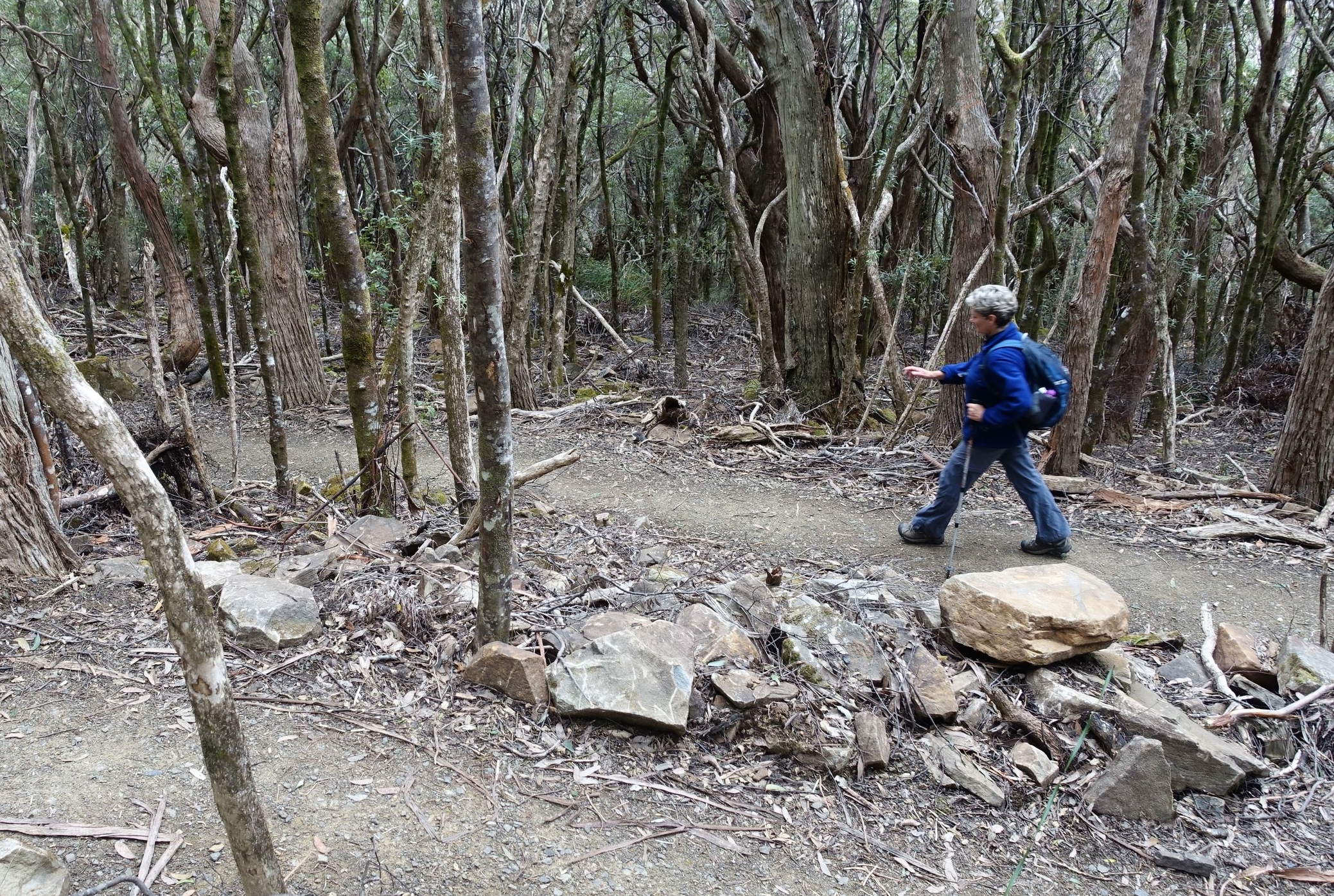
The first part of the track takes you through tea tree, acacia and bracken. Some of the track is duckboarded.

It then gradually ascends through Stringybark and Blue Gum forest.

The track work that has been done is apparent with new bridges, stone steps, duckboard and the occasional feature, such as a seat that is a work of art in its own right.

After 30 minutes or so we reached the junction of the Cape Raoul and Shipstern Bluff tracks.

The left fork took us on to the Cape Raoul Lookout after a further 15 minutes of walking. Even though the weather was a little hazy the views of Cape Raoul were impressive. The height of the lookout is 400m above sea level. Cape Raoul was to our left (east).

And Shipstern Bluff to our right (west).

The two enclosed viewing platforms here are welcome additions. We remember picnicking at this spot 20 years ago and spent most of the time preventing our then small children from falling to grizzly deaths off the unfenced cliffs.

After taking in the vistas we continued on. After another 15 minutes’ walk along the ridge the track descended switch-back style until we reached the plateau of the cape. We dropped 200 metres of elevation in the process.
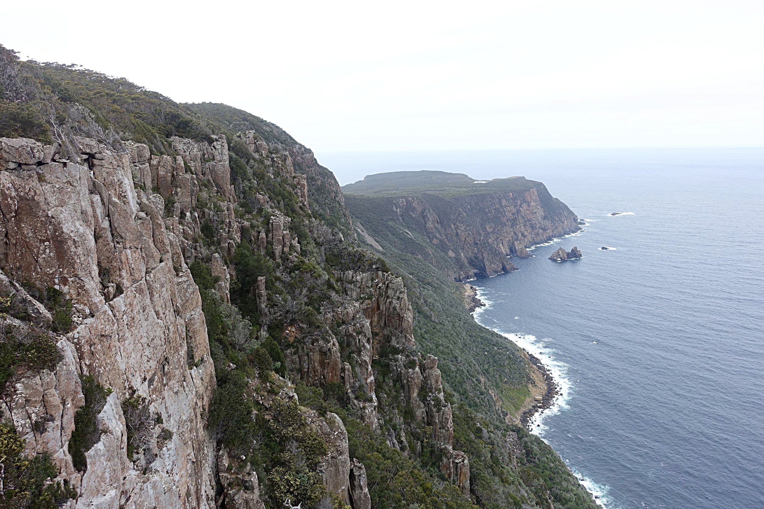
At various points on the descent excellent views to the west opened up.

The level path leading across the plateau was welcomed by our dodgy knees.

Views to the east above the scrub-line exposed the afternoon silhouettes of Tasman Island and Cape Pillar.

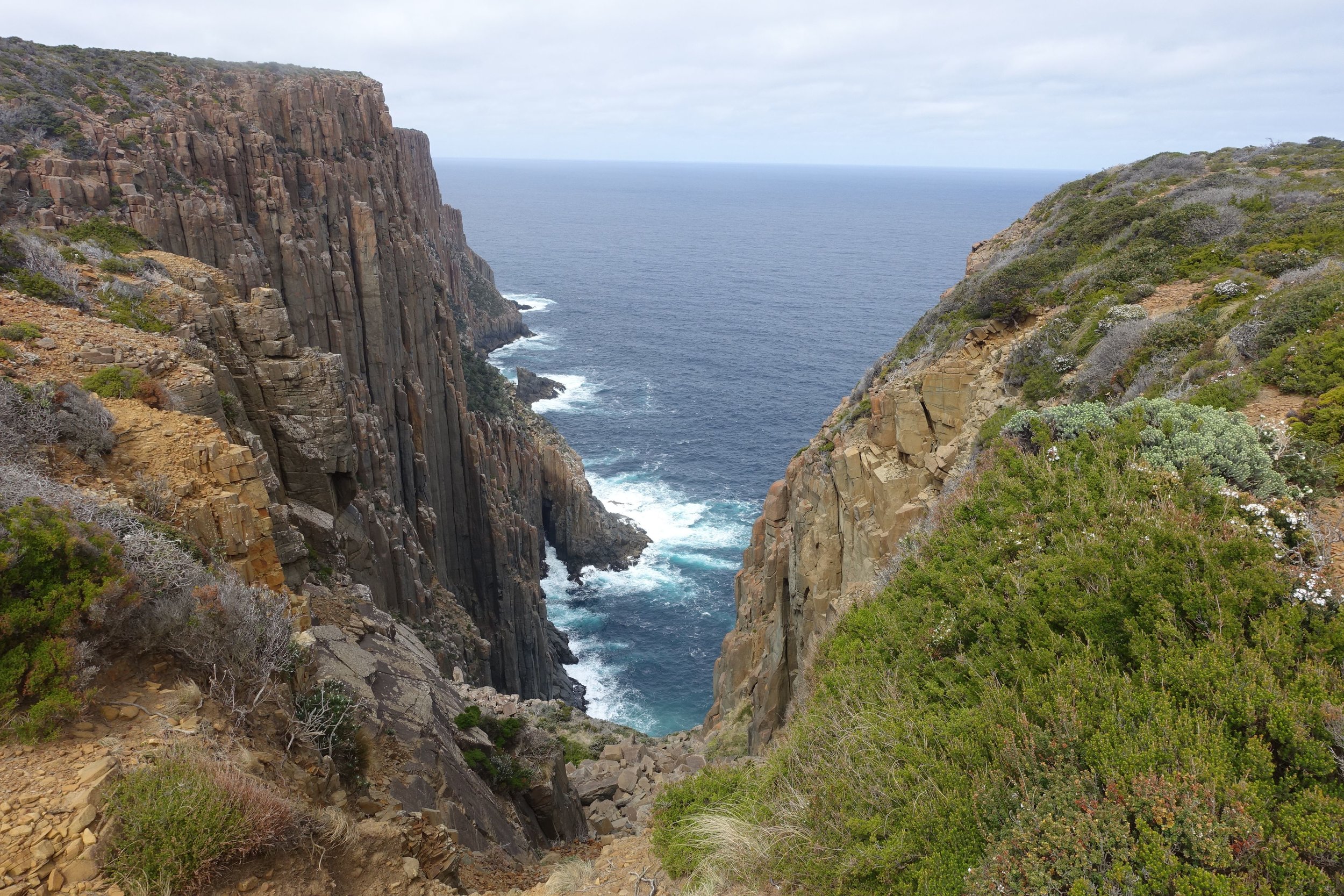
The track meandered to a viewpoint on a south facing inlet of the cape above 200m cliffs.

The trail also passed a small, brackish lake.

Just beyond the lake we came across an echidna curled up beside the track.

We then made our way along the final stretch until we reached a point near the end where the track splits leading to two enclosed viewpoints.

From the Cape Lookout we got further views of the coast adjacent to the Three Capes Track, Cape Pillar and Tasman Island.

From the nearby Seal Lookout we saw seals! Yes, it is aptly named, though the seals were a long way off, resting in a group at the base of a series of sea stacks.

Lacking a decent telephoto lens meant that we couldn’t get any good pictures (you’ll have to use your imagination). Though, in the still air, we could hear them.
Conclusion
We lunched at Seal Lookout before heading back via the same route which had taken us here.

The climb back up to the Cape Raoul Lookout was the hardest part of the whole walk.

The track signage at the start indicates 5 hours for the return walk (no breaks included). We think this is about right – two and a half hours each way. We took slightly less, walking at a fairly brisk pace for most of it.

The upgraded track, with good signage and safe viewing points, made for a very pleasant experience. And it doesn’t cost anything – only the normal national parks entry fee.

So, if you come to do the Three Capes Track, make sure that you don’t miss out on Cape Raoul – the Third Cape.
Ken and Cally
P.S. If you’d like to know how to do the Three Capes Track as day walks, without having to pay the fee to stay in the cabins, click on the highlighted text to have a look at our two posts on Mt Arthur and Mt Fortescue.