

The Tarkine Loop Drive
/
Trowutta arch
Introduction
The Tarkine Loop is a drive on a sealed road through a part of the Tarkine south of Smithton in NW Tasmania. The drive goes through a range of diverse landscapes, all within a short distance of each other. If you start at the southern end of the drive, as we did, you begin the loop with a dramatic lookout over the wild Arthur River. This is followed by a beautiful, short rainforest river walk, an unusual sinkhole lake, broad button grass plains, and finishes with the other worldly Trowutta Arch.
As a day trip it’s an easy way to get a taste of the Tarkine and an appreciation as to why the natural treasures of the region need to be protected. Here is a report on the loop we did on a wet February day.
Peggs Beach
I did the walk with good friend Graeme. We’d been to the Tarkine the previous summer to do a couple of walks (click here to read the post on these two walks). Despite living in Tassie neither of us felt we had a good understanding of the Tarkine region. Armed with the excellent Tarkine Trails book, produced by the Bob Brown Foundation, we decided to base ourselves near Stanley on the NW Coast and do a bit of exploring around that part of the Tarkine for a couple days.
When a wet morning greeted us on our last day, we decided that it was a perfect day to do the Tarkine Loop Drive. If the weather deteriorated, we could simply stay in our vehicle, but if it was ok, we could do short forays out at each stop.
The drive began with a quick stop at Peggs Beach, just east of Stanley, where we got a good view of Stanley’s Nut.

the nut from peggs beach
We then headed west the short distance to Smithton, then south to Edith Creek before continuing further south on the C218. The drive can be started at either the southern or northern end of the C218. We chose the south.
Sumac Lookout
Our first stop was Sumac Lookout. You can’t miss the muscular signage.

From the car park it’s a one minute walk down a short trail to a great view over the Arthur River with surrounding temperate rainforest.

Arthur river from sumac lookout
Julius River
Adjacent to the car park at Julius River is the beginning of a short rainforest walk.

The 10 – 15 minute return walk takes you through myrtle forest beside and over the Julius River.

The well-made track ends after five or so minutes. You can either return via the same route or complete the walk as a circuit on a more basic bush track. There is also a longer, one hour sinkhole walk if you’re feeling energetic.

Julius Creek has good picnic, barbeque and toilet facilities.

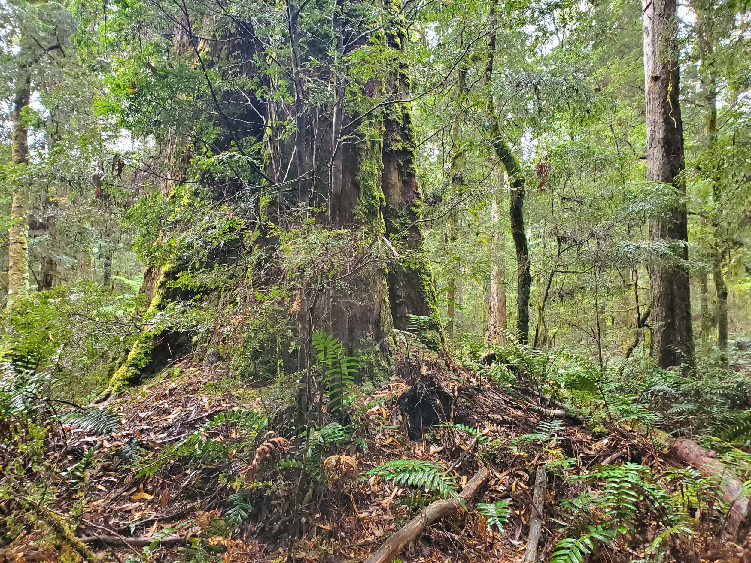
Lake Chisolm
A short drive up a side road off the C218 is Lake Chisolm. Lake Chisolm is a limestone sink hole lake nestled amongst thick myrtle rainforest.

There are no creeks or rivers running out from the lake.

The leisurely walk from the car park is 30 minutes return.

And takes you past some impressively tall trees.

Dempster Plains Lookout
From the car park a short 2 – 3 minute walk up a modest grade takes you to a viewing platform. From here there is an expansive view of the button grass plains with patches of forest.

We had read that it was possible to do a 42 km loop mountain bike ride around the plains. But we were in a more sedate mood when we visited and were happy to just take in the scene.

dempster plains
Close to Dempster Plains Lookout is Les Beckett Falls. Unfortunately, the falls were closed when we were there.
Milkshake Hills
On our way to our next scheduled stop, the interestingly named Milkshake Hills, we pulled over to check out a small sinkhole lake beside the road.

We also spotted a young Tassie devil beside the road.

At the Milkshake Hills we wanted to do the 10 minute forest walk. We also wanted to walk along the path that goes to the top of the hills far enough to get a good view of the Milkshake Hills. We didn’t intend to do the full 1.5 hour return trip to the top. Both walks start at the car park.

The well made track begins promisingly enough.

After a few minutes the main track up the hills splits off from the forest loop track.

We walked up far enough to get a clear view. The hills look a bit like old fashioned milkshake containers from back in the day. Not sure if that’s where the name comes from.

milkshake hills - not looking very miklshakey
We returned to the rainforest loop track which continued on through some heavily logged and bushfire damaged forest.

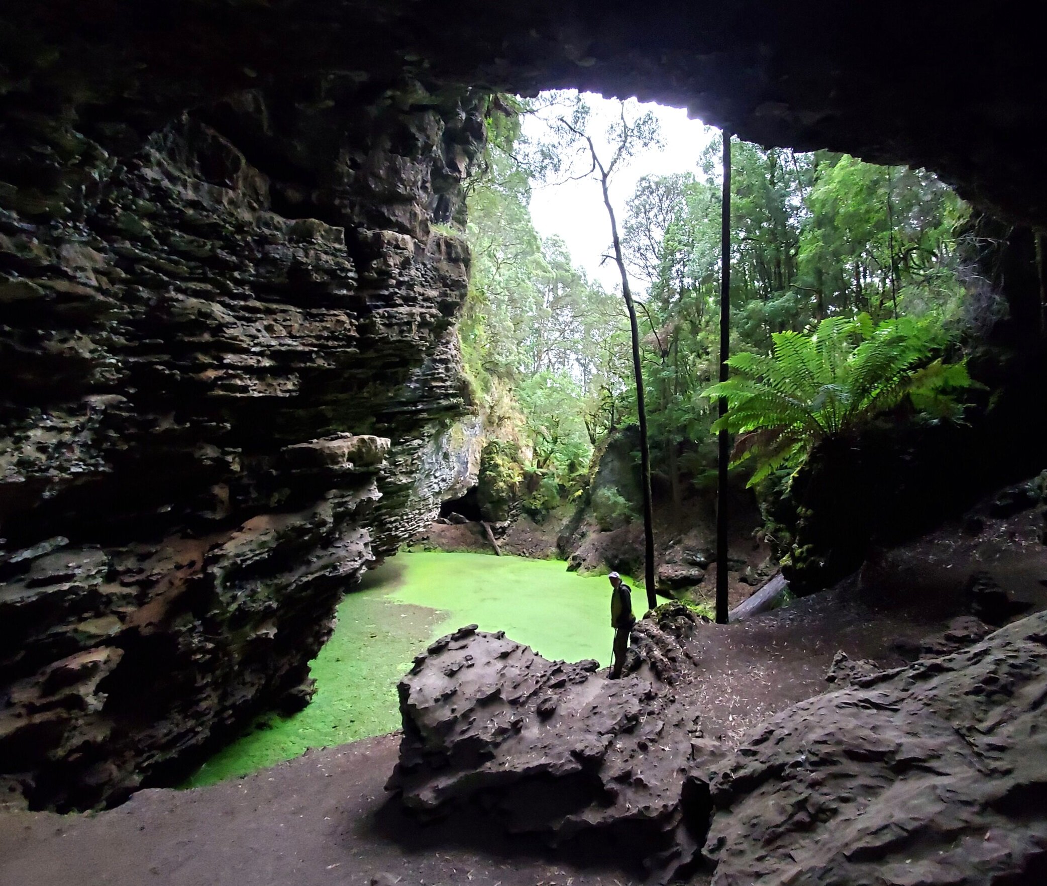
Trowutta Arch
Our last stop on the drive was Trowutta Arch. The arch is reached after a 15 minute easy walk from the car park.

the walk to the arch is easy
The arch frames the way to a water filled sinkhole.

It has a strange feel to it, with the bright green algae of the lake providing a stark contrast to the surrounding grey rock. It was very quiet and a little eerie.

It was then back to the car and the return drive to our campsite near Stanley.

Conclusion
This easy day trip was an ideal way to get a good feel for this part of the Tarkine and can be done in all weathers. The road is sealed so no need for a four-wheel drive vehicle. On our previous day we had visited the impressive Dip Falls. Dip Falls is formed from hexagonal basalt columns, not a geological feature common in Tasmania.

dip falls from the lower viewing platform
There are viewing platforms on either side of the falls.

from viewing platform at the top of the falls on the other side
Just one kilometre on from the falls is a Big Tree reserve. It has a 10 minute circuit walk.

The Tarkine Loop Drive, Dip Falls and Big Tree are just a few of the many things to experience in this northern part of the Tarkine, close to Stanley and Smithton. It’s a great part of Tasmania. We’ll certainly be back.
Ken


