

West Coast Wilderness Railway (with Six Bonus Mini-Walks)
/
Introduction
The West Coast Wilderness Railway (WCWR) is a premier tourist attraction in west Tasmania. The railway was originally built in the 1890’s to move copper from the Mt Lyell Mine in Queenstown to the port of Strahan, a distance of 34.5kms. It was considered to be a major engineering feat in its day as it used an innovative approach, known as the ABT rack and pinion system, to propel the train up and down previously unimaginably steep terrain. It was named after its Swiss inventor, Roman Abt and ran from 1899 to 1963.
After many years of campaigning by dedicated West Coast locals, funding was secured from the state and federal governments in the 1990’s to restore the railway. It commenced as a tourist train in 2002.
We had ridden the first short section of track that was restored and opened in the early noughties. It went from Queenstown to Lynchford. This was prior to the opening of the full line from Queenstown to Strahan. We decided that we were overdue in experiencing the full WCWR journey so headed over to the west to rectify this oversight.

We spent a few days there, and in addition to the train trip, we did a number of short walks which we’ve added to this post.
Note: If you’d like to know more about the history of the WCWR and other tourist options in the region here are a couple of useful links.

Discover Tasmania - West Coast Self Drive
WCWR: Strahan to Dubbil Barril
We had originally booked to do the full length of the line in one day (9 hours)– leaving from Strahan and arriving in Queenstown then returning to Strahan by coach. But problems with the rack and pinion system on the Strahan based engine meant that this trip was cancelled. As an alternative we were offered two half day trips – Strahan to Dubbil Barril (the half way point) and return on one day (4 hours); and Queenstown to Dubbil Barril and back (4 hours) on a second day. We were happy to agree to this change of plan.

We gathered at the Regatta Point Station in Strahan around 8.30am for a 9.00am departure on our first leg. It was a Thursday in late March, so we’d wondered if it’d be busy. As things turned out it was full, with the majority of passengers being interstate grey nomads touring Tassie, along with a sprinkling of international tourists and local Tasmanians.
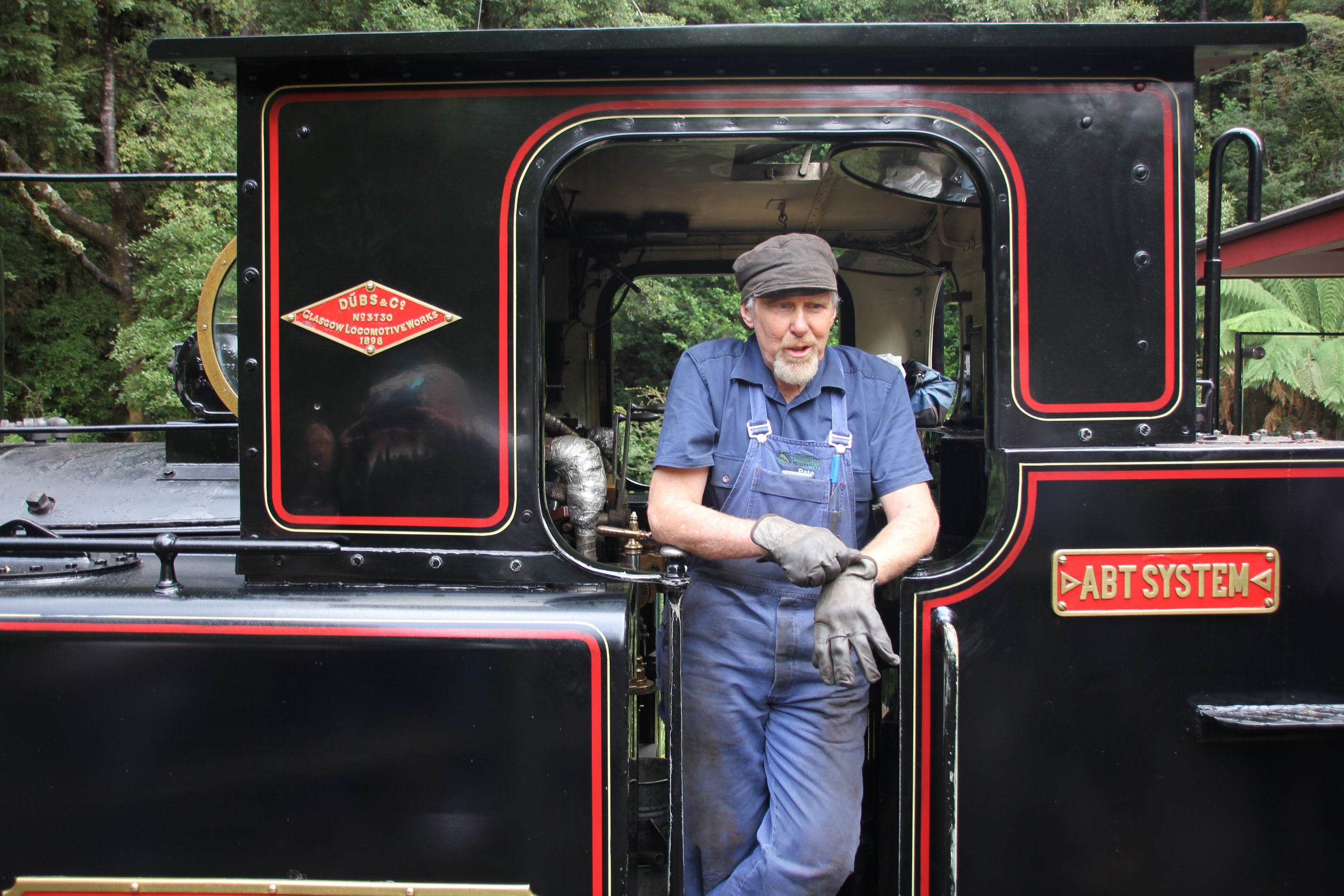
We watched the huffing and puffing of the engine being positioned in place. This process involved two men pushing the steam locomotive 180 degrees on a turntable to get it onto the correct track.

positioning the engine on the turntable
We were then off on our way following the coast along Macquarie Harbour. After a while the line paralleled the King River. We crossed a number of bridges.
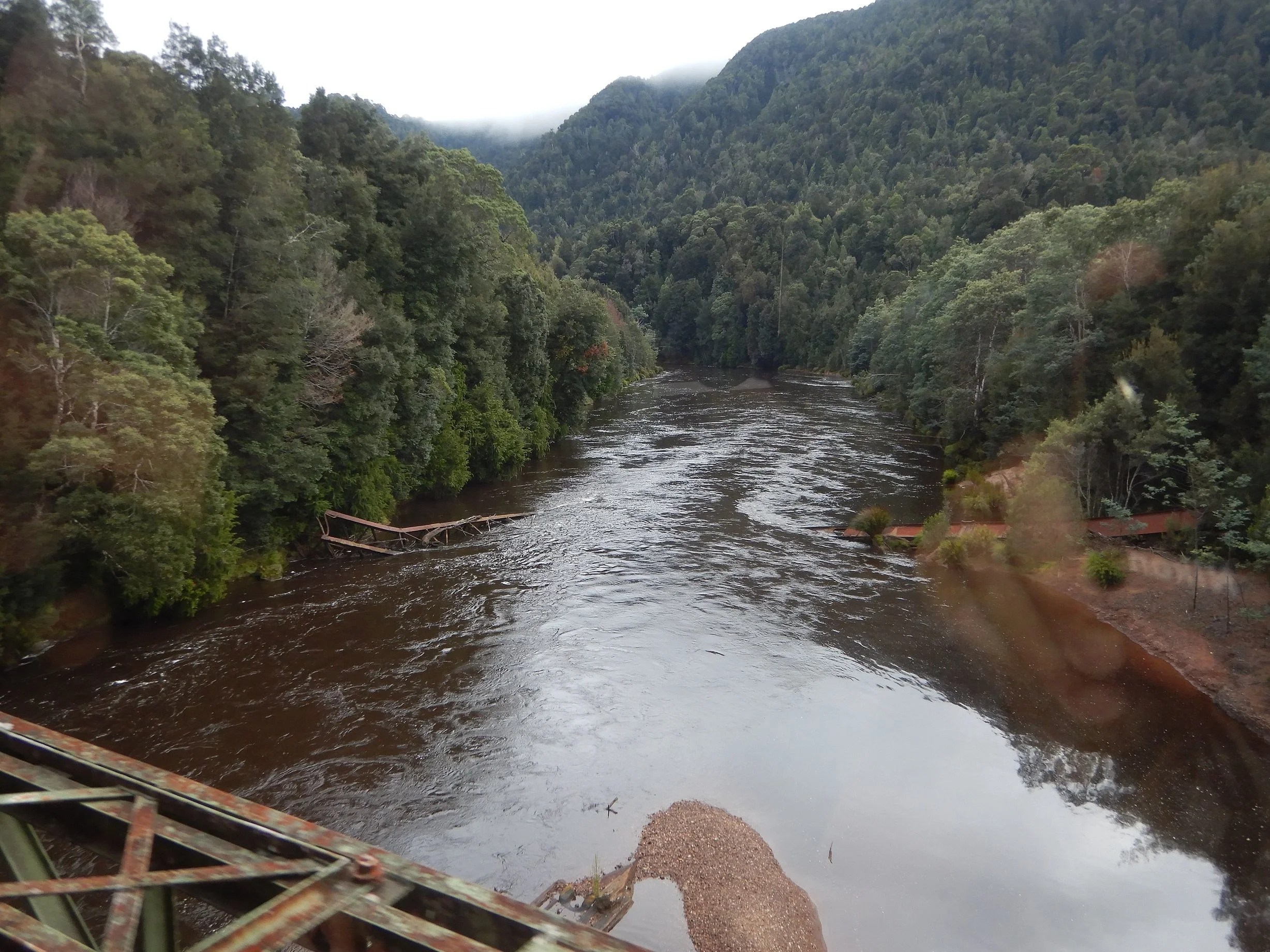
crossing a bridge over the king river
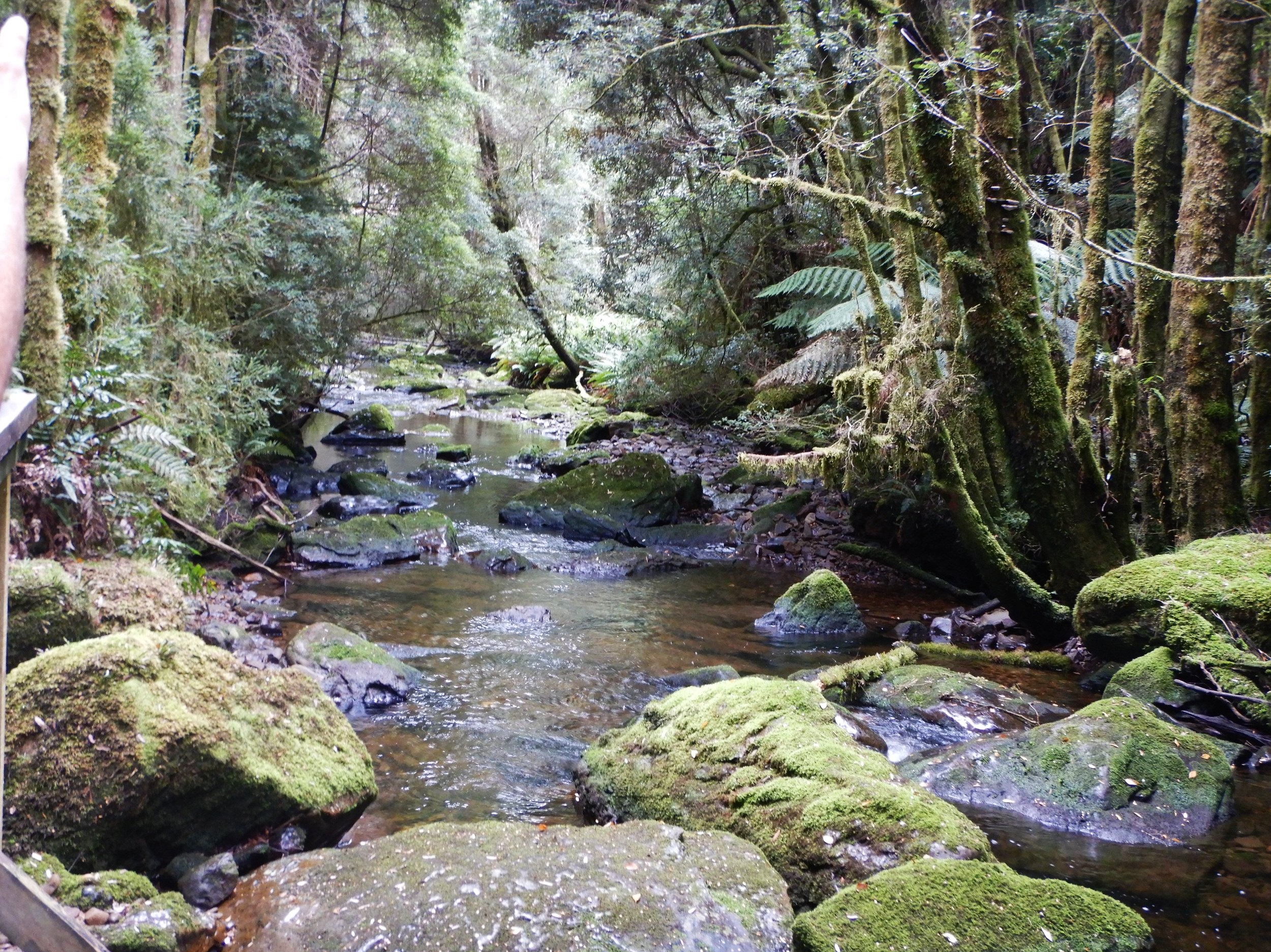
We stopped at Teepookana where we did a short river walk.

king river at teepookana
At Dubbil Barril the engine was repositioned, connecting it to the other end of the line of carriages, so that we could return to Strahan via the same track.

switching the engine around via the turntable at dubbil barril
At this point passengers swapped sides with those directly opposite. This meant that each person got to experience both sides of the track and did one leg facing forward and one backwards. Very fair.

You might be wondering about the spelling of Dubbil Barril, as opposed to Double Barrel. Our informative guide gave several possible explanations for the unusual spelling. But you’ll need to take the trip if you want to know what they are.

With the engine in place we steamed back to Strahan.
Queenstown to Dubbil Barril
Two days later we assembled at Queenstown Railway Station to do the second half of the line.

At 9.00am on the dot we headed out of Queenstown township.

Our first stop was Lynchford. Here we had a 20 minute break and managed to fit in a spot of gold panning which had been the raison d’etre for Lynchford’s establishment.

The track followed the heavily polluted Queen River for a while. The brown, sludgy look due to residues dating back to the copper mining days, which only stopped putting pollutants in the river in 1994.

the queen river
Next stop was Rinadeena. This had been a substantial settlement in the rainforest, established to build the railway through the toughest part of its route, with thick forest, steep climbs and deep gorges. We were able to do a bit of exploring in the immediate environs of Rinadeena Station.

old mine - rinadeena
The most dramatic part of the trip was the climb up the mountain where the train employed its rack and pinion system.

rack and pinion display
We travelled through the thick rainforest.

We had great views of the King River Gorge.

king river gorge
The train then proceeded the remaining short distance to Dubbil Barril, thus completing the full distance of the line for us. After giving our loco a well-earned drink ….

And switching it to the other end via the turntable we headed back to Queenstown.
Conclusion
We enjoyed both trips. If we had to choose one over the other, we would say that the Queenstown out and back trip was the more spectacular.

The commentary on both legs was excellent – being both informative and entertaining.
We were pleased that we took the time to travel to the West Coast to ride the West Coast Wilderness Railway. Definitely worthwhile.
Bonus Mini-Walks
There’s a lot more to visiting the West Coast of Tassie than just the railway. For example, there are plenty of short walks all around the region that provide a diverse range of sights. We thought we’d give a quick mention to six which we did on our recent trip to Queenstown and Strahan.

yacht moored off strahan
We’ve called these six walks mini-walks as none are very long. We think the longest is about 1 km, though there is a beach walk which you can make as short or long as you wish.
Franklin River Nature Trail
On the Lyell Highway 60km east of Queenstown is this short, scenic walk along the upper reaches of the Franklin River.
The one kilometre circuit takes you through lush rainforest.

It’s a flat walk suitable for strollers and wheelchairs.

Nelson Falls
After doing the Franklin River Nature Trail, if you drive another 30kms towards Queenstown down the highway, you’ll reach the car park for Nelson Falls.

This is an easy 10 minutes each way walk from the car park to the falls on a flat, wheelchair friendly track.

The path leads through thick rainforest before emerging into an open area and behold – the impressive Nelson Falls!
Macquarie Heads
The entrance to the enormous body of water that is Macquarie Harbour, upon which Strahan sits, is Macquarie Heads aka Hells Gates, a treacherous stretch of water for vessels to navigate to enter the harbour.

Macquarie heads. Can you spot the small lighthouse on entrance island?
From Strahan the C251 leads out to the heads. We parked at the end of the road where there is a camping ground. From here a short, sandy path leads to the beach and you can then walk all the way down to the heads, opposite Entrance Island with its small lighthouse.

Bonnet Island Lighthouse
Bonnet Island Lighthouse can also be observed on the opposite shore.

ocean beach
You can continue up Ocean Brach on foot or drive a short distance north to another car park and access Ocean Beach from there.
Spion Kop Lookout
Spion Kop Lookout sits on a hill overlooking Queenstown.

view from spion kop
The short walk to the top affords good views of the township.

This includes good views of the Railway Station, a dominant presence.
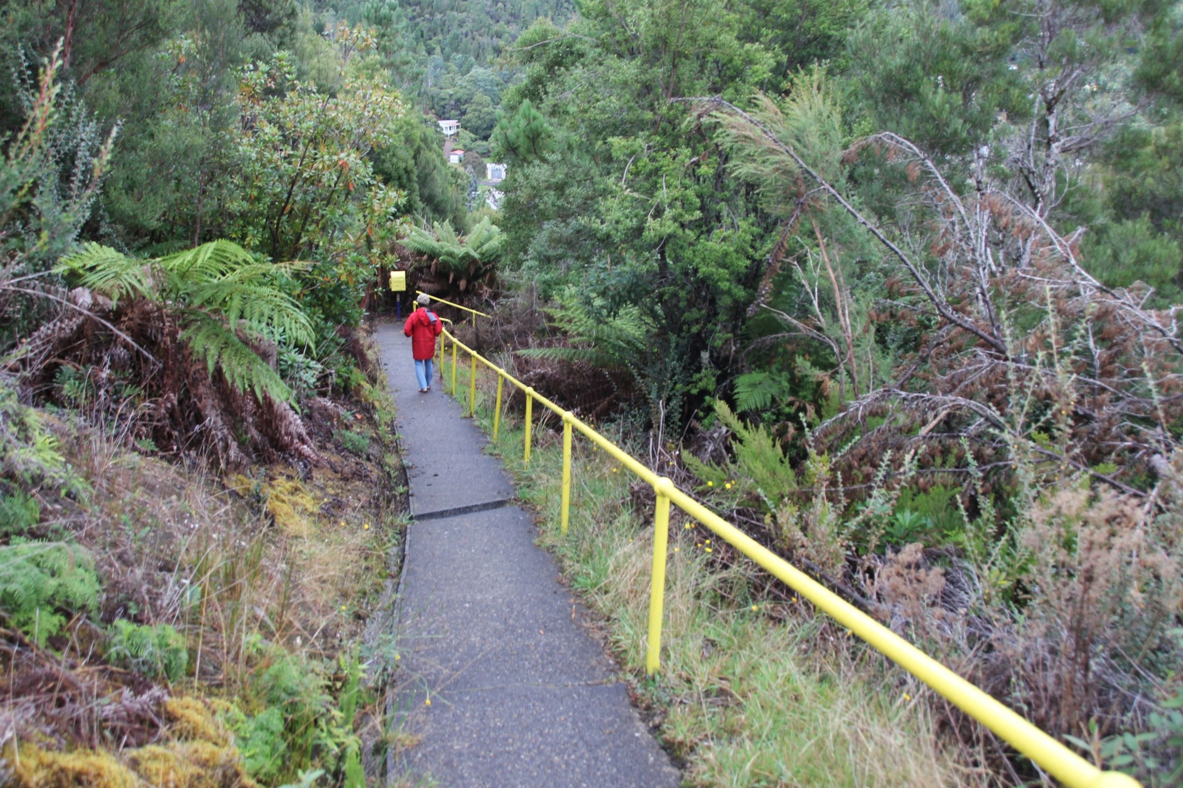
heading back down from the lookout
It was named in honour of a Boer War Battle which took place at a location in South Africa called Spion Kop (meaning spy hill in Afrikaans), and where many Commonwealth troops lost their lives.
Iron Blow
Iron Blow is a big hole in the ground full of water, a remnant of past mining operations. It’s not really a walk at all, as you can drive right up to the viewing platform.
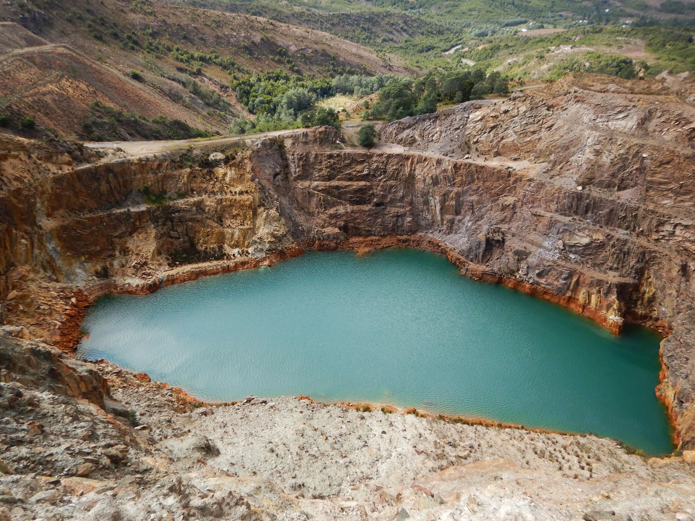
iron blow
The turn off is 5kms east of Queenstown on the Lyell Hwy directly opposite the car park for Horse Tail Falls.

Horsetail Falls
Even if there is not a lot of water in the falls the Horsetail Falls is still worth doing for the impressive boardwalk that clings to the side of the mountain.

The half kilometre stretch of boardwalk hugs the cliff face and is a great piece of engineering.

If there has been recent rain the falls are also a pretty good sight.
Ken and Cally


