
Arthurs Peak Day Walk, Tasman National Park
/(a Bit of the Three Capes Walk Without the Pricetag)

Introduction
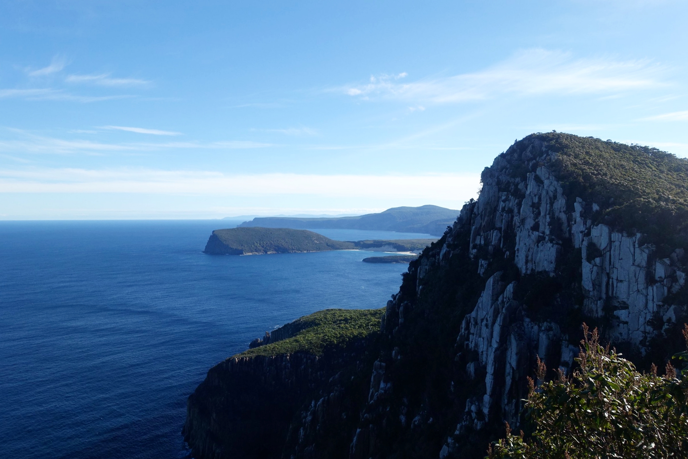
For people doing Tasmania’s new premier walking experience – the Three Capes Walk – Arthurs Peak is the first serious elevation that provides spectacular views of the huge coastal cliffs, Cape Raoul and Crescent Bay. The stunning views provide an early taste of what’s to come.
The stretch of track to reach Arthurs Peak from where walkers start their trek at Denmans Cove was purpose built for the Three Capes Walk. It is not accessible to walkers other than those paying for the Three Capes Walk.
But that doesn’t mean that non fee-paying walkers can’t visit Arthurs Peak. In fact, Arthurs Peak has long been visited by bushwalkers via another route. But with the advent of the Three Capes Walk and paying customers we were unclear as to whether it was still possible to visit Arthurs Peak by following the old route in. Web searches, and even a call to the National Parks Service, still left us uncertain, but encouraged that it was likely to be doable.

eucalypt forest on the old cape pillar track
So, with regular walking companion Graeme, we set out to clarify the situation for ourselves and hopefully, in the process, succeed in reaching Arthurs Peak. And to do it all as a day walk.
The Start
The starting point for our walk was via Fortescue Bay in Tasman National Park, which is around 1.5 hours drive from Hobart.
We had some old walk notes and a map which stated that the way to Arthurs Peak was via a track that led directly to Cape Pillar. This track used to start on the access road into Fortesque Bay, two or so kilometres before reaching the park entrance, but nowadays it starts just short of the park entrance.
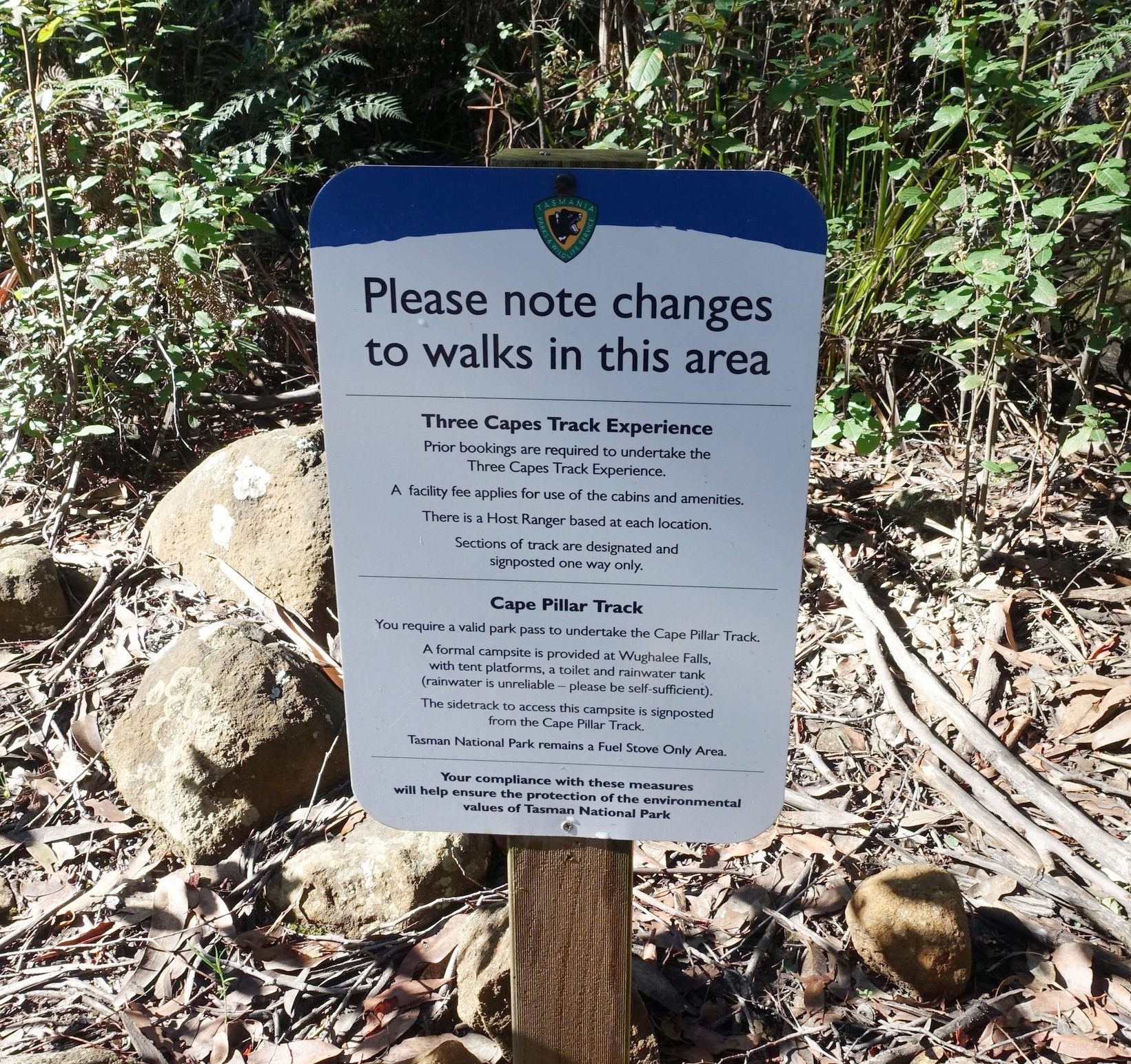
sign at the start of the old cape pillar track
It is called the Old Cape Pillar Track and is clearly signposted. Information is also provided about free camping on platforms, along with a toilet and water tank at Wughalee Falls.
We estimated that the new section of the Old Cape Pillar track links up with the original track after around an hour. So, if you’re using an old map that has the original track marked it’s still valid as long as you allow for this change to the starting point.

the beginning of the track
We headed off down the trail, crossing a small, fairly new metal bridge early on.
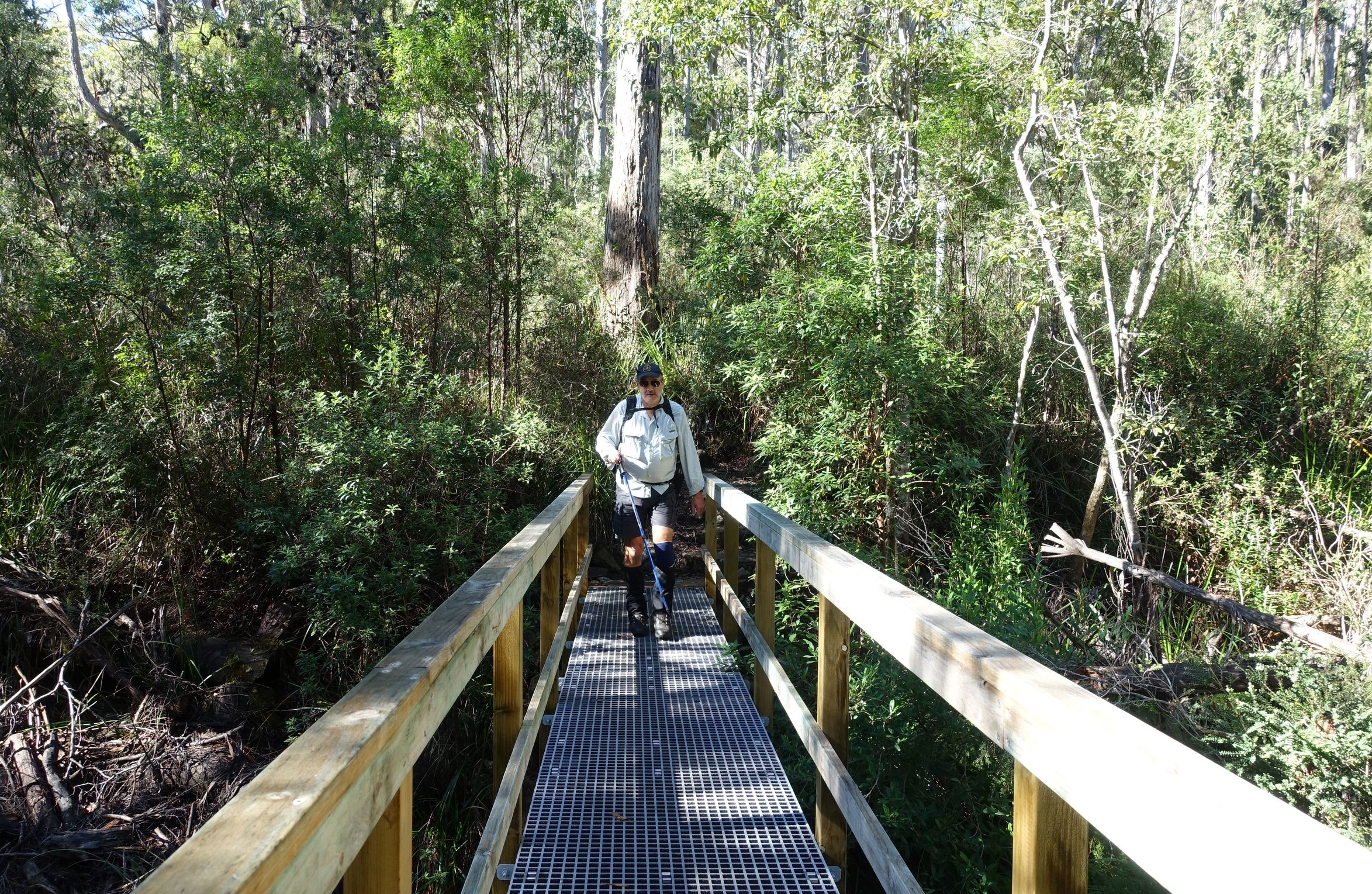
We continued through gum forest climbing over the shoulder of Snake Hill.

Not long after commencing we met a National Parks ranger who was coming out from Cape Pillar. He was very helpful providing us with current info on the Arthurs Peak track. Yes, it still exists. And as expected, its not particularly well marked, so we’ll need to pay attention.
Buoyed by this news we picked up the pace and promptly walked straight past the turnoff (which we knew was going to be on our right). Some 15-20 minutes after missing the turn we realised our mistake, back-tracked and found it. We estimated we walked an extra, unnecessary 2kms.

the arthurs peak track
The turn was as the ranger had described, with branches placed across the entrance to avoid Cape Pillar walkers inadvertently taking it. There were a couple of bits of coloured tape, and rocks piled in a sort of cairn on a tree stump. As the saying goes, if it’d been a dog it would’ve bitten us, but we somehow managed to miss it first time around.
A further tip: not far past the Arthurs Peak turn off there is an old sign on a tree “Water” pointing down to what we presumed was a creek. If you’re doing this walk and reach the water sign, you’ve come too far.

Old Arthurs Peak Track
Having found the track, we pressed on through dry sclerophyll forest, across Denmans Creek (which had a little water in it) then up a small rise. We then crossed a button grass plain heading in a south westerly direction, with Crescent Mountain on our left.

battling the scrub
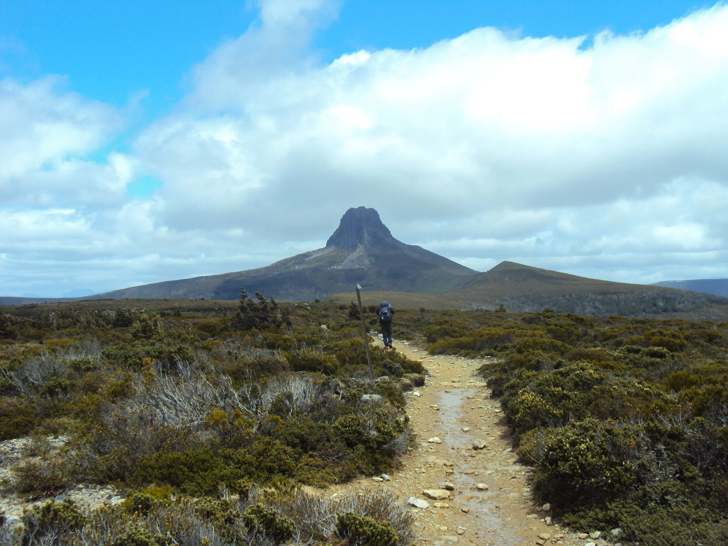
After much battling with thick tea tree scrub and sedge across a long plain we finally reached the beginning of the rise up to Arthurs Peak.

arthurs peak ahoy
A short way up we encountered a phytophthora cleaning station, which the ranger had mentioned to us. Phytophthora is a plant disease that causes dieback and it can be quite devastating in its destructiveness. It can be easily spread on hikers boots by moving from a diseased area to a disease free one.

Cleaning stations sterilise walking boots and thereby reduce the spread of the disease. Many walks in Tasmania have such cleaning stations and it is critically important that walkers use them.

We gave our boots a thorough clean and then continued out ascent, taking in views to our right of the area around Denmans Cove, the official start of the Three Capes Walk.

the view towards Denmans cove
Eventually, our trail popped out on the Three Capes Track, part way up the steps that lead to the peak. The track’s stone masonry is impressive and felt more like something built by the Romans than a Tasmanian bushwalking track.

the point where the three capes track meets the old arthurs peak track (on the right of shot)
We headed up the steps to the top where we had a well earned break and took in the fabulous views.

Crescent Bay and Brown Mountain were prominent in the foreground with Cape Raoul in the back.

The good, clear autumn weather (mid-April) blessed us with exceptional vistas.
arthurs peak in the foregroiund
Leaving out the extra couple of kilometres we did by missing the turn off the walk to the peak had taken us around three hours.
The Return
When it was time to leave we followed the Three Capes Track for the next four or so kilometres across the Ellarwey Valley to where the track intersects with the Old Cape Pillar track we’d come in on.

on the track from arthurs peak to the junction with the old cape pillar track
This intersection point also has signposting to two of the Three Capes fee-paying cabins, Munro cabin, which is down the track closer to Cape Pillar, and Retakunna cabin, where walkers stay on their final night.

We’d been to Cape Pillar over ten years prior to now with our sons, Gavin and Zac, who were then in their early teens. This was well before the Three Capes walk was developed. So, we knew how fantastic the views are of Tasman Island and the Blade, and therefore didn’t feel the need to revisit it on this occasion. If we had this would’ve required overnight camping for one or two nights at nearby Wughalee Falls campsite. Another time.

tasman island from cape pillar (shot taken on an earlier trip)
It was now getting late in the day at around 4.30pm, and in April it can be dark by 6.00pm so, rather than stick to the Three Capes track and take the longer route back to Fortescue Bay (which goes over Mt Fortescue and has a side-track to Cape Hauy), we decided on the quicker route, which was back down the Old Cape Pillar Track.

With fading light we made our way back to starting point and the car. In total the circuit had taken us around seven and a half hours, which included half an hour of breaks and another half an hour with our early stuff up. We estimate the walk to be around 16-18kms doing it this way.

heading for home
Conclusion
We’d set out to reach Arthurs Peak in order to take in the scene that we’d heard was pretty special. We achieved this goal.
But we also wanted to clarify what was permissible for walkers to undertake in this region of Tasman National Park for those who were not fee-paying customers of the Three Capes Walk. To our delight we learned that most of the new track is accessible, as long as you pay the normal national parks entrance fee (we have annual National Parks passes, but you can just buy a day pass if you’re visiting).

fortescue bay
To go to Arthurs Peak you do need to do it how we did, via the Old Cape Pillar track and the old Arthurs Peak track. You can not walk up the new trail against the foot traffic coming from Denmans. This is important for avoiding the spread of phytophthora, so totally justifiable.

cape pillar
You can also visit Cape Pillar and take it all in by coming in via the Old Cape Pillar track and enjoy the free camping at the Wughalee Falls site. You just need to be self-sufficient.
All in all a successful walk, both in terms of the experience and what we learned.
Ken
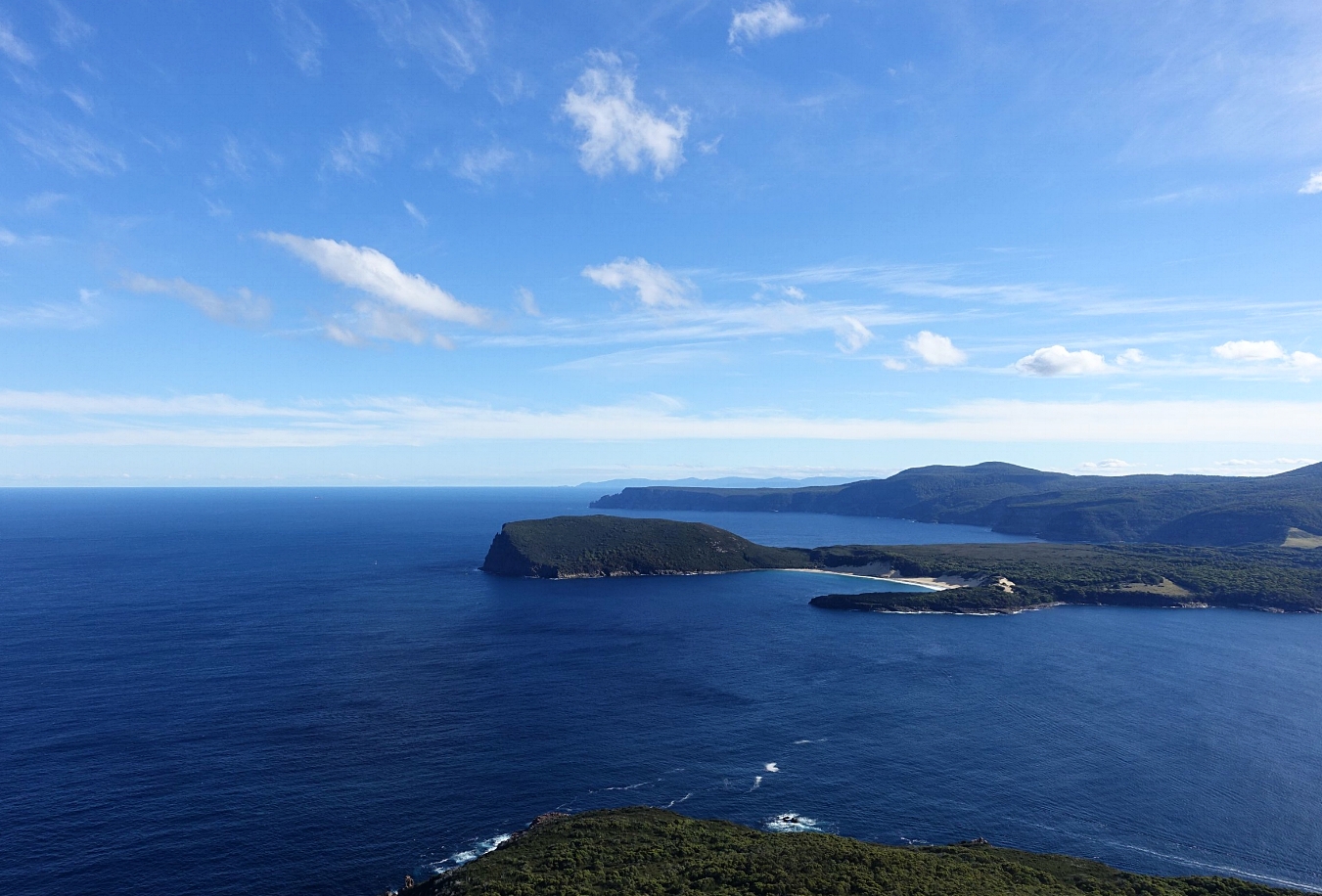
crescent bay and brown mountain in foreground with cape Raoul behind


