

Highlights of Argentinian Patagonia
/
Fitz Roy Range, El Chalten
Argentinian Patagonia is a big place. It starts in the north around the pretty city of San Carlos de Bariloche and extends down to Ushuaia in Tierra del Fuego at the southern tip of South America and from the Andes to the Atlantic. It is a region that you can spend weeks, even months exploring.
With our more limited time we decided to focus on three of Patagonia's main attractions: El Calafate and the Perito Moreno Glacier; El Chalten and it's mountains, particularly Cerro Fitz Roy; and Bariloche and the Lake District.
El Calafate and Perito Moreno Glacier

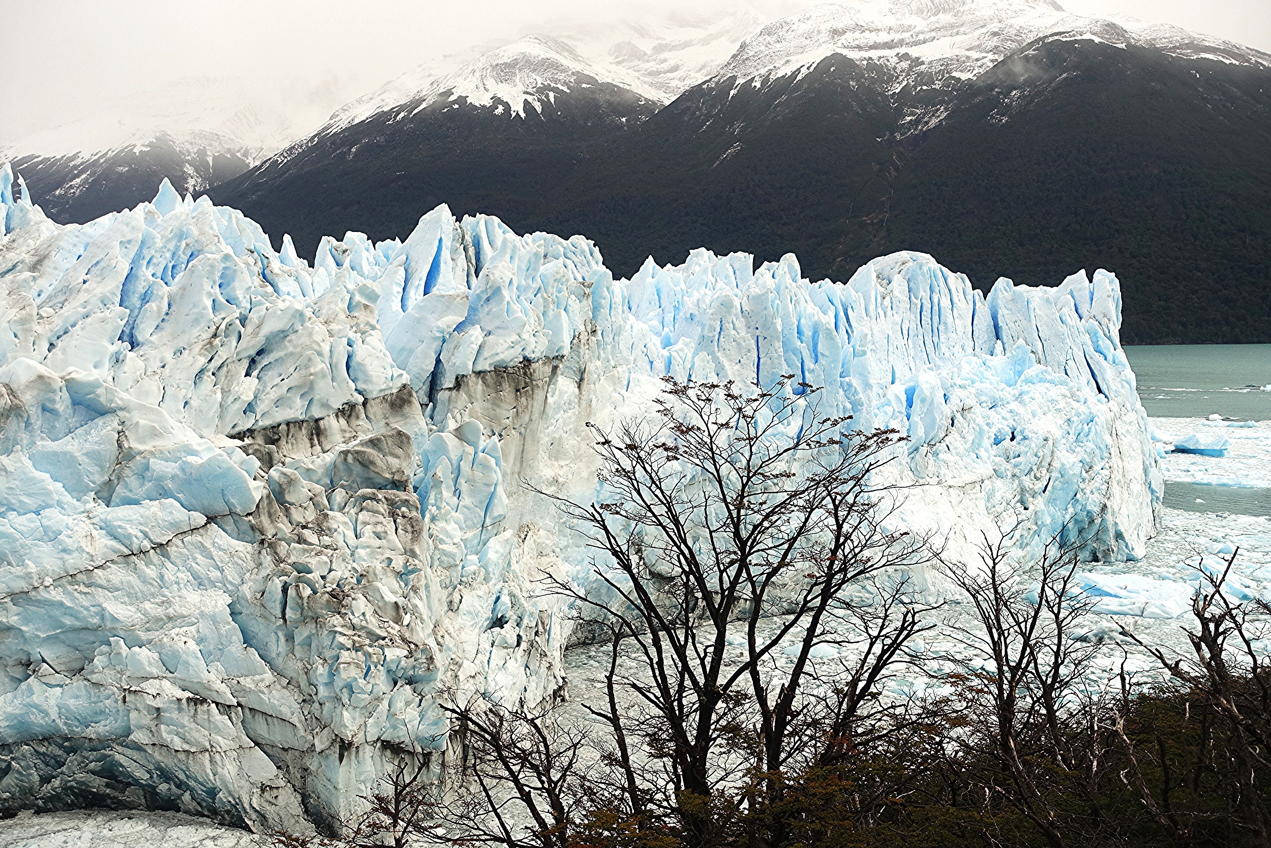
Perito Moreno Glacier
El Calafate is a tourist town of some 20,000 or so inhabitants in Southern Patagonia. It's a pleasant enough town, but by far the main reason people come to El Calafate is because it is the gateway to Glaciar Perito Moreno and other glaciers in Parque Nacional Los Glaciares.
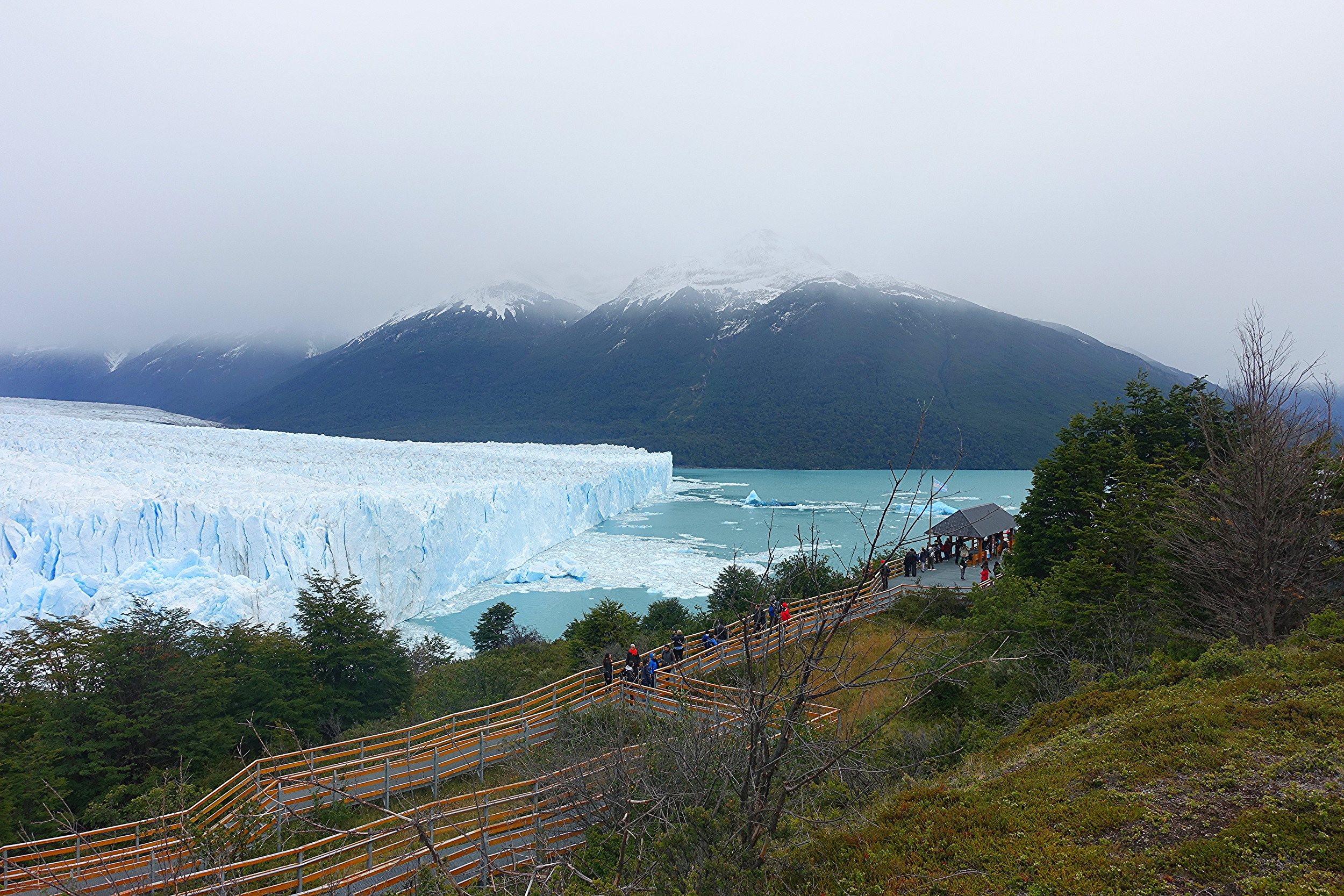
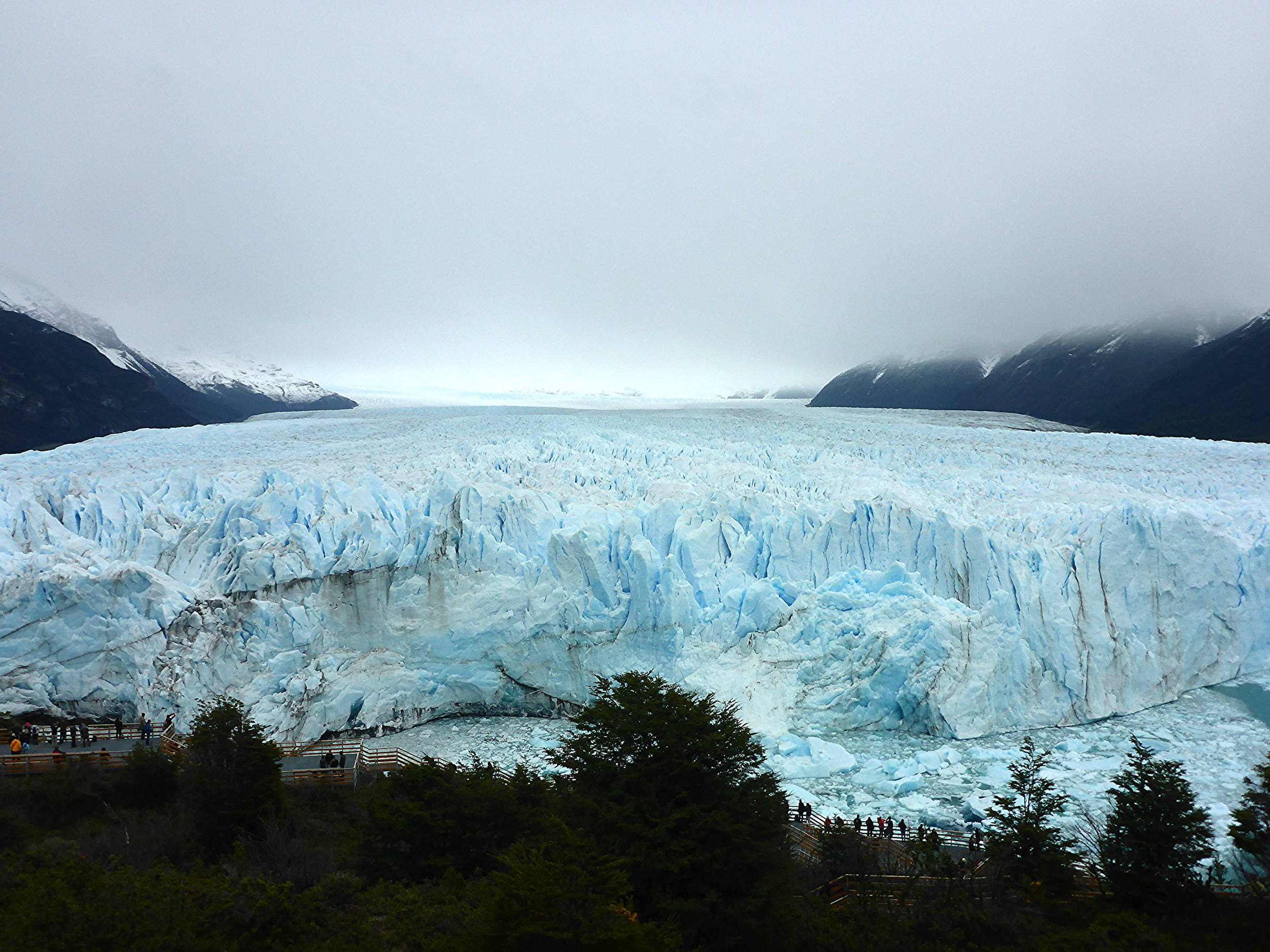
Perito Moreno Glacier is a spectacular sight. It is 5km wide, 35 km long and stands 60m high – a huge wall of ice which regularly carves great icebergs into the adjacent Lago Argentino. It appears on various lists of ''great natural wonders of the world”.
From an independent travellers point of view the first thing to say about visiting the glacier is that it is easy to do on your own. While there are plenty of tour companies offering trips with a guide, lunch etc, there are also a number of bus companies offering the return trip to the park for around $AUS45/$US32. Along with park entry of $AUS25/$US18, it was not an expensive day out for such a great experience.

If you decide on a bus trip out to the glacier, make sure you sit on the left side of the bus. The views are much better of the lake and of the glacier. The bus winds around the lake, with scenery changing from open fields to forest. Keep an eye out for wildlife. We were lucky enough to see an Andean fox in the forest. The vegetation opens out and the bus continues to wind around the side of the hills. We were somewhat bemused when the bus driver put on Flutes of the Andes music: shades of the 70's. Then as the music built, we rounded another bend, and there was the first glimpse of the huge wall of blue ice - the reveal. More views followed as we continued towards the glacier. Definitely sit on the left side of the bus.
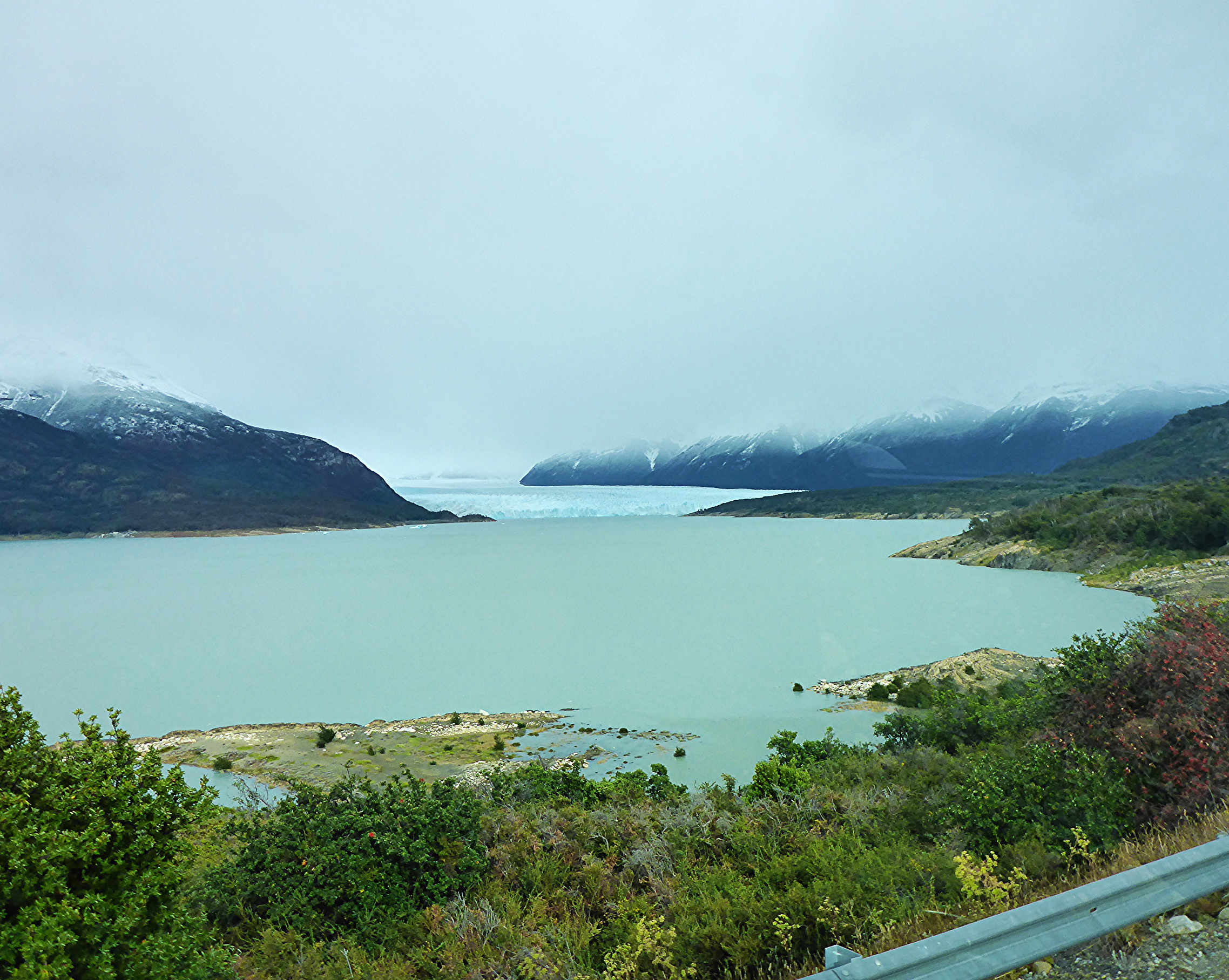
The Reveal from the bus
Some people got off the bus at a stop where a boat ride was available to the smaller face of the glacier. We went to the end and would recommend that. This is where the walkways start and more boats are available for the main face.

The park has extensive walkways (pasarelas) which enable viewers to get close to the glacier. We spent several hours exploring the different walkways.
Some give you an up close and personal view of the face, while others higher up allow you to see the course of the glacier and surrounding mountains.
A note on facilities: the only toilets available in the park were demountables at the entrance point where buses arrive and depart, which makes for a long walk if you're caught short at the more distant parts of the pasarelas. There are toilets marked on the parks map near the highest section in the middle of the park, but these were out of action and appeared to have been burned down, so it's likely to be some time before they're replaced. It's also best to take food and drink as the only restaurant/kiosk is at the entrance.

Many people rushed to take the boat trip when we first arrived. It would probably be worthwhile if your boat fluked a moment when a big iceberg calved off in front of it, but overall, the boats don't get any closer than the walkways, and with similar views, so we didn’t see the point.
All in all the glacier is a very spectacular sight and one we'll long remember.

A few other tips for El Calafate:
Visit the Glaciarium if you want an in depth understanding of glaciers and the topography and history of the region (and there's a free shuttle bus from town to take you there).
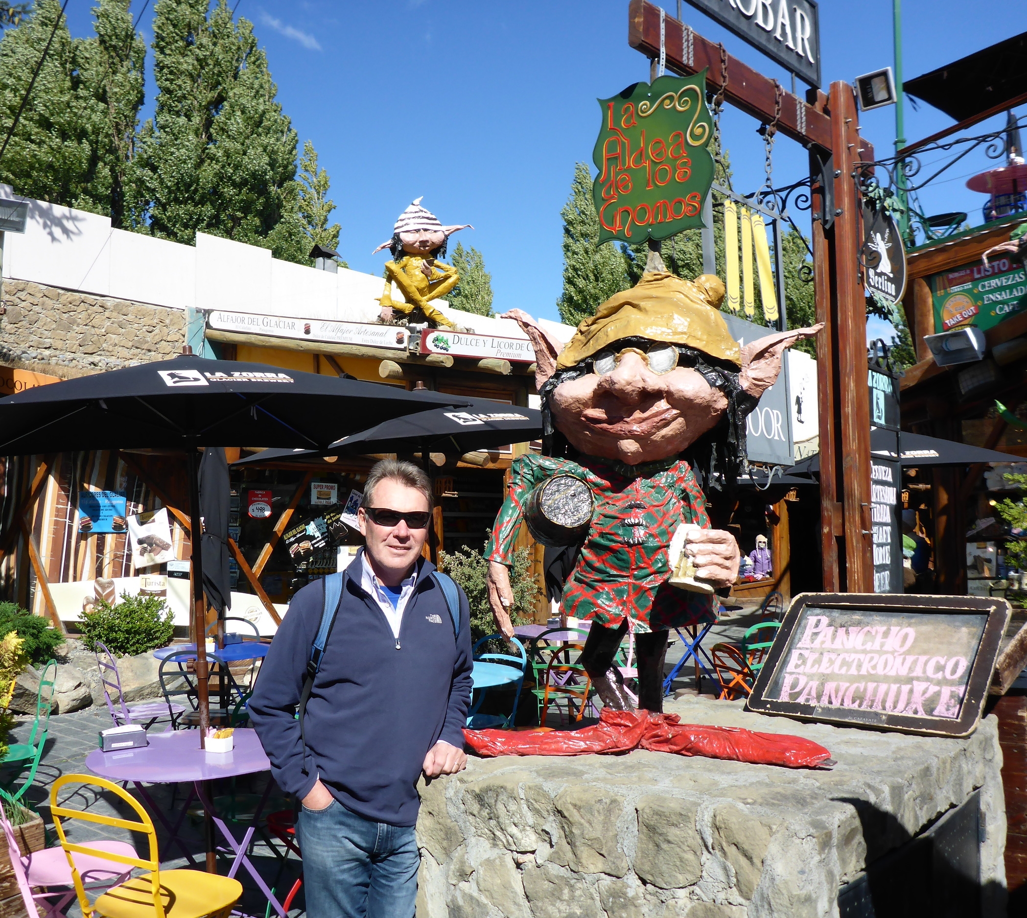
Visit the Aldea de los Gnomos (Village of the Gnomes) if you're wanting a dose of kitsch.
Go to Pietros Restaurant in the main street if you want a burger the size of your head (no need for an entree here).
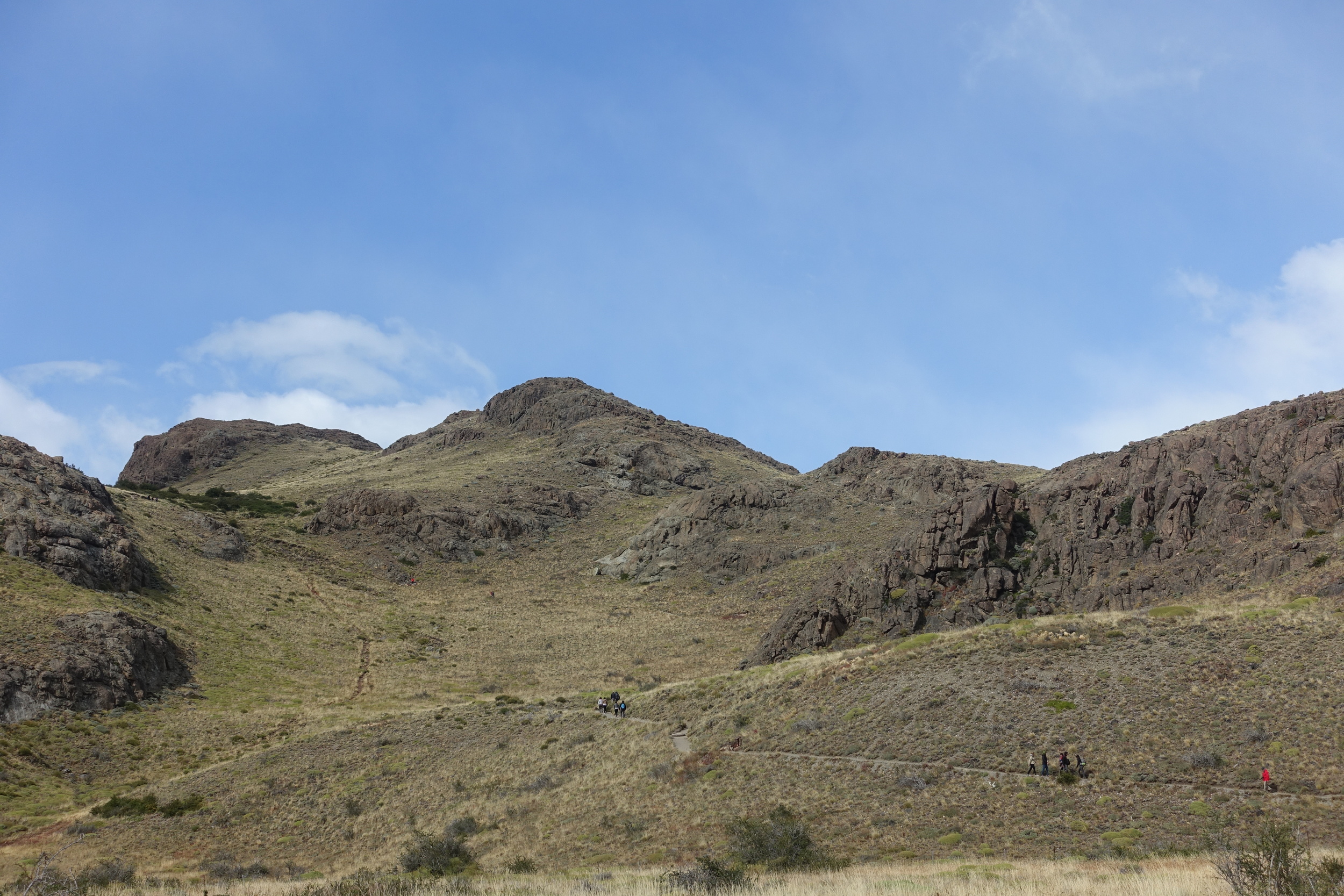
El Chalten

MOUNT FITZ ROY
El Chalten is a small town of around 1200 and Argentina's trekking capital. It is 3 hours north by bus from El Calafate and several bus companies do the run. It is the gateway to treks around the Fitz Roy Range at the north end of Parque Nacional Los Glaciares. The star attraction is Cerro Fitz Roy at 3441m.
One of the things we really liked about El Chalten is that all the walks start within walking distance of town. No need to organise buses or hire cars to get to the national park, you are there. Tracks are clear and easy to follow.
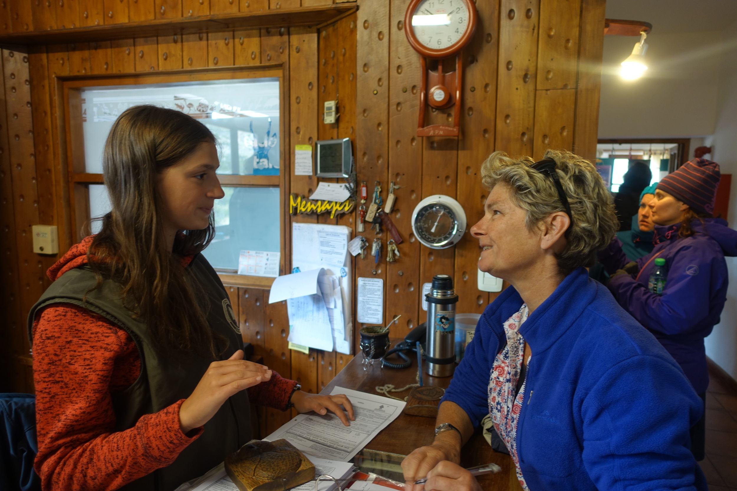
Our very helpful B&B host looked up the weather forecast for us. A useful thing to do as the weather can be sunny and pleasant, or gale force winds, biting rain and freezing cold, regardless of the season. On her advice we decided to do the Laguna de los Tres walk the next day. This takes about 8 hours in total and is 22 kms. It is a popular walk as it takes you to the base of Mount Fitz Roy with a stunning view of a small glacial lake in front of the towering vertical rock faces of Mount Fitz Roy. (If you're wondering who Fitz Roy was he was Robert Fitz Roy, captain of the Beagle when Charles Darwin travelled around the tip of South America in 1834).
We chose to get a mini bus to start the walk from Hosteria El Pilar for about $AUS12/$US8, even though you can start the walk by strolling just out of town. We did this to make the walk one way with no doubling back on the track, also fewer people do it this way. It was a good idea as we got to see a wonderful view of the Glacier Piedras Blancas.
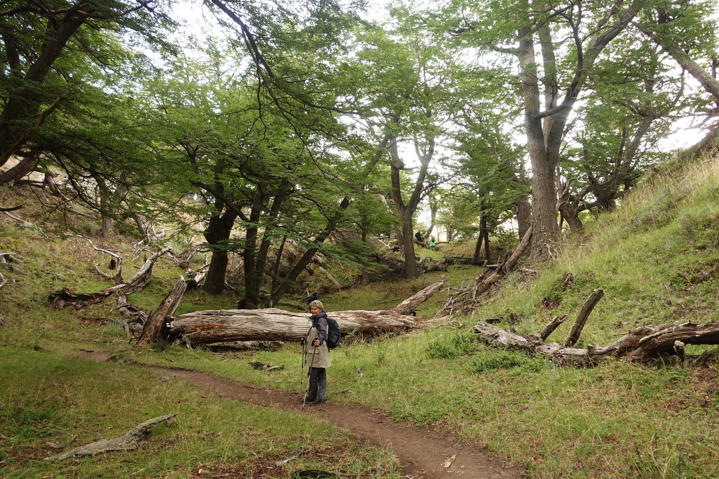
The track is easy to follow and winds along the river at first, then climbs very gently through the forest. The trees and ferns were very like those in Tassie, the fagus especially so. Walk quietly and keep your eyes open and you may be lucky to see the very rare Andean Deer or huemul. These solitary animals are so rare that the park rangers ask you to report any sightings. We were thrilled to come over a small rise to see a female huemul elegantly stepping through the ferns, grazing as she went. We watched until she disappeared. So lucky!

Glacier Piedras Blancas on the way from HOSTERIA EL PILAR TO LAGUNA DE LOS TRES
The track eventually crosses the river and starts the climb to Mount Fitzroy. After a gentle start, through forest, crossing little creeks, the track begins to open out and become steeper.

Signs warn that walkers must be of good fitness as it is going to be very steep. Yes, it does get steep, but not too bad. It is exposed to the wind, and as it happened, the track was closed in the following days as the rangers considered the wind too strong. We walked slowly up and over a rocky shoulder to the viewing ledge.

A magnificent, expansive view of the small, blue glacial lake at the base of the impressive vertical rock soaring upwards, Mount Fitz Roy. We got brief views then the clouds would cover much of it once again.

Laguna de los Tres - MOUNT FITZ ROY IS HIDING IN THE CLOUDS
The cold wind was picking up, so after a short time, we started back down. We continued back towards El Chalten, the track very clear and easy walking.

We made a side trip to walk along Laguna Capri, a pretty and protected lake. Many people do this as a day/ half day walk from town.
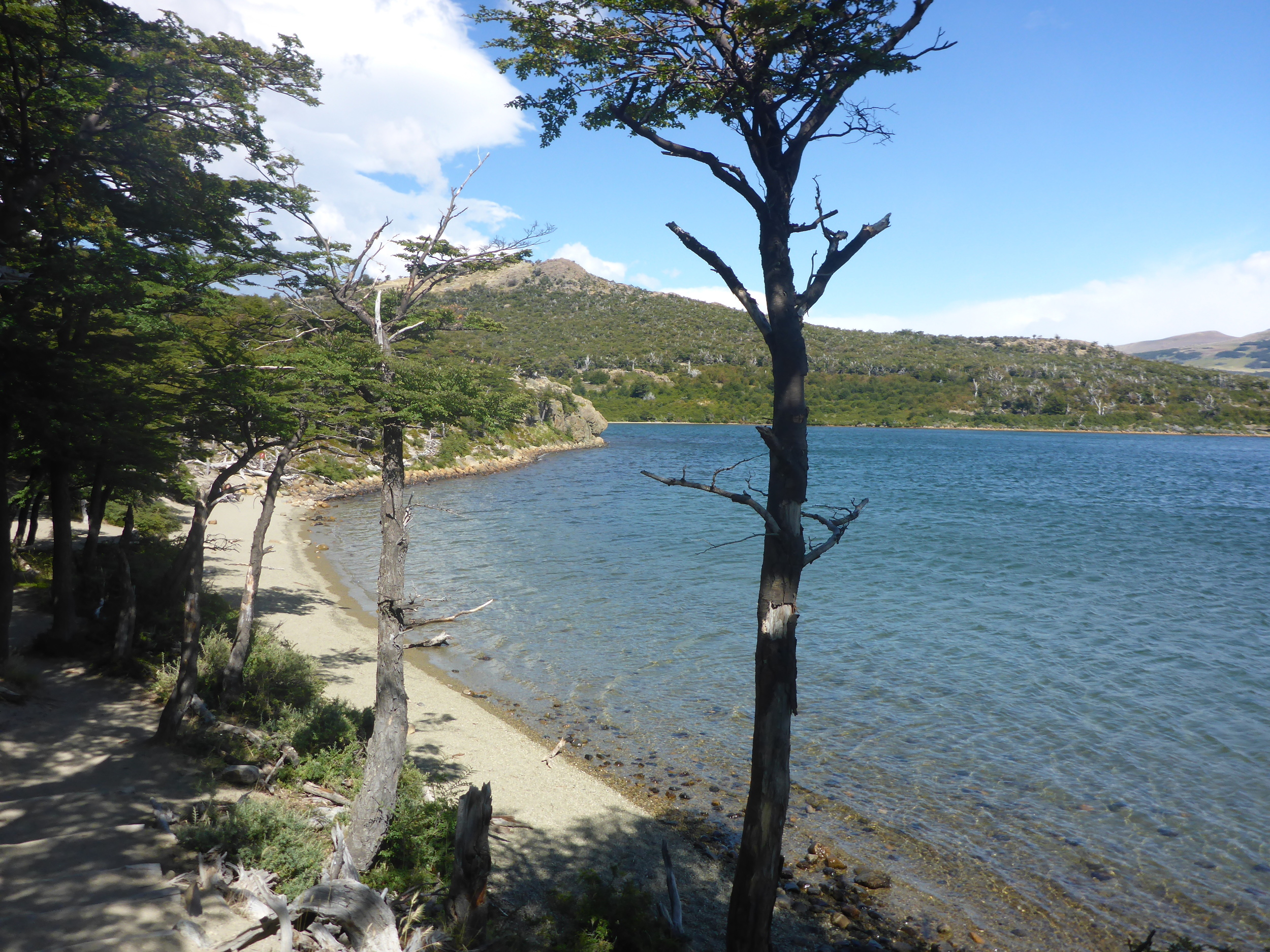
Laguna Capri
A lovely picnic destination. The track rejoins the single path back to town, passing an expansive view of the river valley, Mirador Valle de las Vueltas. From here it's a short downhill section where you arrive at the eastern end of town.
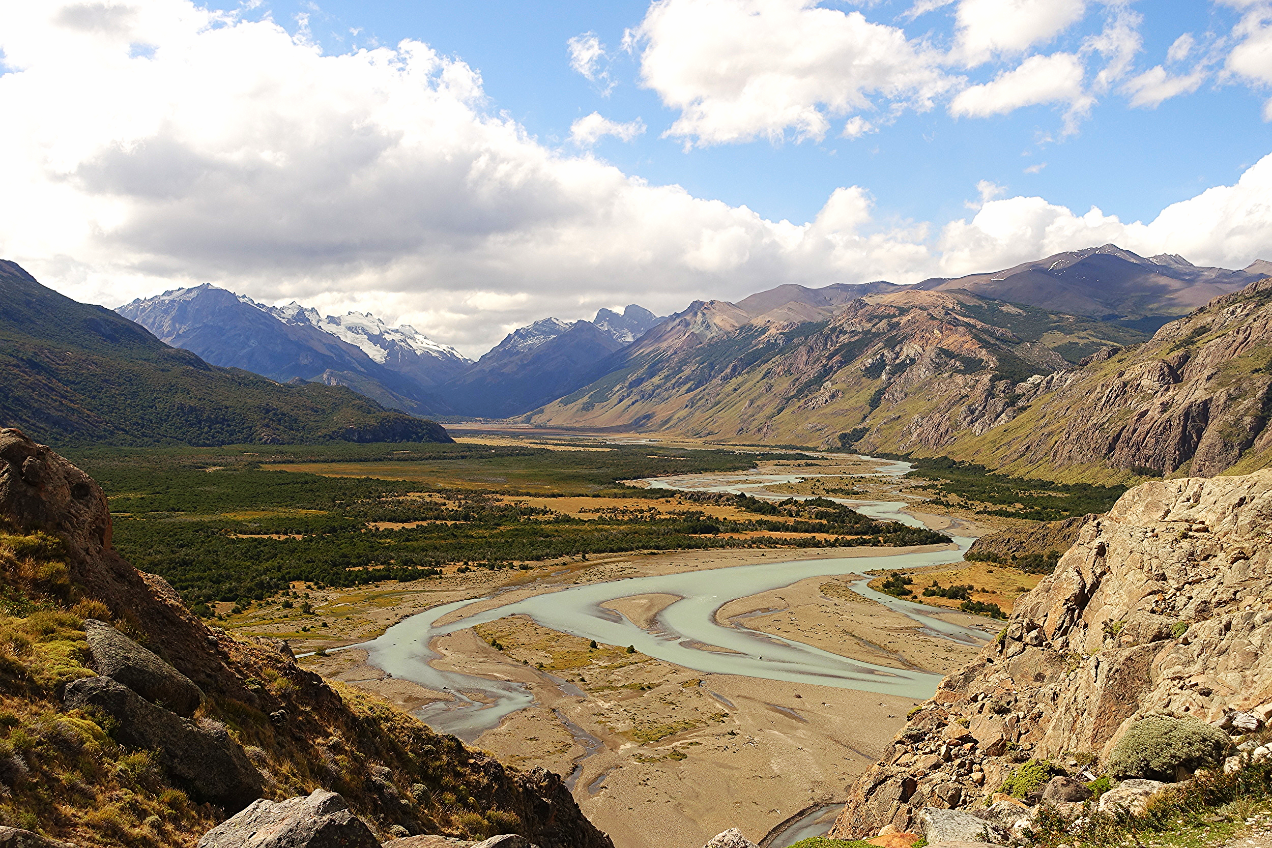
Rio de Las Vueltas
One of the other popular walks is to Laguna Torre, not to be confused with the more difficult walk to Laguna Toro. We decided not to go when we woke to pouring rain and freezing winds.

On our third and final day, the weather was a little better. We walked over the bridge, past the rangers' station and up to the Mirador de las Condores. And there they were, condors soaring on the thermals, close to the rocky hilltop where we stood.
Track to Mirador de los Condores
We then walked on to the Mirador de las Aguilas (eagles) which gives a view along the river valley in the opposite direction. Both well worth doing.

On our return we dropped in to the rangers' station to report our huemul sighting from two days before. They were pleased and more excited than we would have thought. All details were taken down in a register.
Reporting our Deer Sighting
Feeling pretty chuffed with ourselves, we left the rangers and there, just crossing the track, was an armadillo. A busy and very cute animal, hairy under his armoured plates (a cold place to be an armadillo).

Like El Calafate, El Chalten was a place which is quite easy to explore without a guide and not expensive. Indeed there were no park entrance fees at all for the walks from El Chalten.
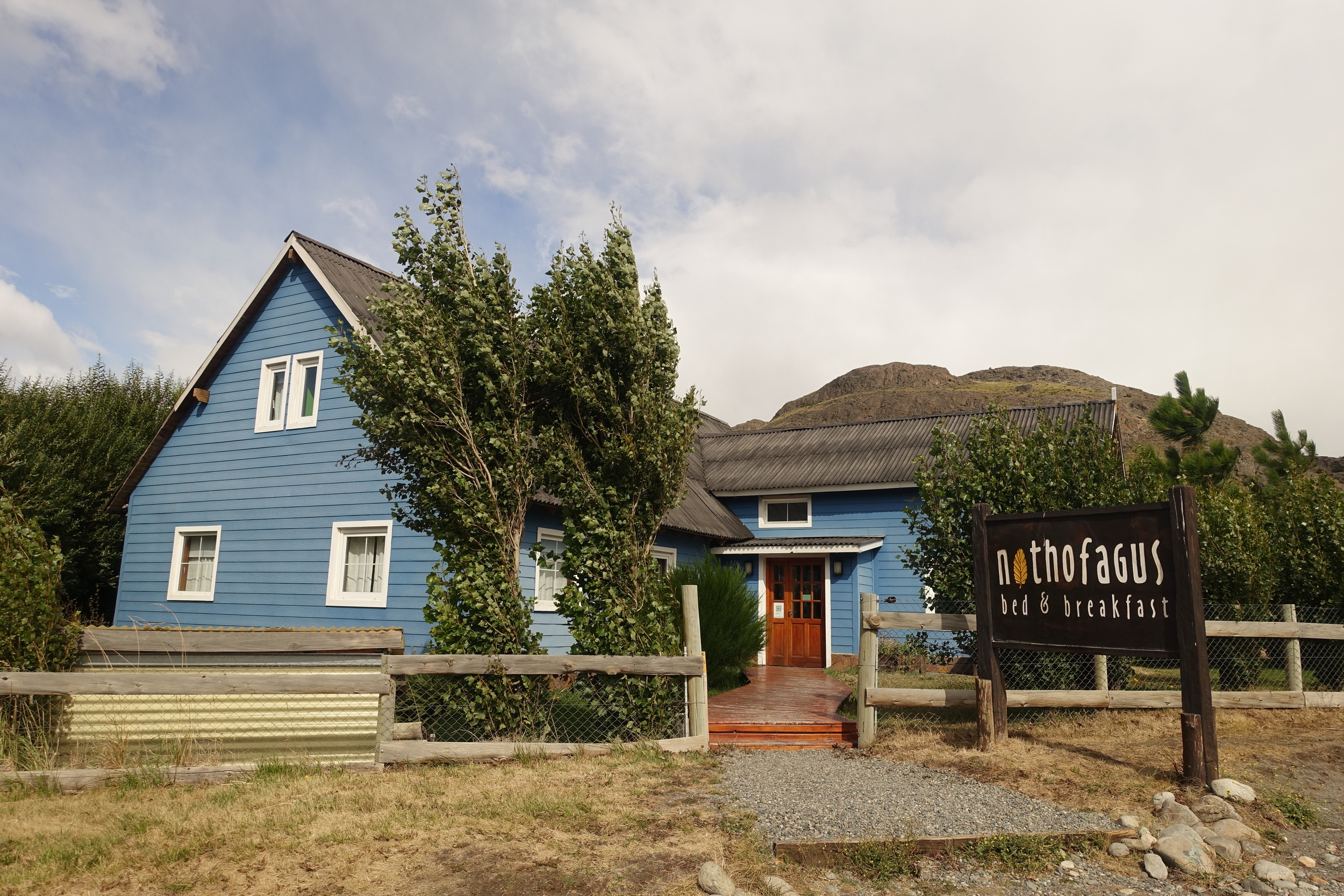
A few other tips for El Chalten:
Nothofagus B&B – an excellent bed and breakfast option.
Techado Negro restaurant – good food at reasonable prices
Che Empanada – for a comida rapida hit.
San Carlos de Bariloche

View From Cerro CampANARIO OF Lakes REGION AROUND Bariloche
Bariloche, in the Argentine Lake District in the far north of Patagonia, sits on beautiful Lake Nahuel Huapi and is surrounded by a plethora of majestic peaks. It is a very pleasant place to spend a few days. A city of 110,000 Bariloche has all the mod cons and services that any traveller needs and is of a manageable size.

Centro Civico Bariloche
The town itself is worth exploring with a walk along the lake shore to admire the view is a good place to start. The centre of town is the town square at Centro Civico with it's mid-European style of buildings which is common to this region.

Centro Civico
Also worth a look are the Museo de la Patagonia and the Catedral.

The Cathedral (Catedral)
There are many activities you can do in and around the town including rafting, horse riding, camping, walks, kayaking, paragliding and fishing, as well as skiing in winter. We've mentioned just two here: the chairlift at Cerro Campanario and a walk in Parque Municipal Llao Llao (pronounced shao shao).
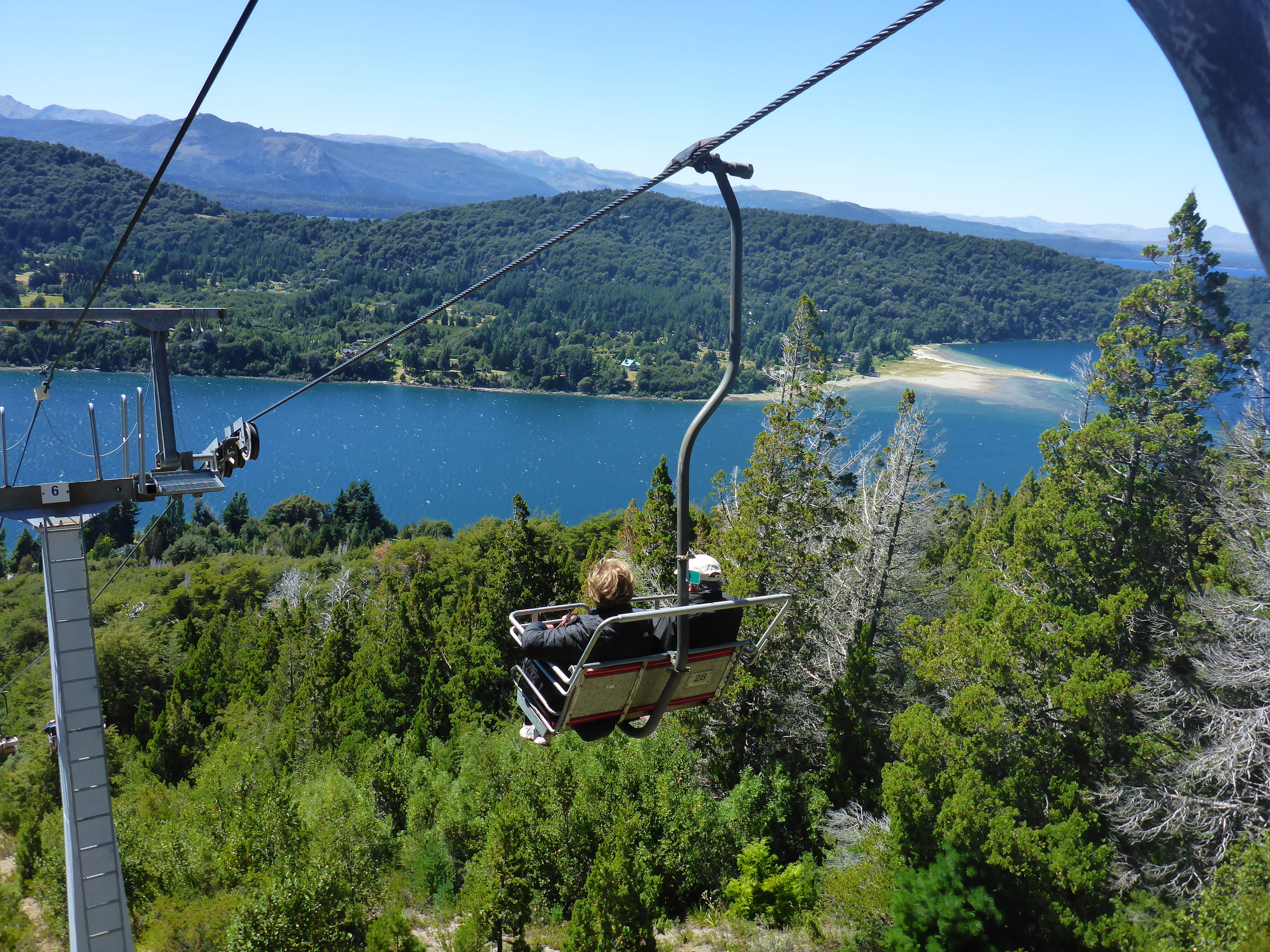
Cerro Campanario Chairlift
Cerro Campanario provides some of the most expansive vistas of the region, with incredible views in all directions. It is easily accessed from the town by catching the #20 bus. It's a 17.5km, half hour bus ride. The bus is always full so try to get on at the starting point. The helpful tourist office in Centro Civico can provide maps and information about all the local sights and how to access them.

View From CERRO CAMPANARIO
The chairlift to the top of the mountain is a nice, knee-saving way to get to the miradors. But you can walk up if you're so inclined.
Municipal Parque Llao Llao is also accessed by the #20 bus, you just need to stay on for an extra 15-20 minutes until the end of the route at Hotel Llao Llao. The park is on an isthmus and is bordered on all sides by different lakes. It has a number of walking trails. The park is not huge and we did an 8 km loop which took us to all corners of the park. A reasonable map of the region is on the official Bariloche Tourism website - but the text is in Spanish.
We started at the park entrance closest to the bus stop and walked through the Bosque de Arrayanes. The arrayan is a native tree to this region which has a strong cinnamon coloured bark, and is unlike any we'd seen before. They stand out quite noticeably from the rest of the surrounding forest.

Arrayan Forest
Views of the lake were frequent.

Lake Perito Moreno West, Municipal Park Llao Llao
We then crossed onto the track leading to Mirador del Tacul and Villa Tacul, passing by the Puente Romano (Roman Bridge – those Romans really got about!).

Roman Bridge
More lake and mountain views, before the track winds back past Cerrito Llao Llao (a 1080m mini-mountain which you can climb if you want yet more great views) and back to the starting point and bus stop. A good little walk overall.

Mirador Del Tacul
A few other tips on Bariloche:
Pasta restaurant/steak – El Boliche “de Alberto” has 3 parrilla (steaks and other meats) and a pasta restaurant in Bariloche and they are recommended.
Cheap Eats - Great churrascos (aka steak sandwiches) available most days in San Martin street, behind Centro Civico.
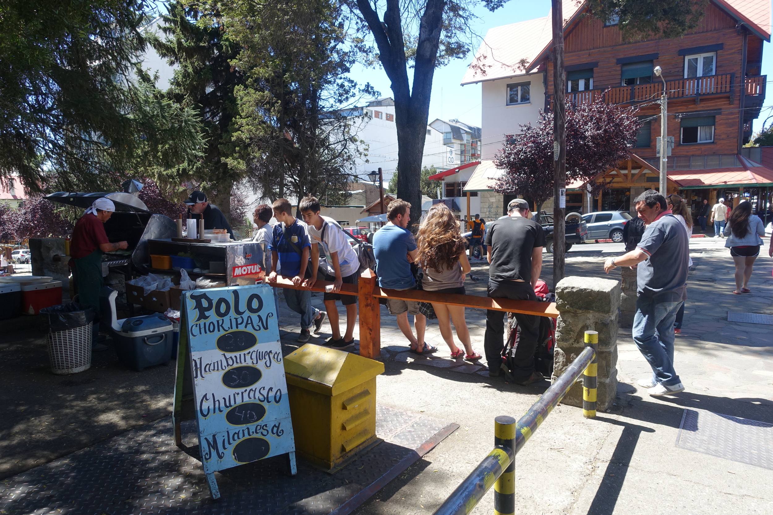
Great Currascos here
- More cheap eats - Excellent parrilla take away (barbequed chicken, steak and other meats) - Las Brasas on the corner of Villegas and Elflein.
Argentina's best fruit shop is next door for your salad provisions and great fruit (but don't touch the merchandise or you'll be in trouble). The proprietor will select you the very best produce.

The Fruit Shop in Question
As we said we only scratched the surface of Argentinian Patagonia and the Lakes District around Bariloche. There is so much more. If we've whetted your appetite go and see for yourself – you won't be disappointed.
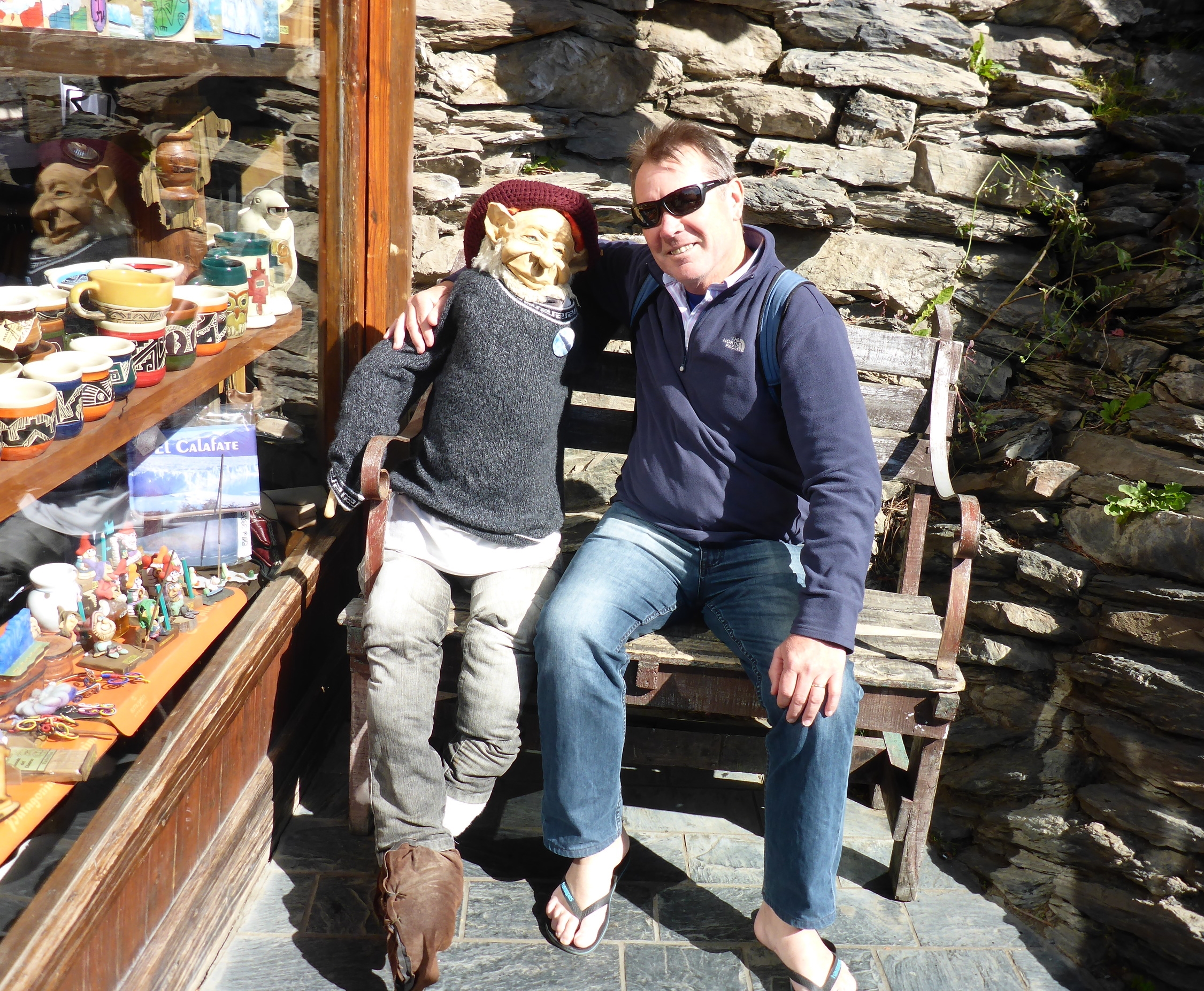
Ken and his new mate
Ken and Cally


