Two Weeks in the Ecuadorian Highlands
/
Laguna Quilotoa
Introduction
We arrived in Ecuador less than 24 hours after the April 2016 earthquake which devastated much of the NW and coastal regions of Ecuador. We'd been in transit from Brazil (Sao Paulo via Lima then to Guayaquil in southern Ecuador) when the earthquake struck and were unaware of it until some people spoke to us in Guayaquil airport and asked us how we'd coped with the earthquake. What earthquake we asked? And they explained.
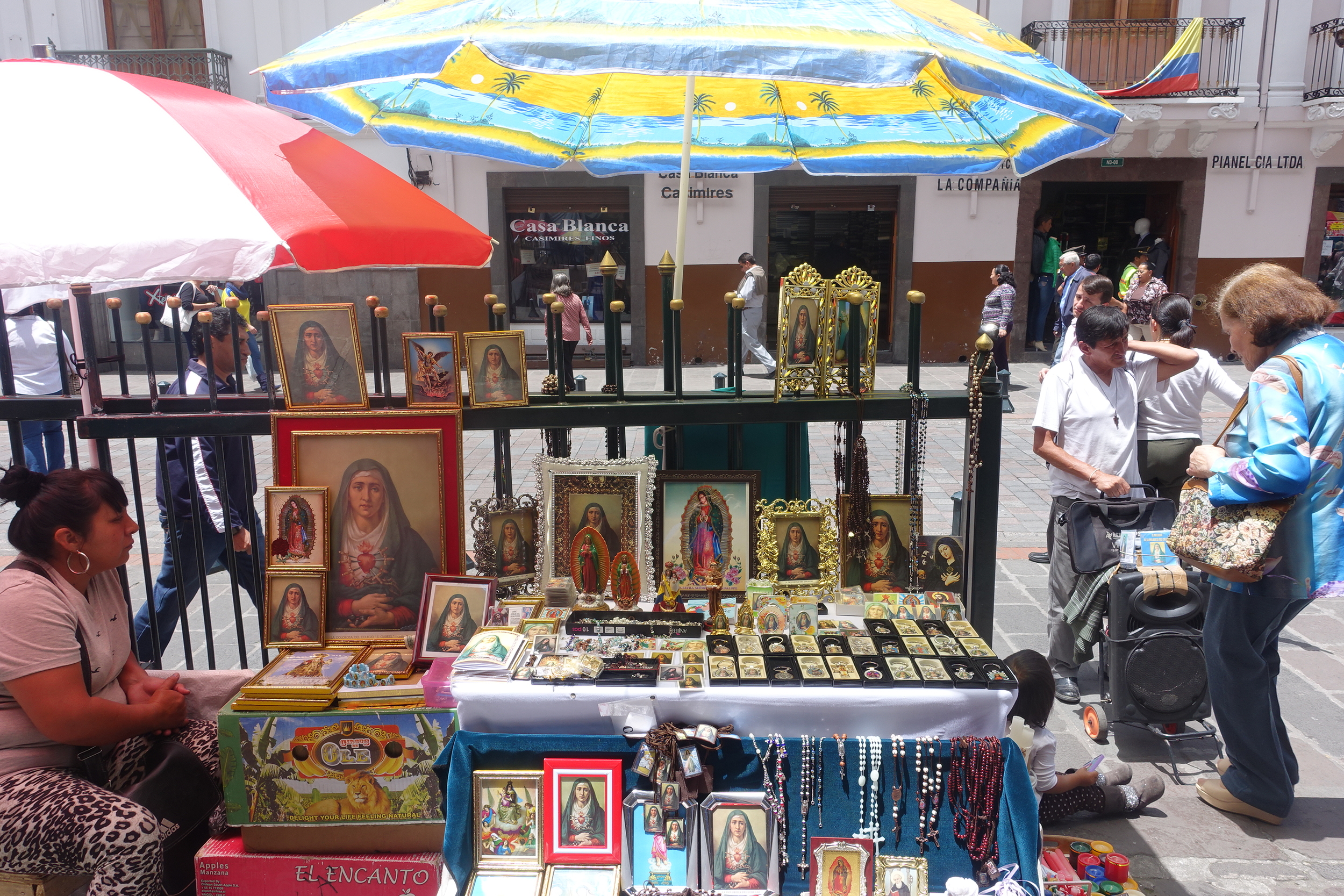
ECUADOR IS A devout CATHOLIC COUNTRY.
As it was so soon after the quake it was not yet clear what effect it had had across all the country. We flew on to Quito, and over the next few days learned that the regions away from the coast, including the Central and Southern Highlands, where we were intending to visit, were largely unaffected.
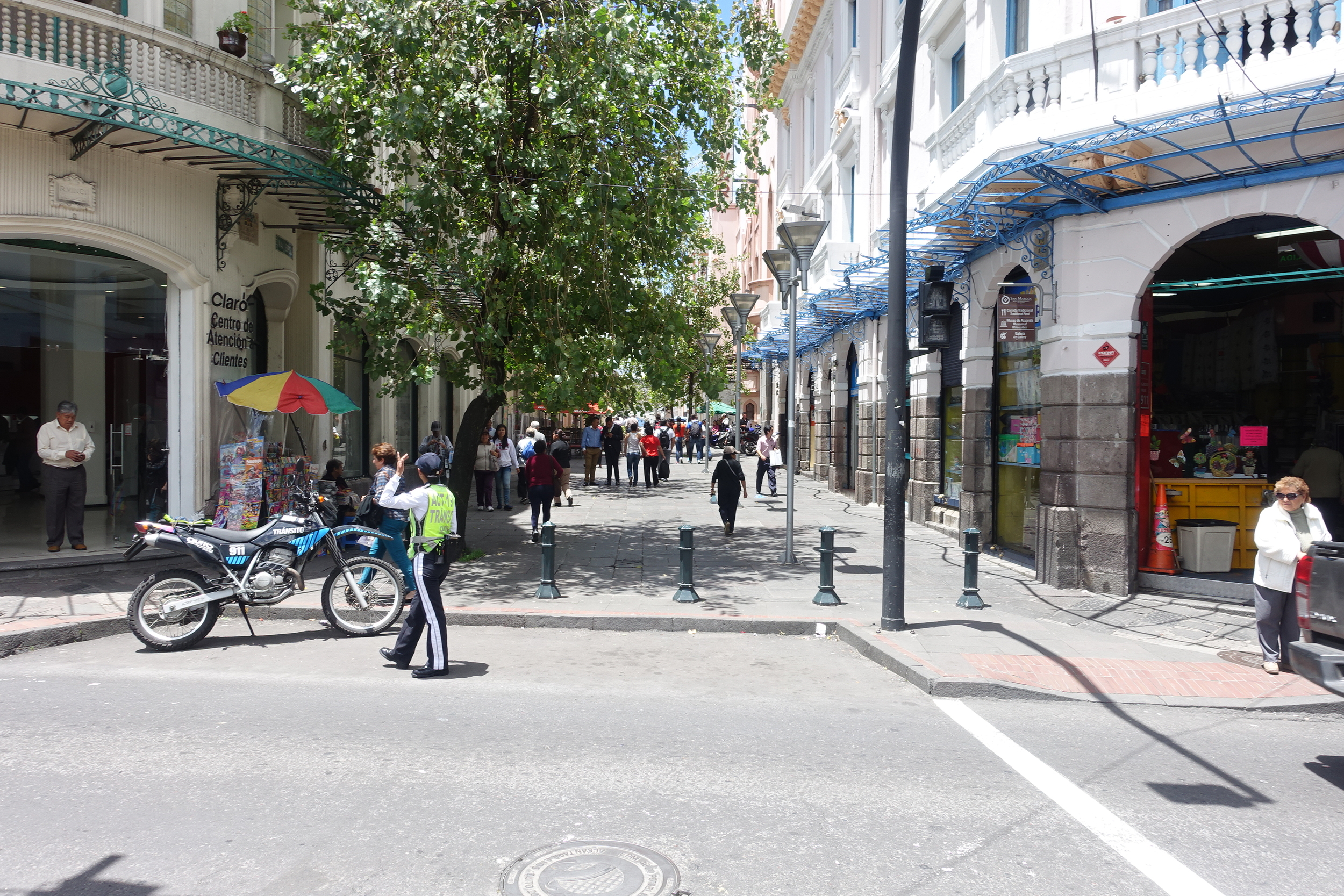
there are a number of pedestrian streets in the centro historico in quito
As we were not intending to visit the affected regions, we decided to continue with our original plan which was to spend 2 weeks in the highlands of Ecuador. We also discovered, as we toured the country, that hotel and tour operators had had cancellations because of the earthquake. While this was understandable in the areas that were impacted, much of the country was fine and they wanted the tourists to come and spend money, which was now needed for the economy more than ever.
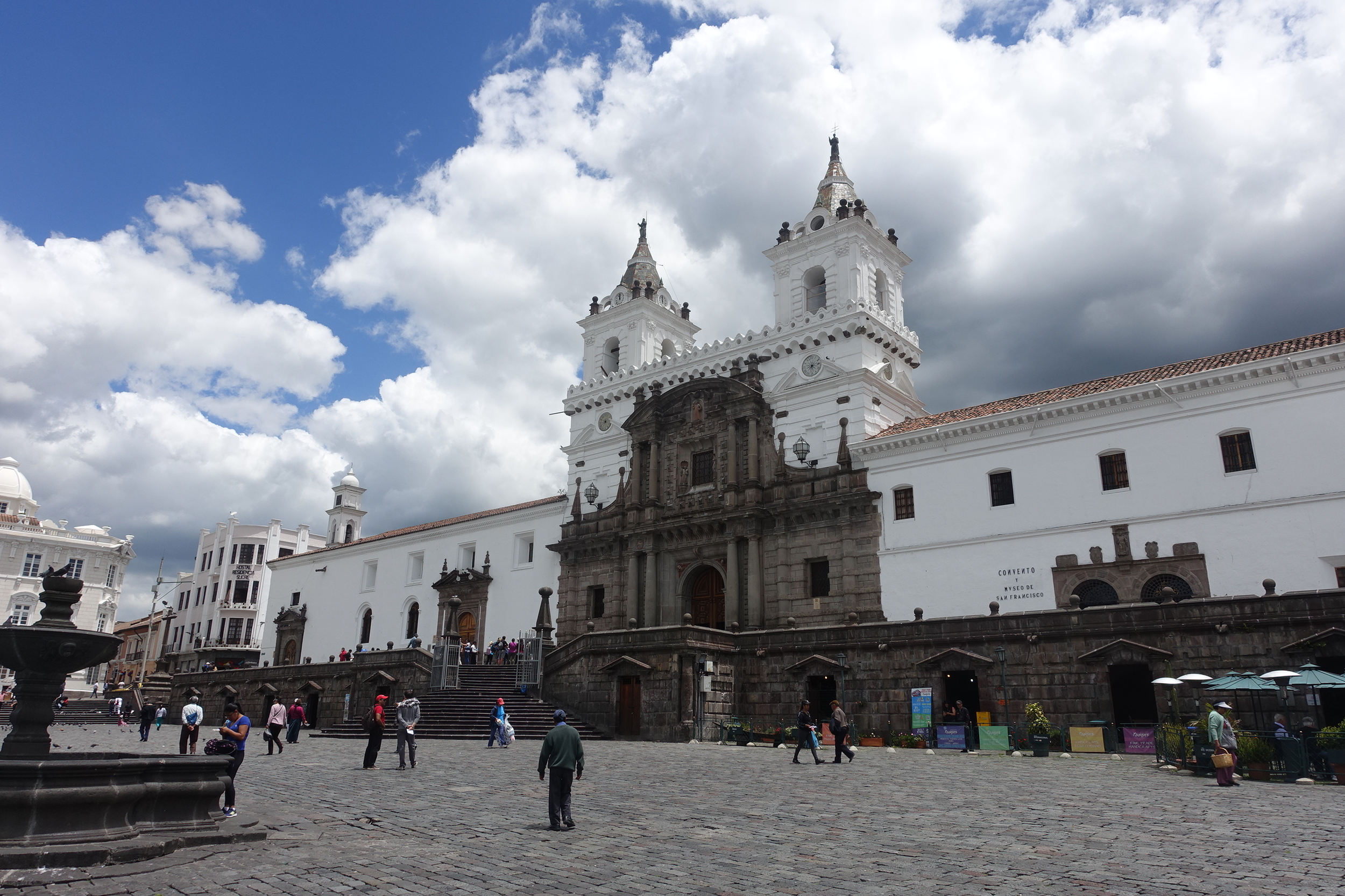
Quito

plaza grande, quito
We spent a couple of days in Quito, staying in the historic centre (Old Town). This part of the city has many worthwhile sights. Around Plaza Grande alone there is the Palacio del Gobierno, the Cathedral and Palacio Arzobispal (which is full of shops and restaurants).
la catedral, quito
There are various pedestrian streets, including La Ronda, a small lane with restored colonial buildings and various restaurants, galleries and shops.

LA RONDA
A visit to the Museo de la Ciudad was a good way of getting some understanding of Quito's history as well as the many different ethnic groups which make up the population.

museo de la ciudad (city museum)
Throughout the Centro Historico there is a very visible and numerate police presence. Unfortunately some parts of Quito have a growing crime problem, but in the main tourist precincts there are few problems.

We wanted to get a sense of the scale of Quito and went up the TeleferiQo, a cable car which travels 2.5 kms up the side of Volcan Pichincha to an elevation of 4100ms. We went in the morning, which is when the views are best. It was an impressive sight and the cost was only $US9. We took a taxi from the Old Town to the TeleferiQo station ($US5 each way).
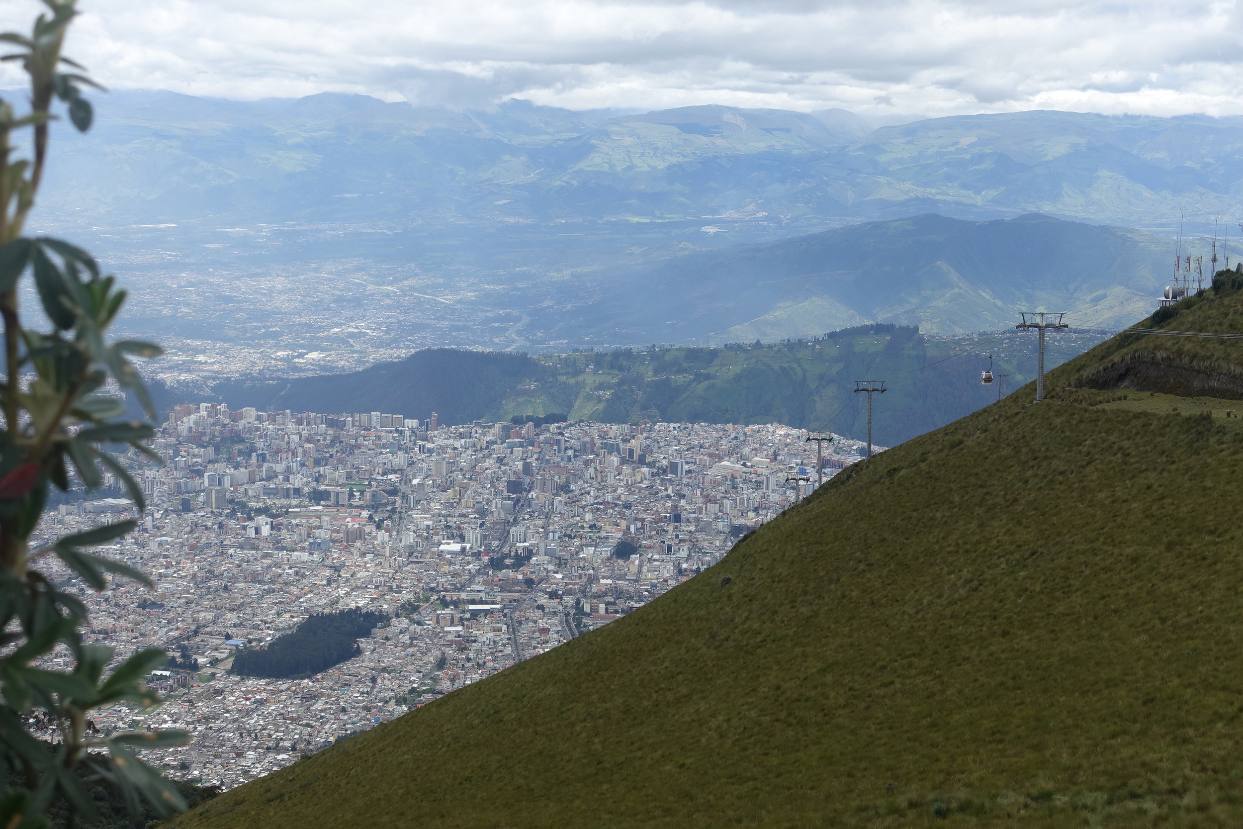
Teleferiqo and view from volcan pinchincha
Ken's brother Pete was joining us for the trip to the highlands. He arrived after we'd been in Quito a couple of days. We had a day revisiting the Old Town sights with Pete, while he acclimatised to the elevation. Quito is at 2850m.
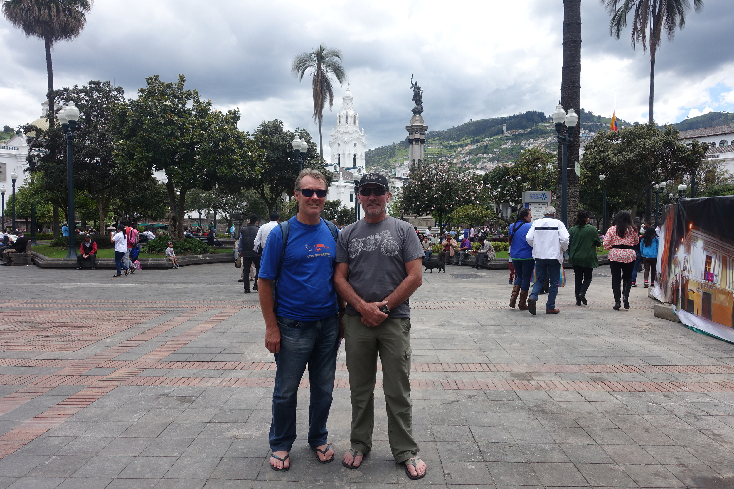
ken and pete in plaza grande
Our research prior to arrival provided us with a modest list of places we wanted to visit. Two weeks is not long so we thought it better to focus on a few locations rather than spend the whole trip on the road. And while Ecuador's bus system reputedly works well, and the distances are not that great, to get to some of the national parks and some more remote highland towns, we decided to rent a car. With three of us to share the cost, this seemed like a sensible option. We had also done a bit of research on the roads and driving in Ecuador sounded very doable.

quito streetscene
Cuenca

cuenca - new cathedral
Cuenca is Ecuador's third largest city and is around 300 kms to the south of Quito. After picking up our rental car we headed down the Panamerican Highway.

on the road - pete at the wheel.
To avoid driving after dark, and not knowing how long the trip would take, we booked and stayed the night in the small highland town of Chunchi. While TripAdvisor rates Chunchi as having “no attractions”, we found the people friendly and welcoming.

checking in at the chunchi Imperial
We stayed at the impressively named Chunchi Imperial (rated #1 of 1 in Chunchi on TripAdvisor, a rating they are rightly proud of).
the morning view from chunchi
We arrived enveloped in the ever reliable Ecuadorian Andean afternoon fog so didn't see the view from Chunchi until the morning. But it was worth the wait.

who said there's nothing to do in chunchi. these young fellas were enjoying the big green rock
chunchi
From Chunchi the road south took us to Ingapirca, Ecuador's most important Inca site.

ingapirca
Ingapirca was an important Inca town built in the 15th century, and while it's no Machu Picchu, it is worth a visit. The $US6 entry included an English language tour guide who gave us an excellent commentary over the 45 minute tour.

Our guide explaining the significance of these stones.

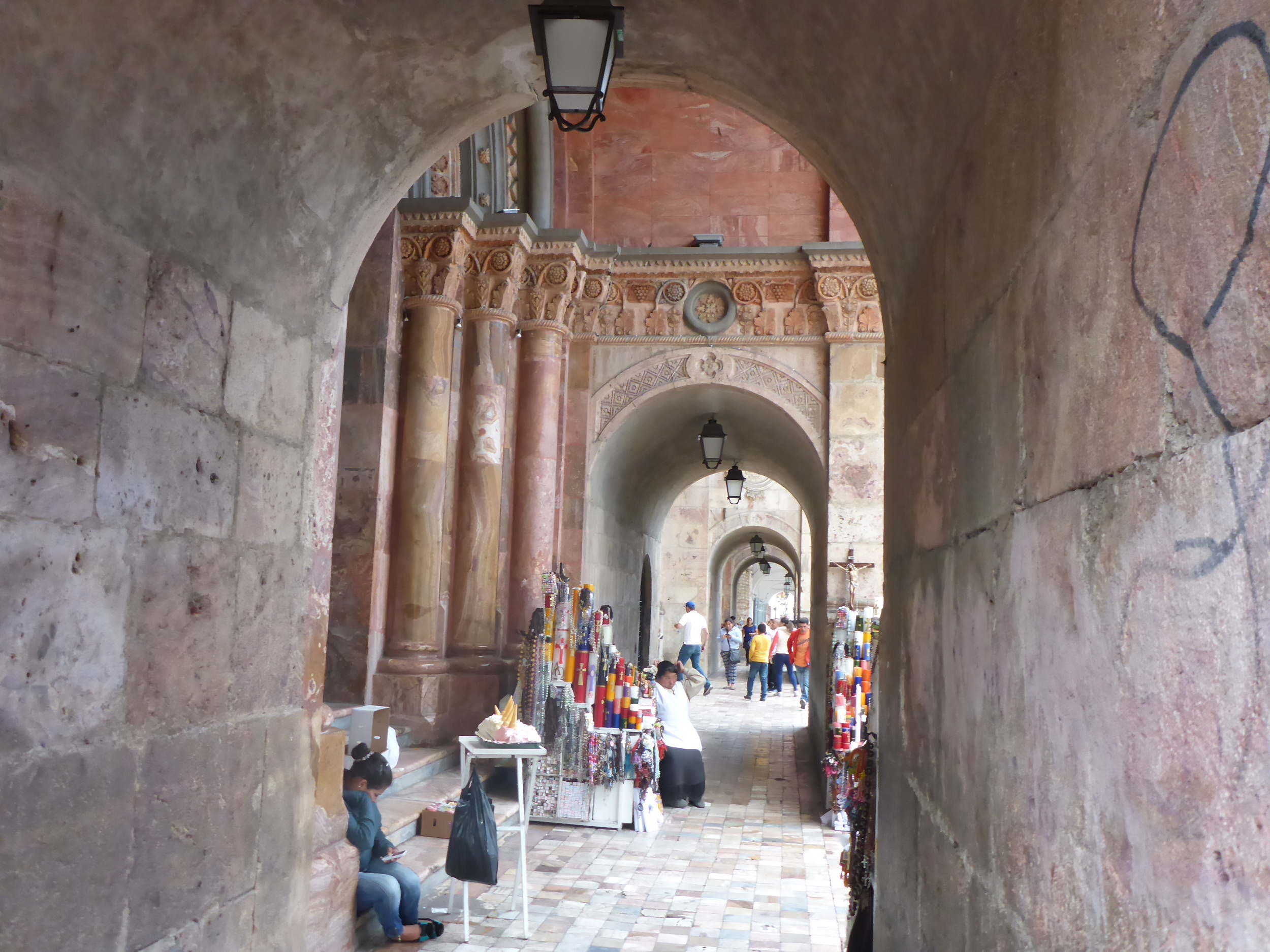
It was then a 50km drive to Cuenca. As we often do in South America we gravitated to the Historic Centre for accommodation.

hotel inca real
The classy Hotel Inca Real, was an excellent choice both in terms of the quality of the rooms and service and it's location, a 5 minute walk to the central square, Parque Calderon.
catedral, parque calderon
Cuenca has a lot of one way streets and endless roadworks as the city was in the process of installing a new tram system, so it was a challenge to drive in.

cuenca streetscene
We left our hire car safely tucked away in a secure car park and jumped on the hop on/off tourist bus. There are two routes – a northern and a southern. Each takes around an hour and a half to two hours. At $US8 per route it's not expensive.

at the panama hat factory
The northern route includes a half hour stop at the Panama Hat Museum and Factory (yes, panama hats actually come from Ecuador) and the southern route stops at Mirador de Turi from where there is a great view of the city.
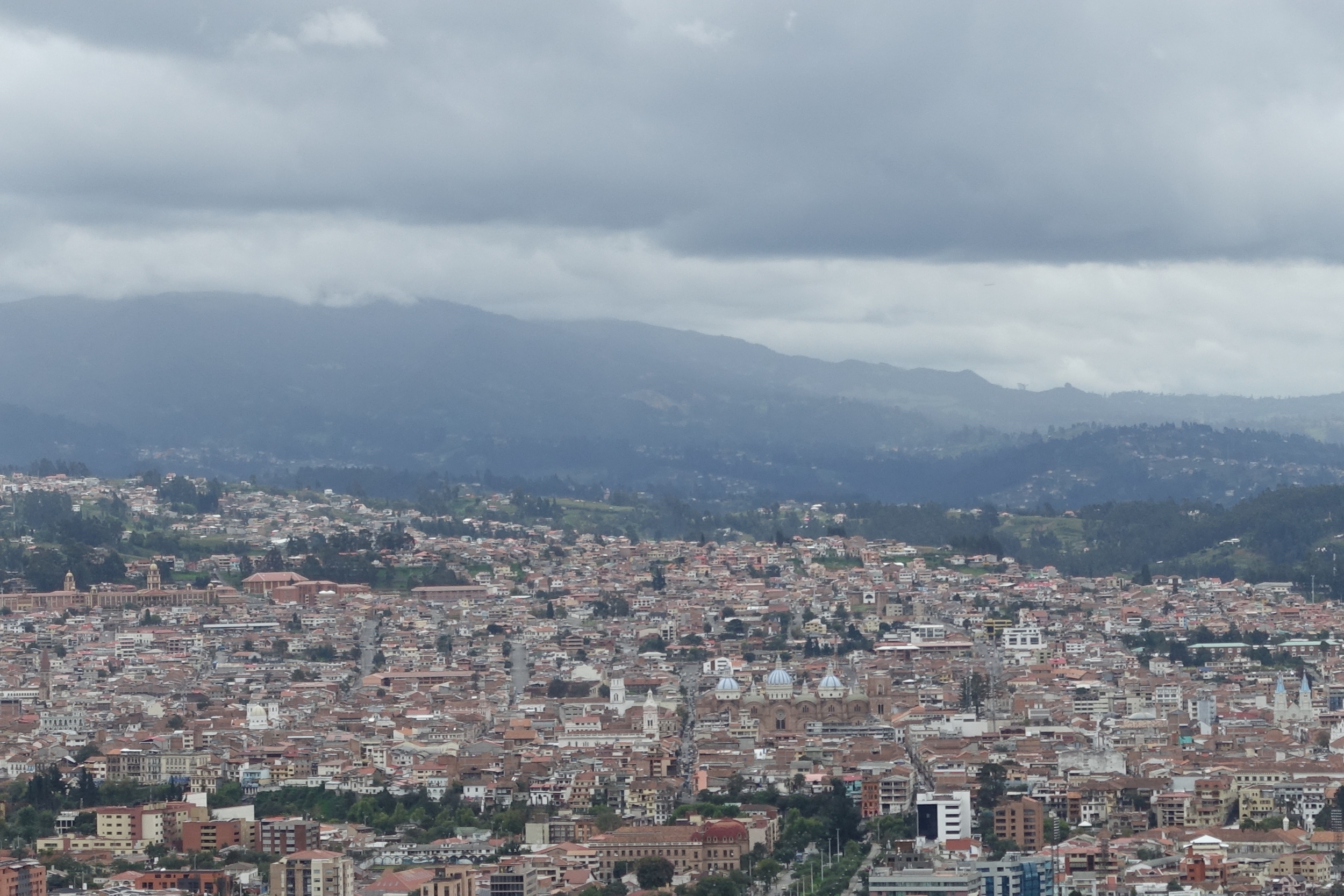
mirador de turi
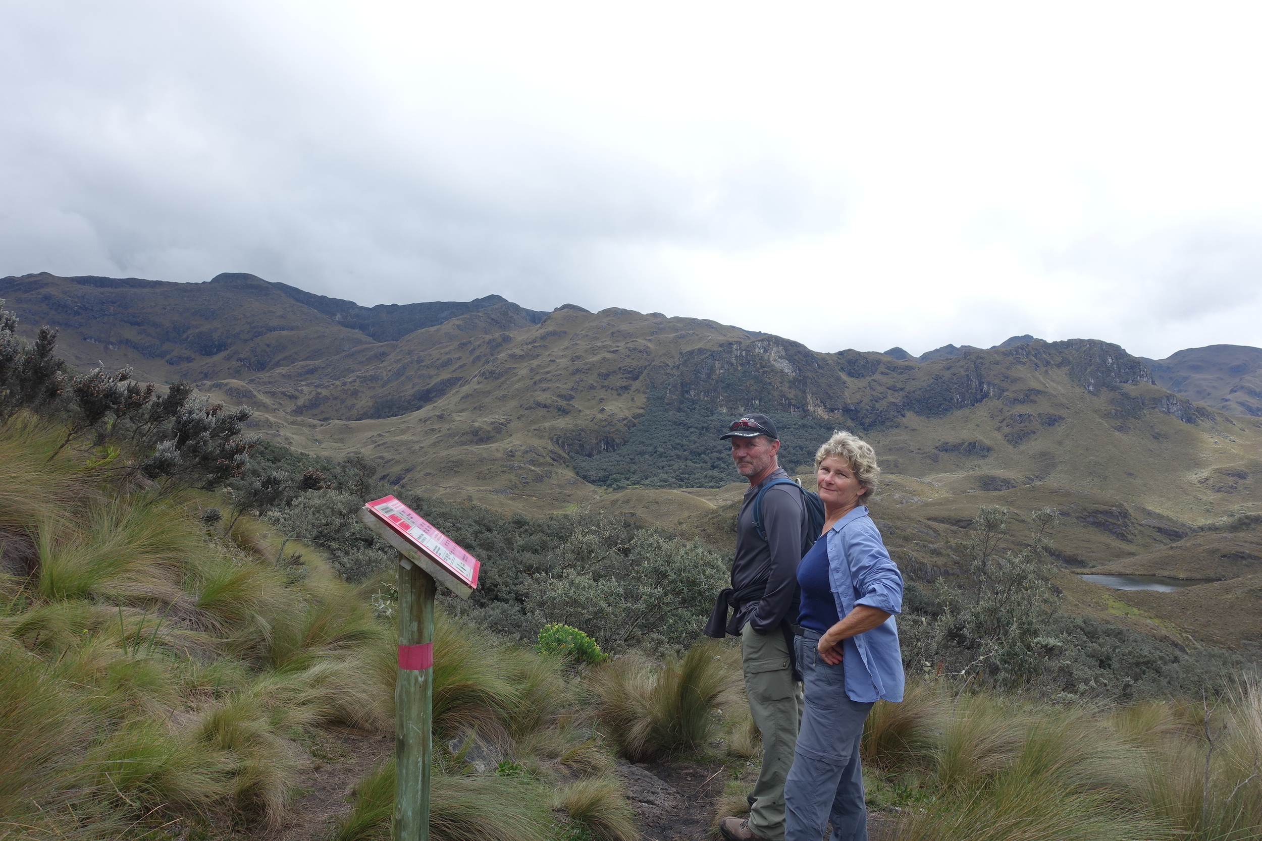
The next day we liberated our hire car and drove the 30kms to Cajas National Park.
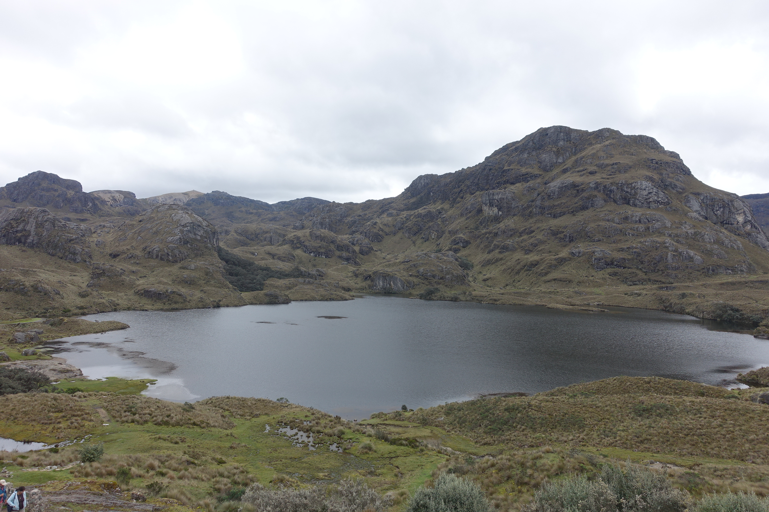
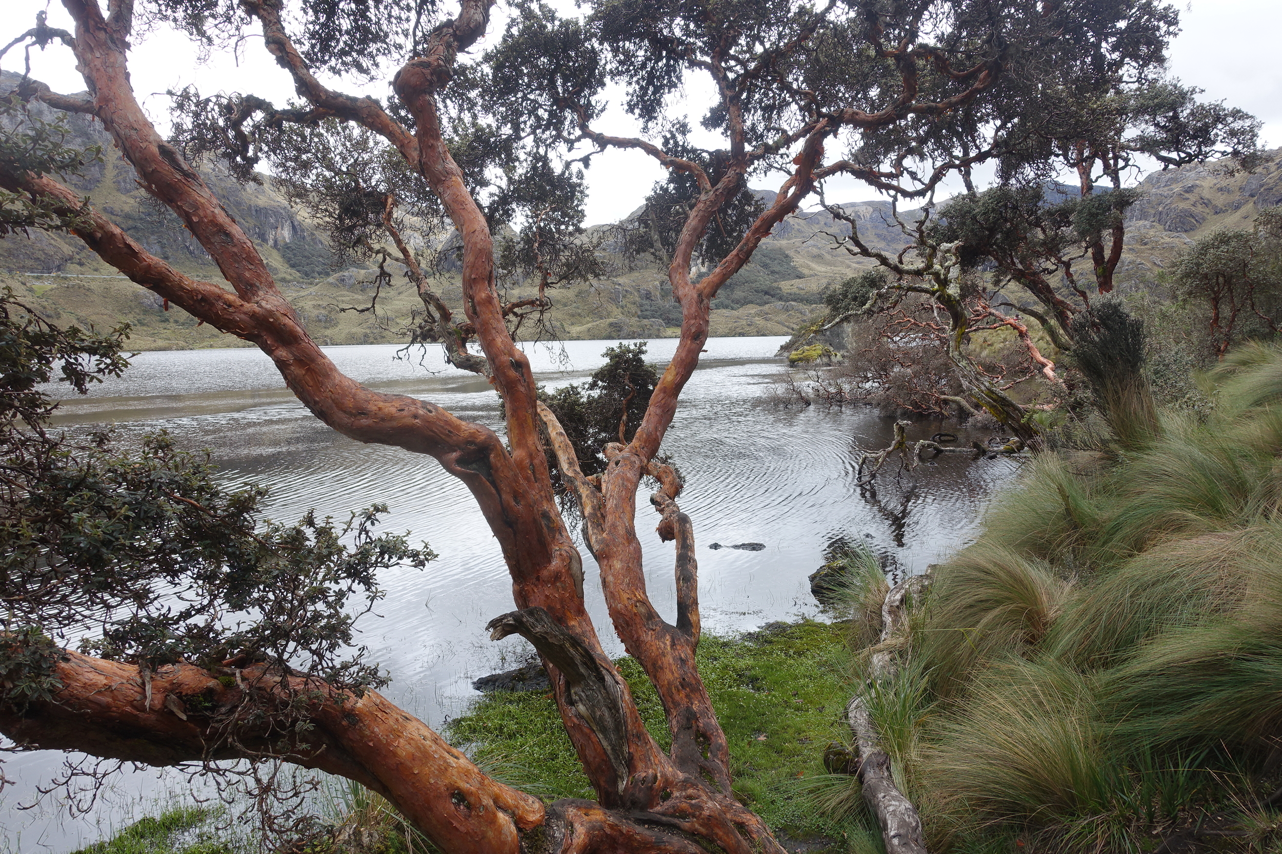
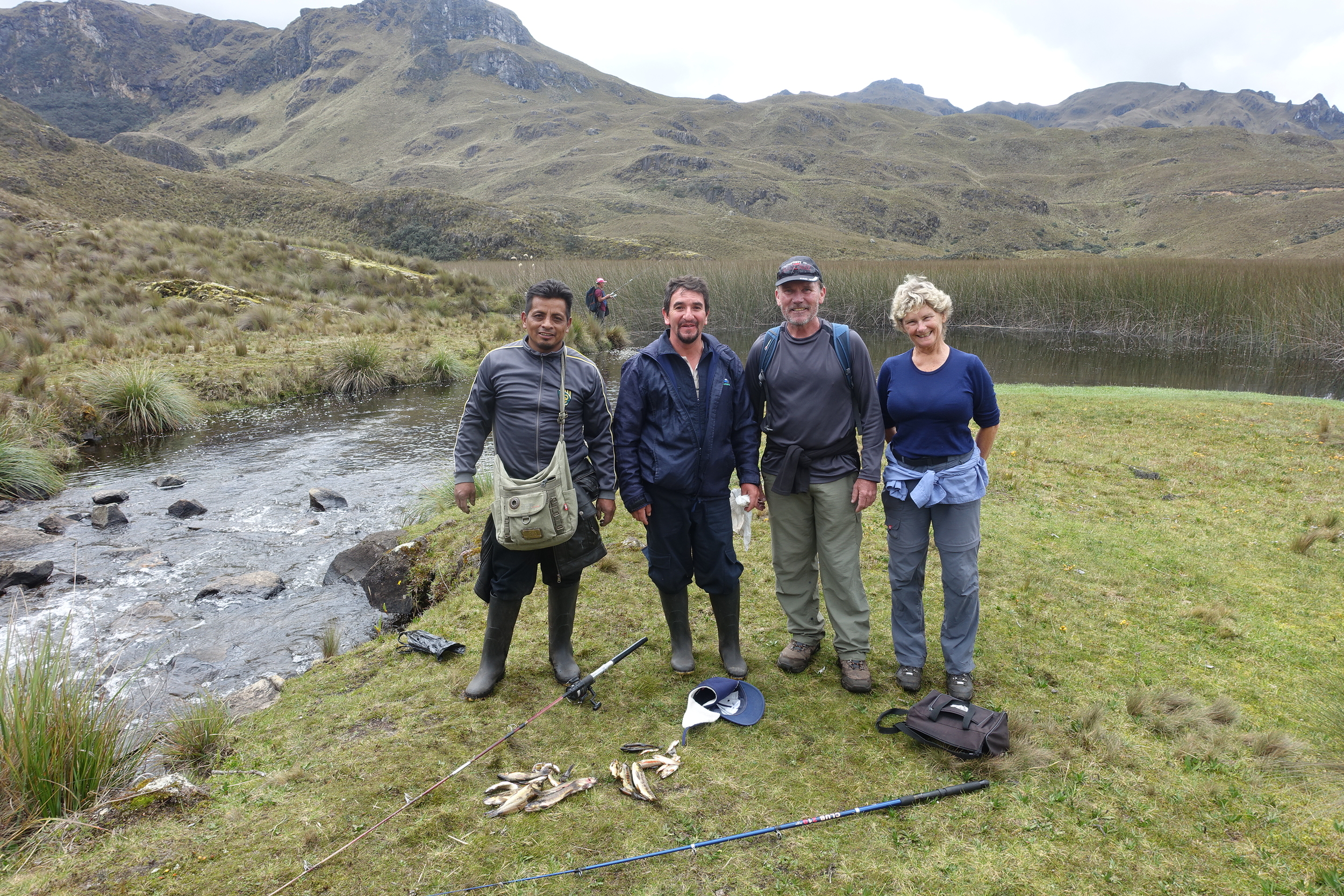
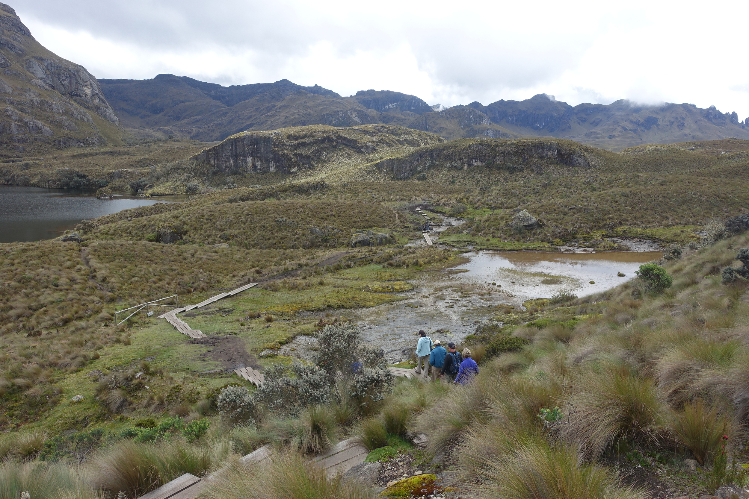
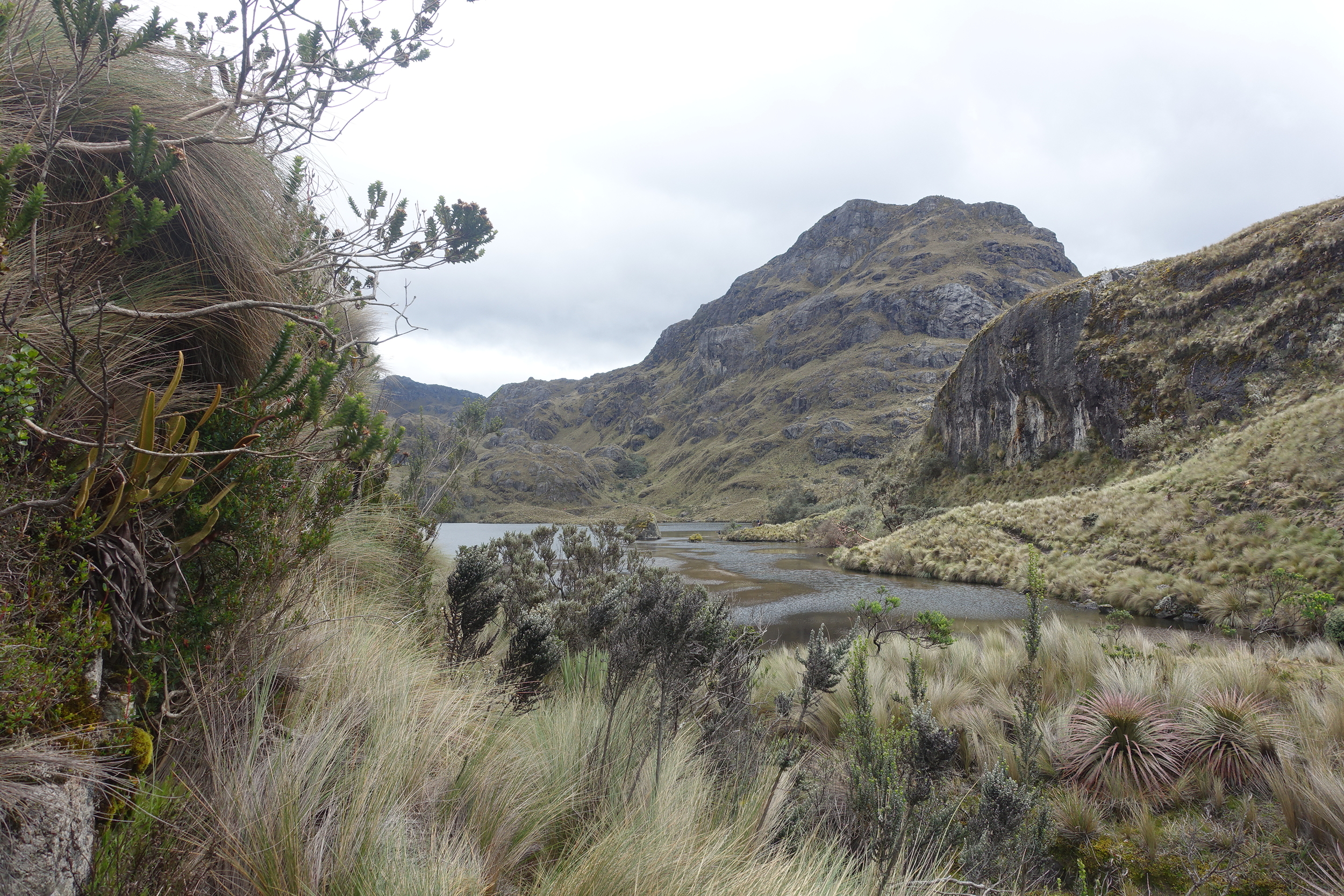
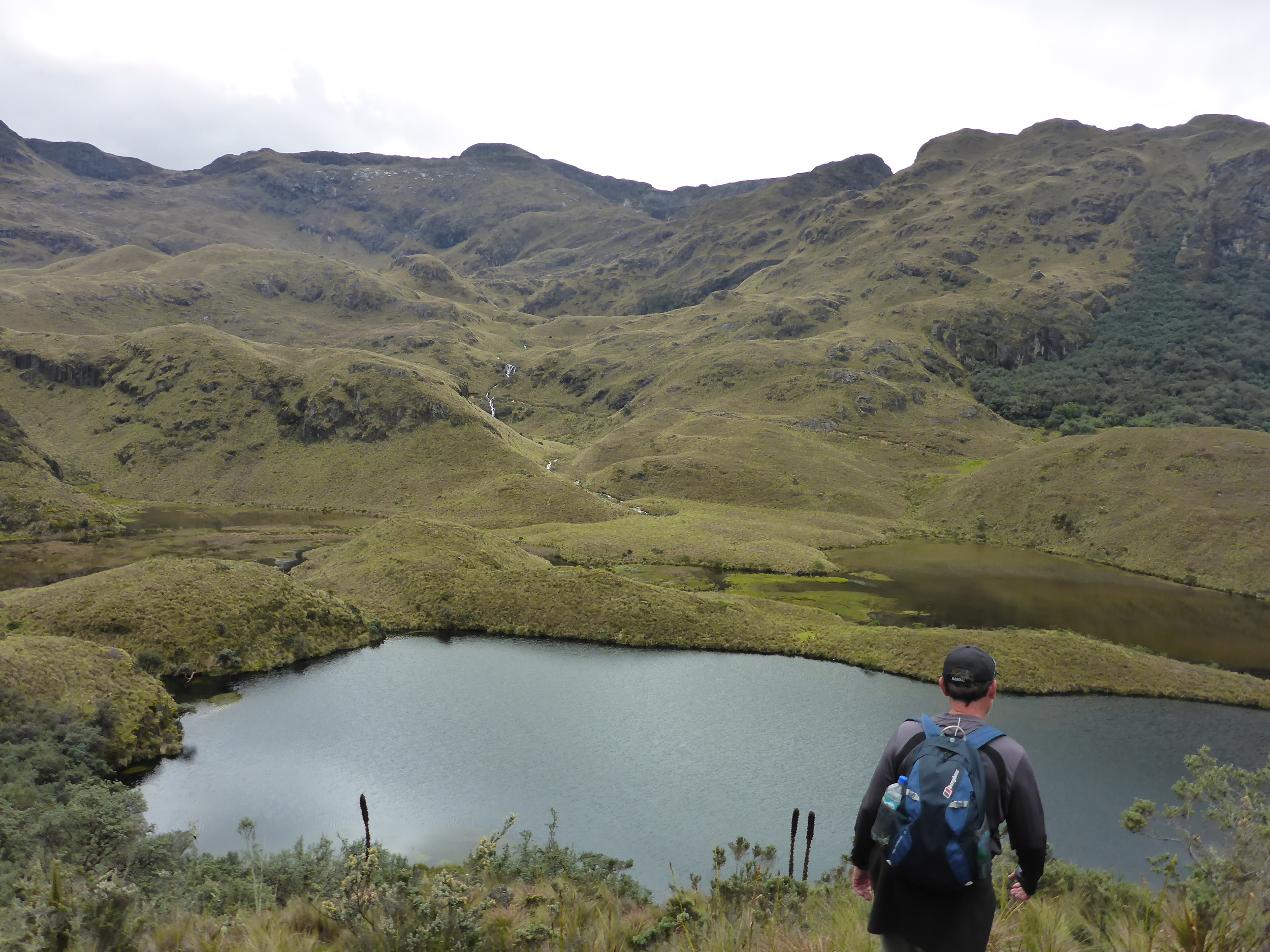
cajas national park
The park has dramatic mountainscapes and alpine vegetation, lots of lakes, and plenty of people trying to land a trout in it's many streams. We even saw a quinoa forest (we didn't know how quinoa was grown before this).
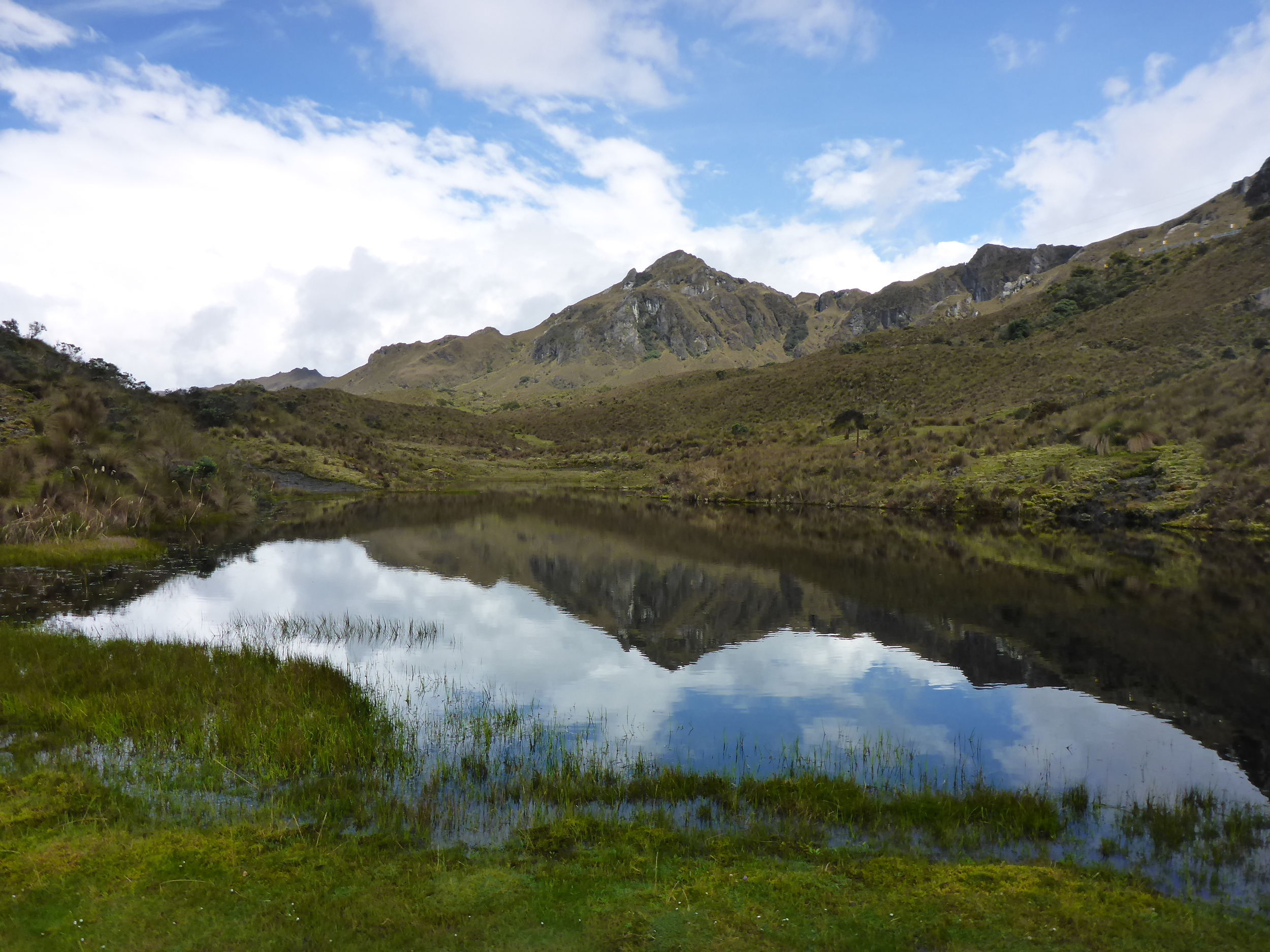
There are a number of short and long walks that can be done in the park with different degrees of difficulty. We chose a 3.5 hour circuit as recommended by the helpful park's staff. You need to register before starting any of the walks, but park entry is free.
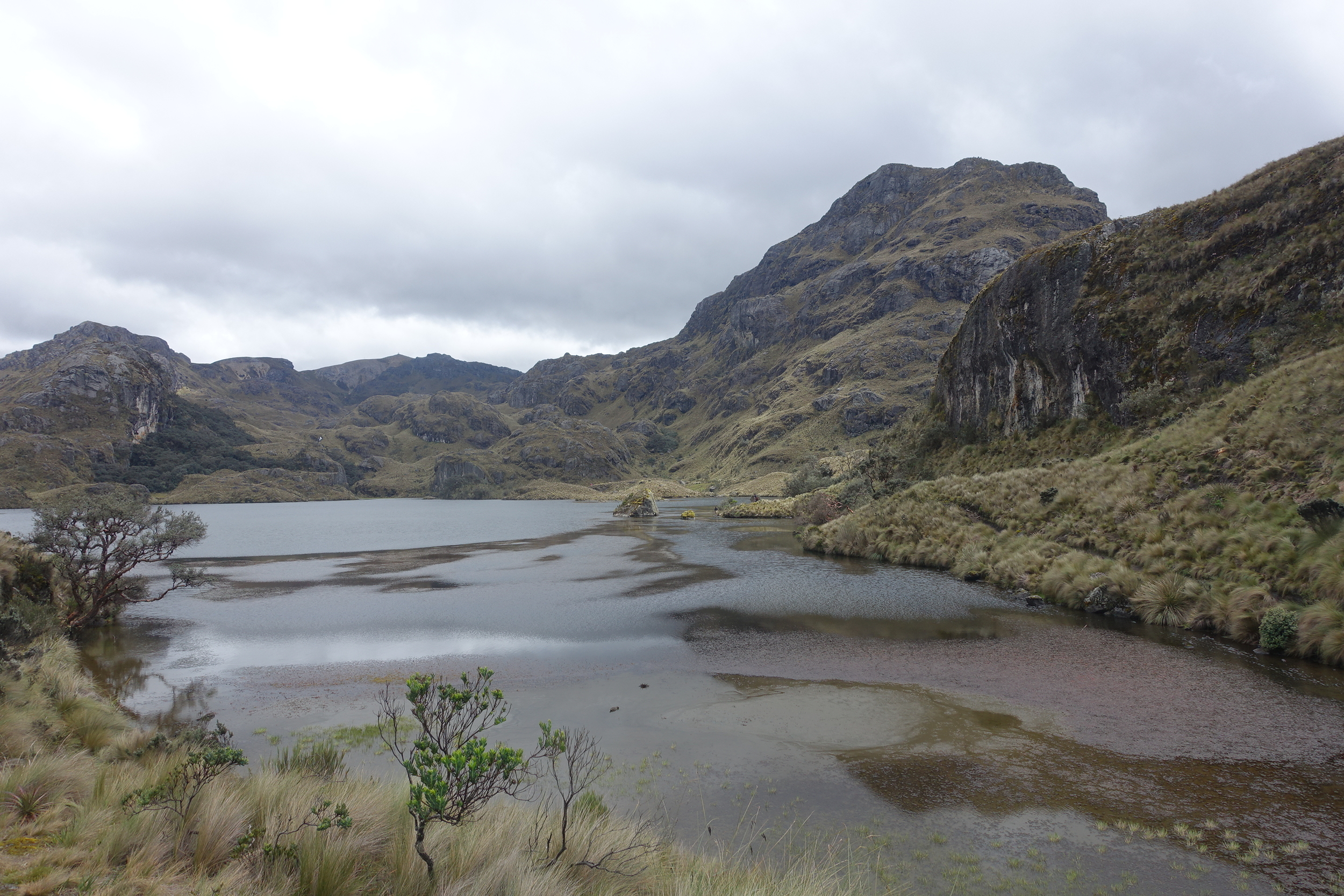
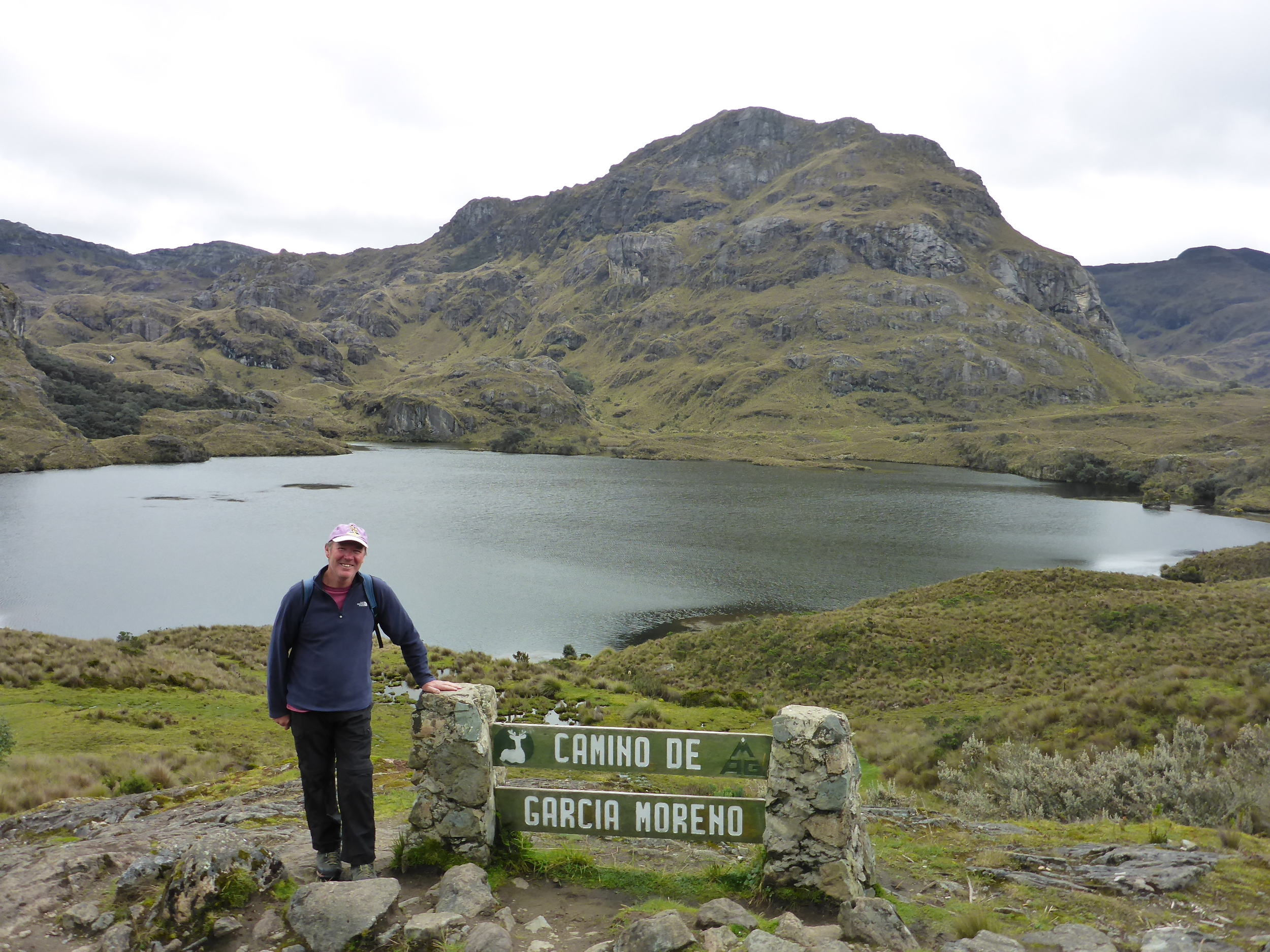

cajas - photo peter hardaker
Baños
Baños is to Ecuador what Queenstown is to New Zealand, with a range of adrenalin inducing pursuits, including white water rafting, mountain biking, bungy jumping and zip lining. It's also home to a number of thermal baths, hence the name Baños.

the road to Baños
We had two full days in Baños.

Baños
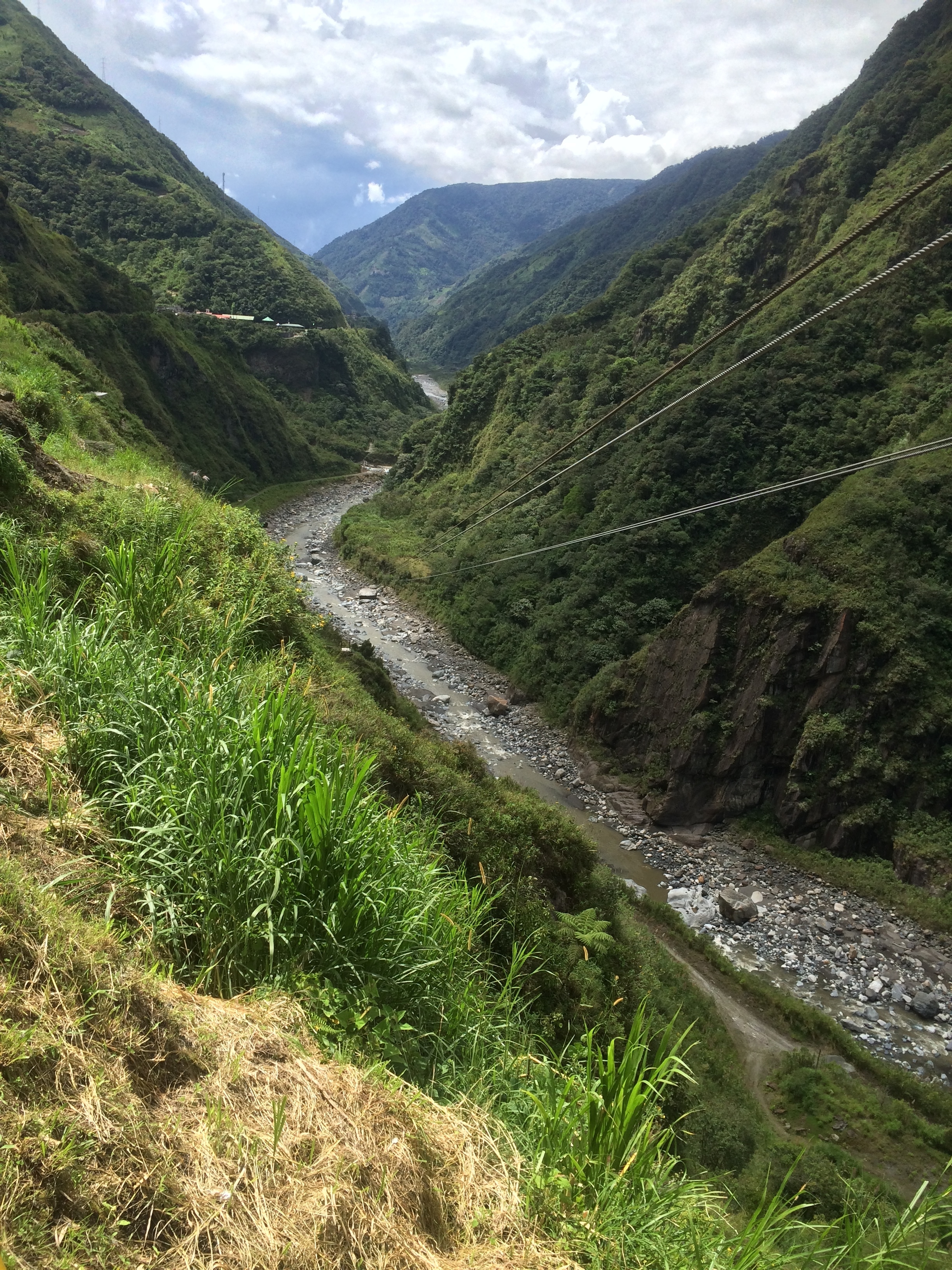
On the first we took what's known as a Chiva Tour. Chiva means baby goat and this refers to the fact that the tour jumps all over the place (like a baby goat). In reality it involved a 2 – 2.5 hour trip visiting a series of impressive waterfalls (cascadas) – cost $US6.

chiva bus
At most stops there were additional activities that you could pay for such as zip lining across a considerable canyon, or cable car rides.
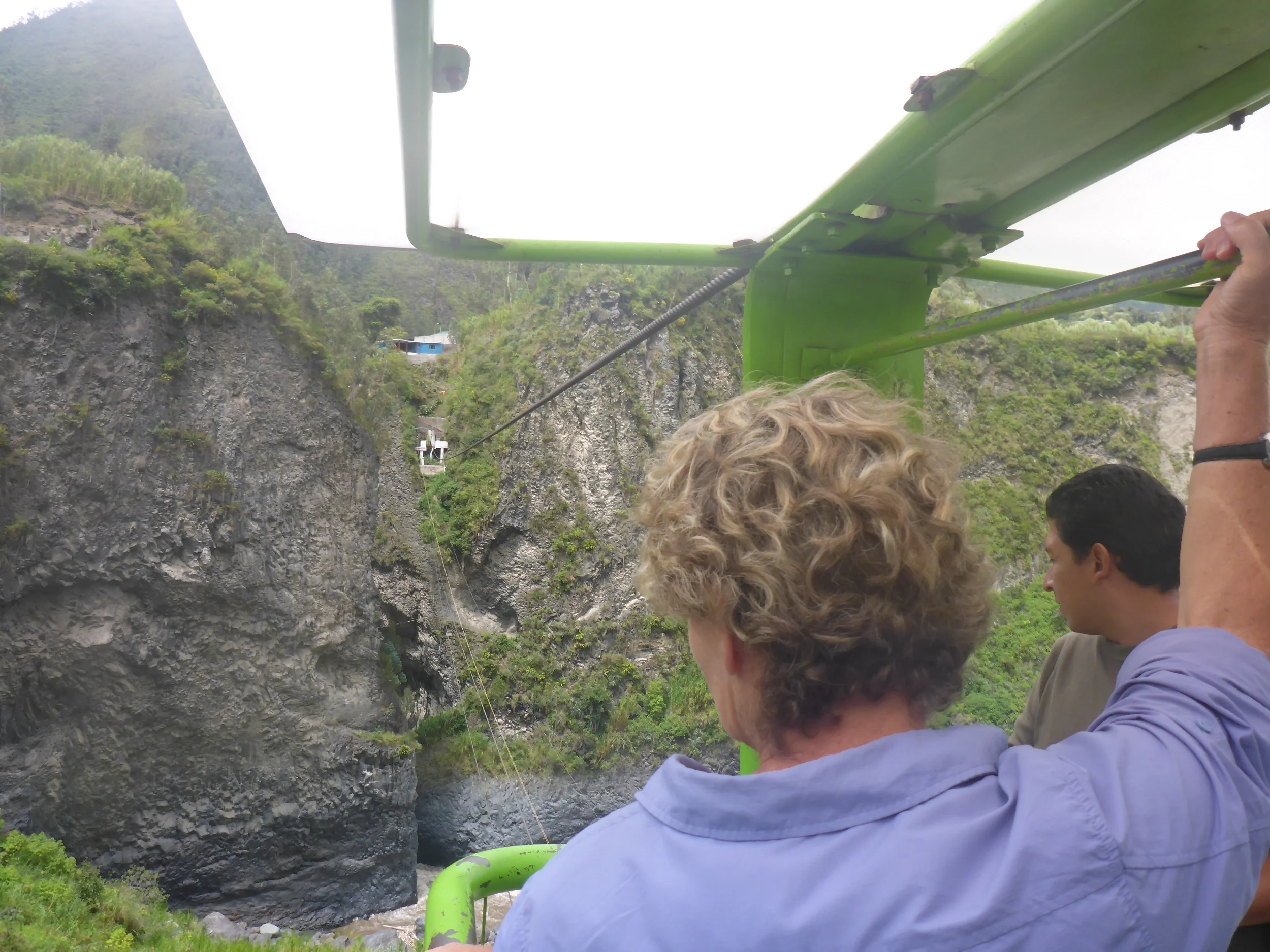
cable car Baños
We had a go at both the zip lining and a cable car ride.
Pete doing a bit of zip lining.

one of the many waterfalls (cascadas) on the chiva tour
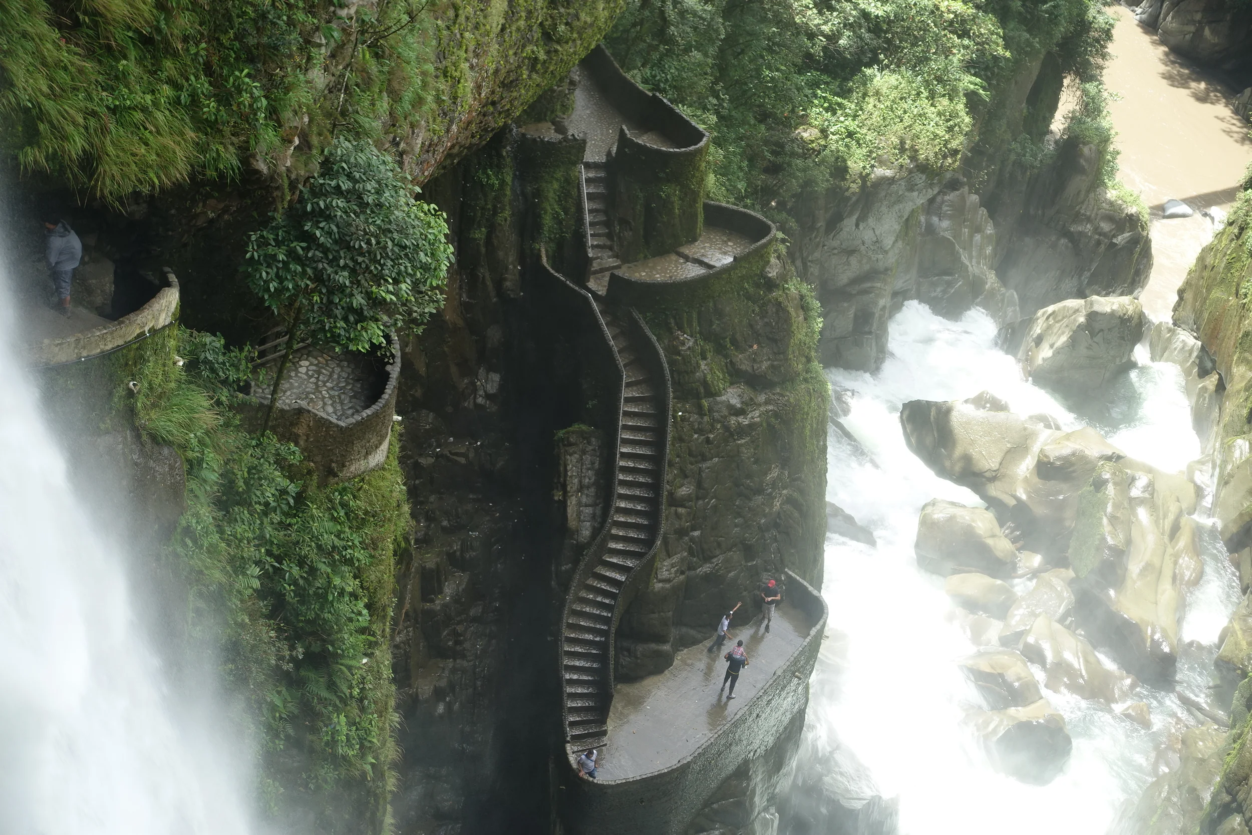
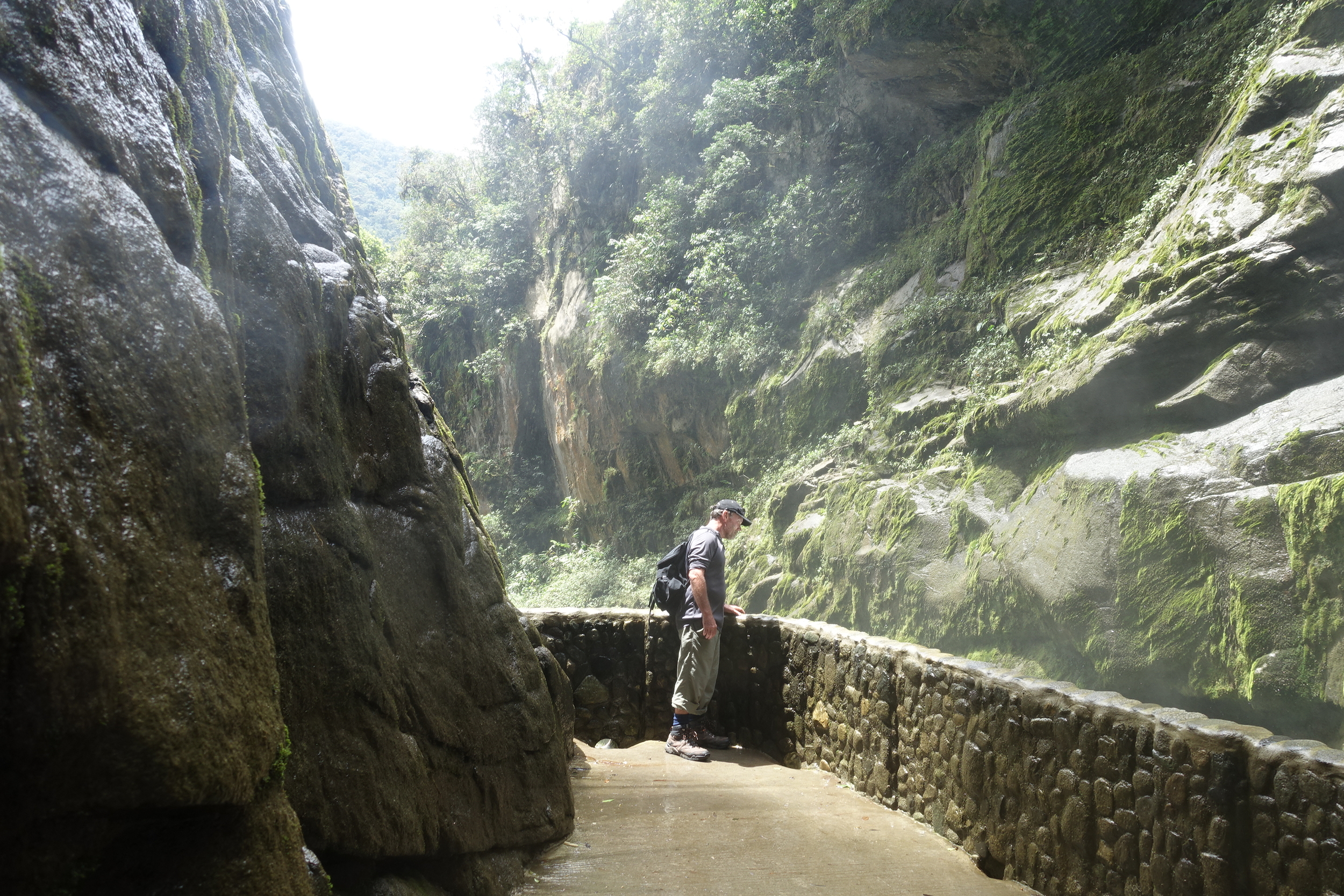
The last stop was at Pailon del Diablo Waterfall. This was a dramatic thundering affair with walkways that take you up close and personal with the falls.

pailon del diablo
The chiva tour was an excellent way to see the region around Baños and do a few fun things along the way. Definitely recommended.

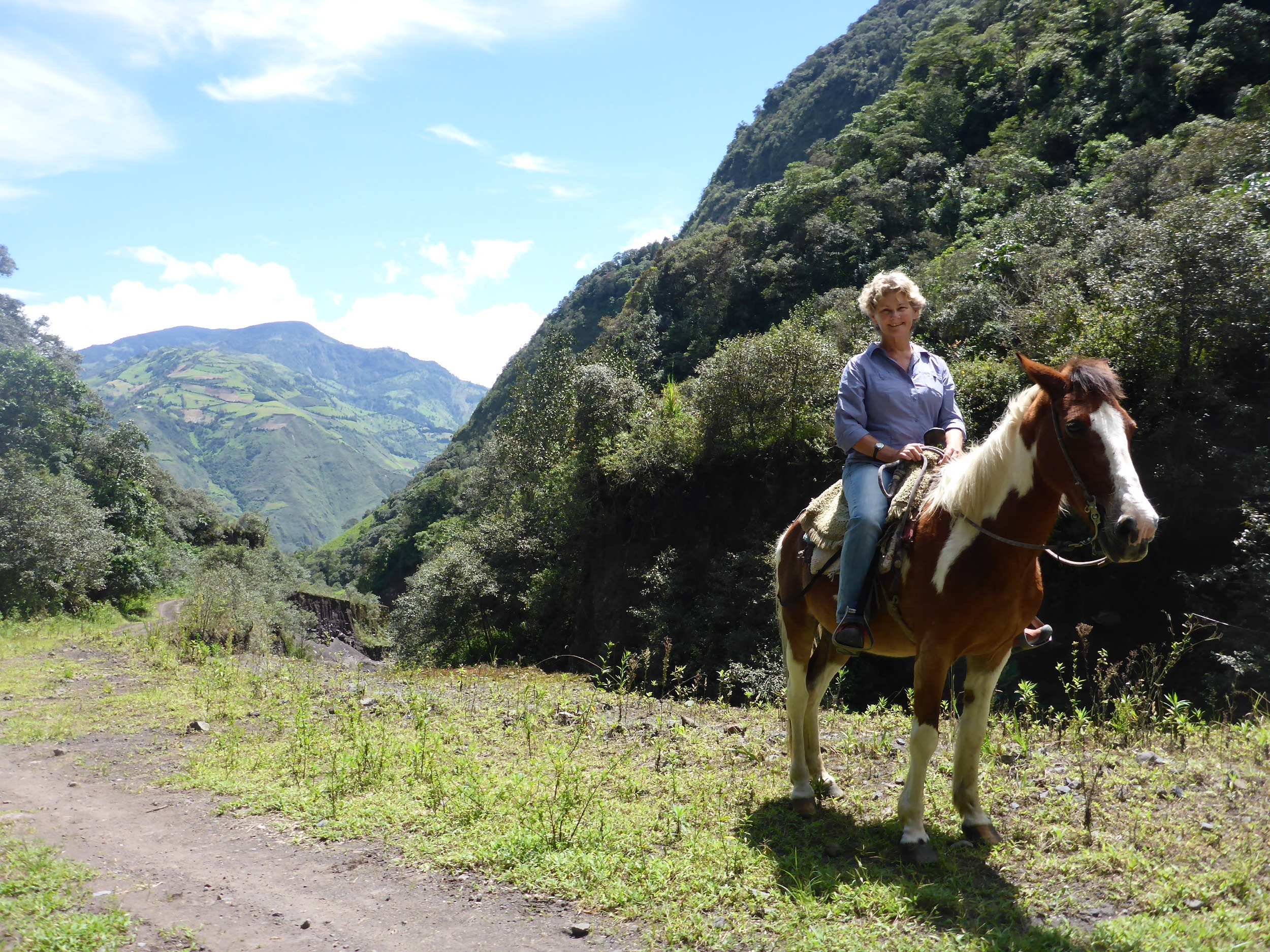
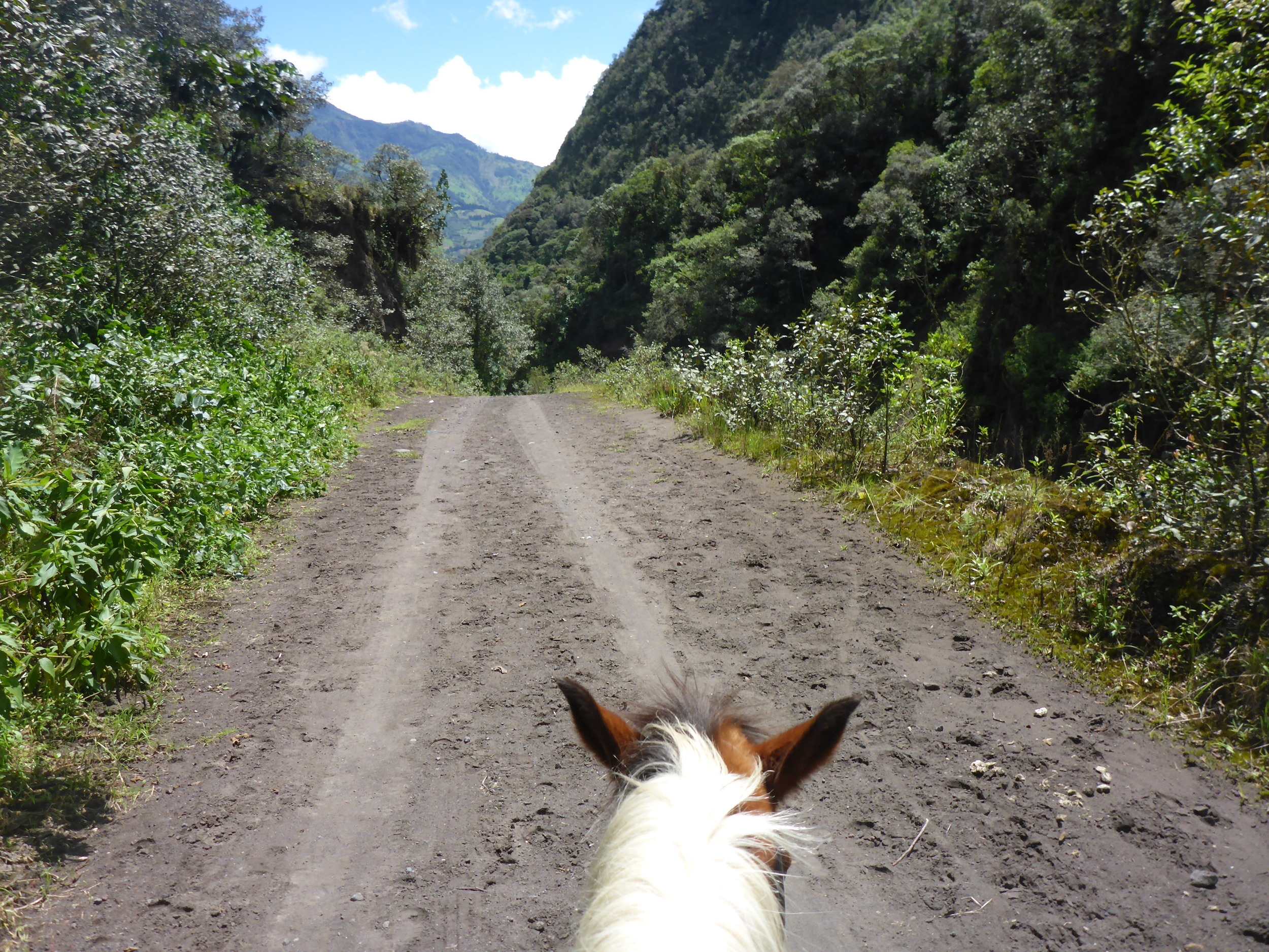
On our second day Cal went for a 2 hour horseride exploring gullies and some different waterfalls on the side of the volcano that sits behind Baños – Volcan Tungurahua.
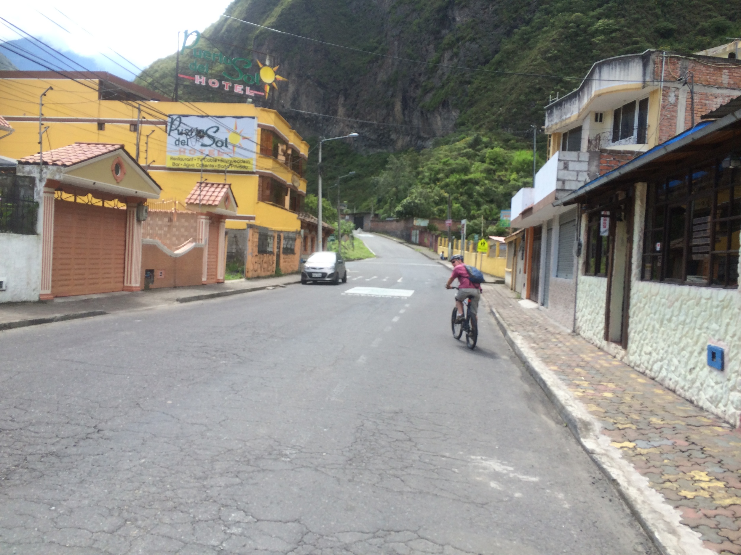
Pete and Ken did a mountain bike trip which replicated the path of some of the previous day's chiva tour. We'd seen a 1km zipline and were keen to give it a go. We did and it was awesome. That's a shot of the view down the valley from the start of it on the bottom right (above).

At the end of a 20km bike ride, which was nearly all on a gradual downhill incline, we arrived at the Pailon del Diablo. This time we visited the other side of the falls for views equal to yesterday's.
After a cleansing ale we threw our bikes on the back of one of the trucks that cart cyclists back to town -$US2 well spent. The bike hire cost us $US7 for the day.
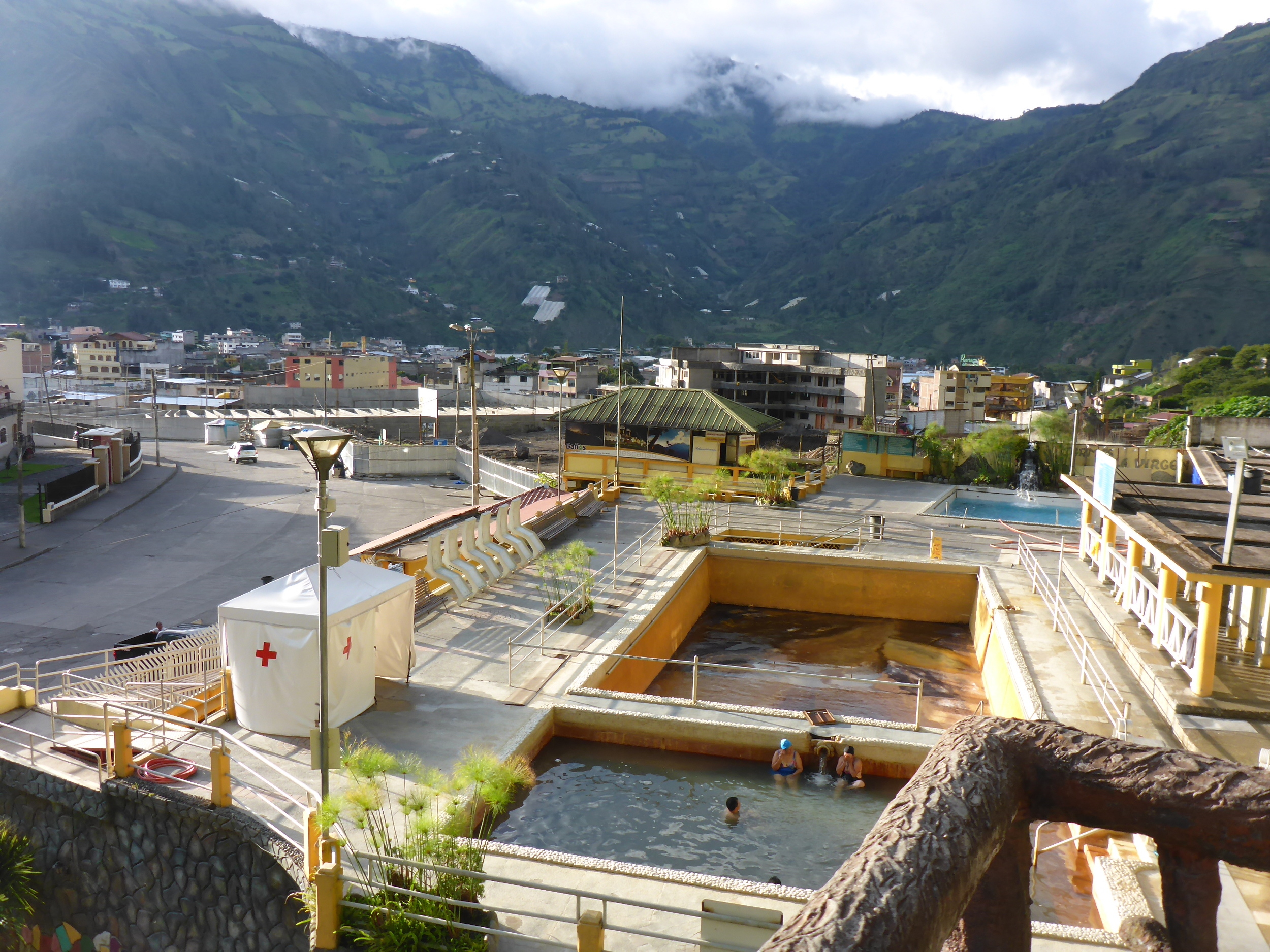
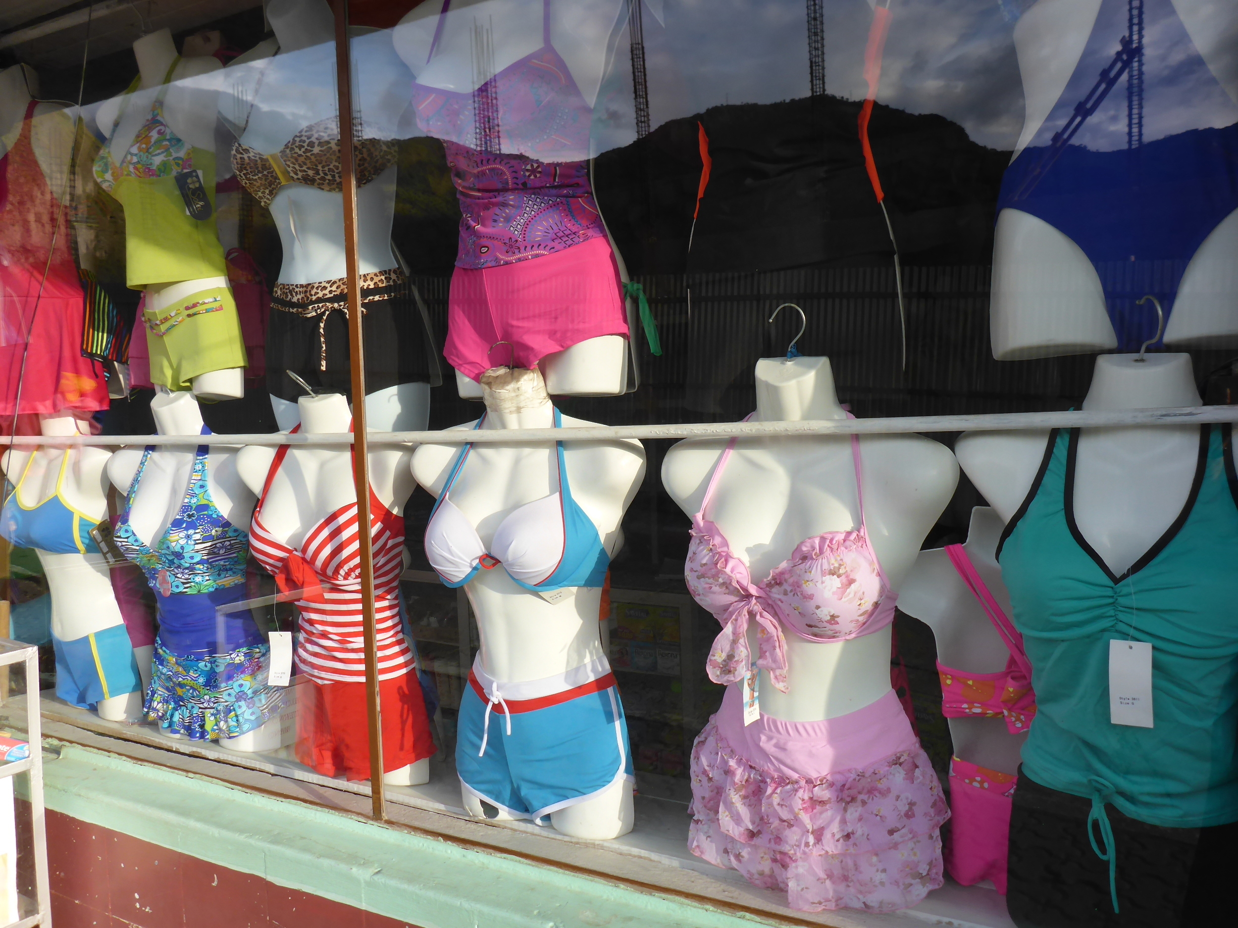
We weren't tempted to visit the thermal baths (banos). They looked uninviting. But clearly Baños is a good place to pick up that retro swimwear you've been seeking.
Quilotoa Loop

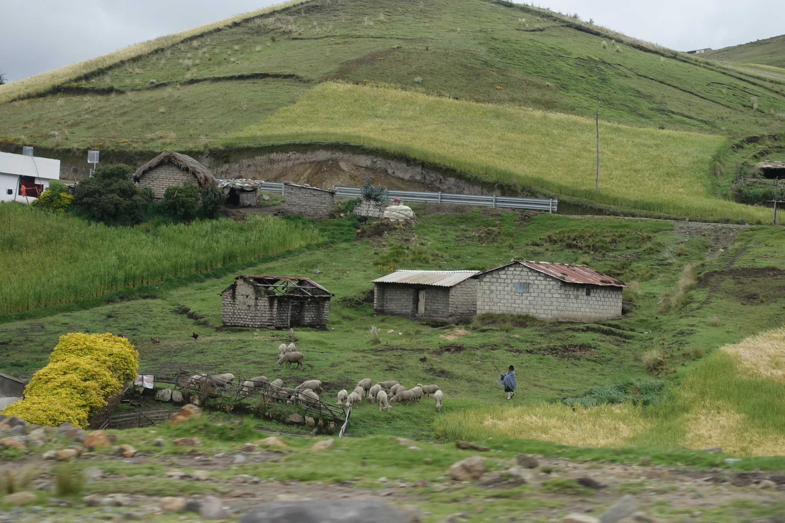
quichua woman , quilotoa Photo - peter hardaker
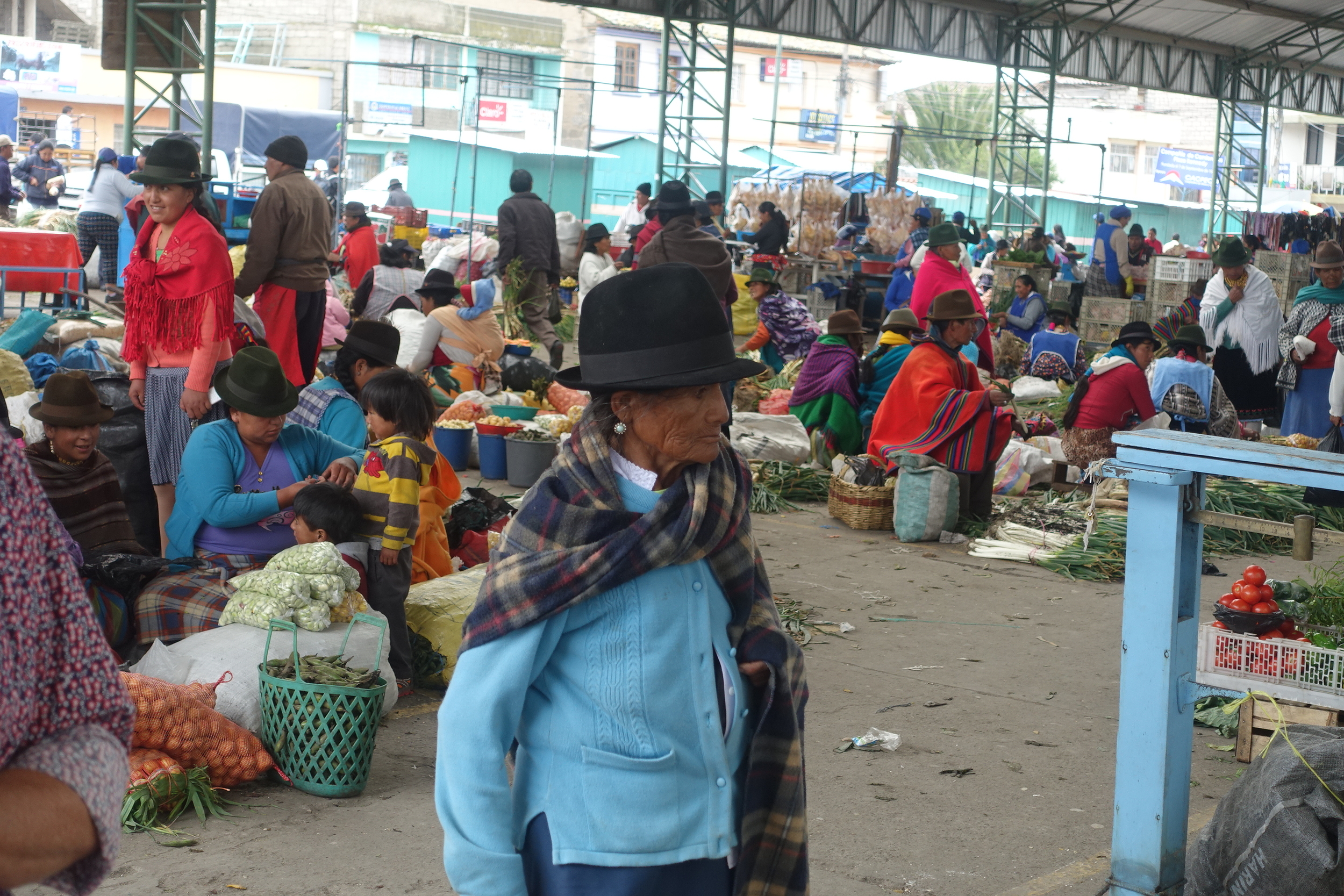
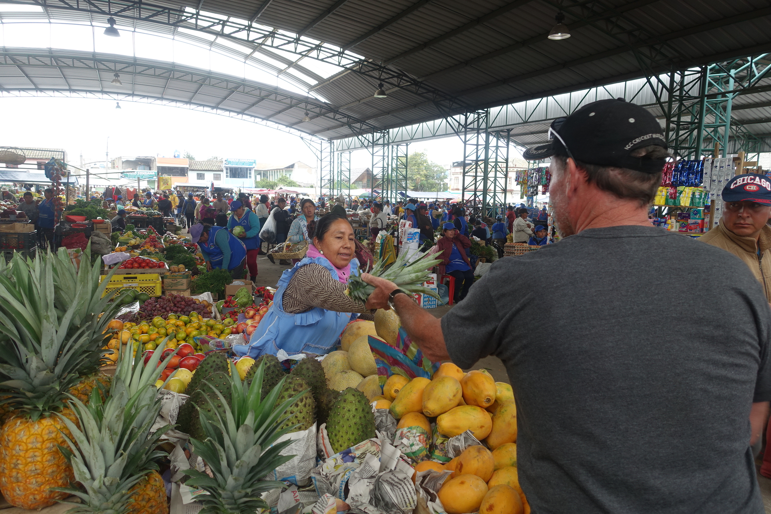
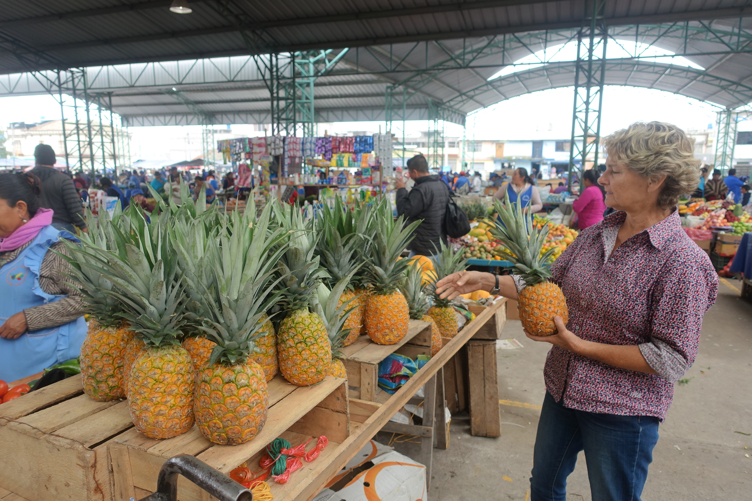
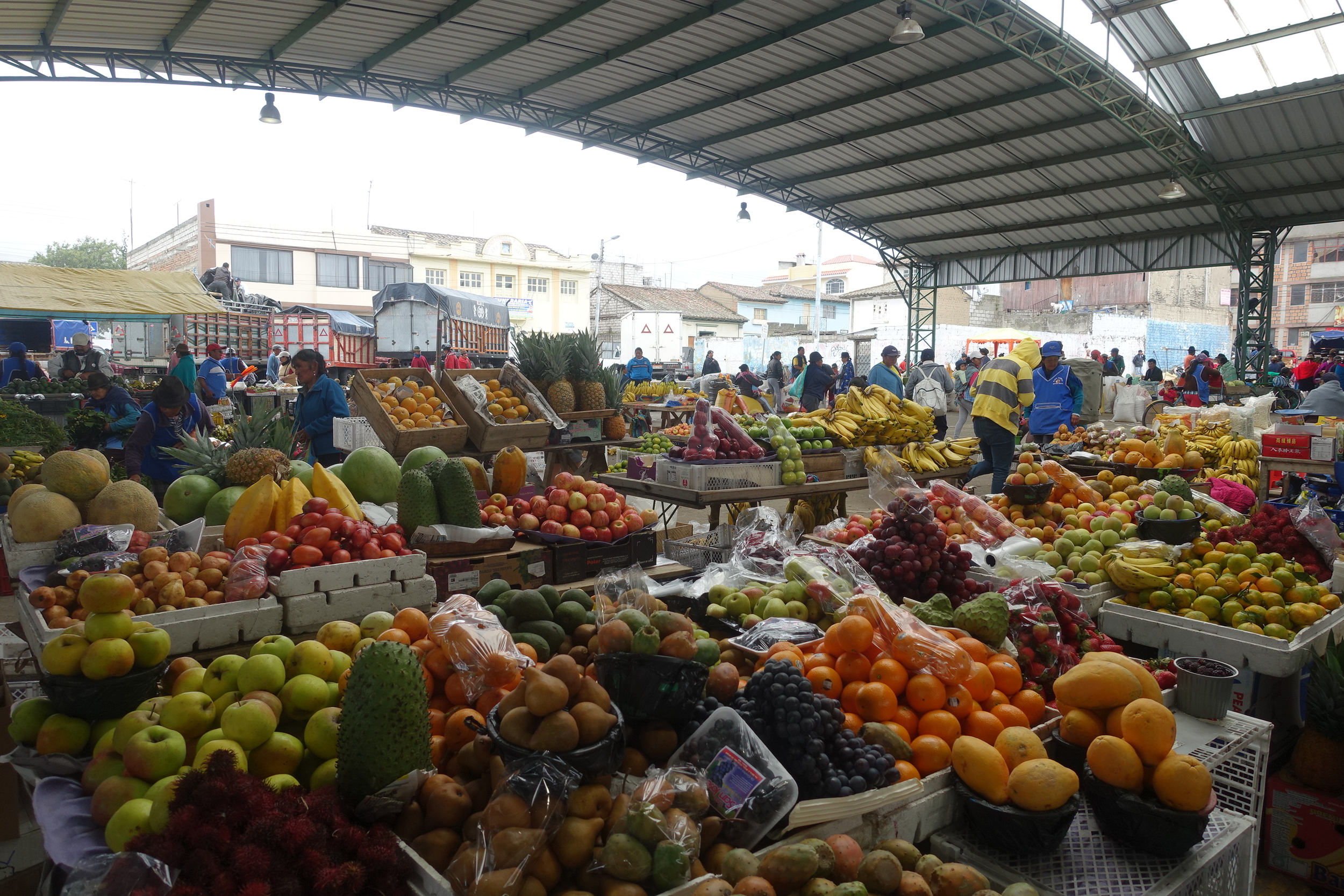
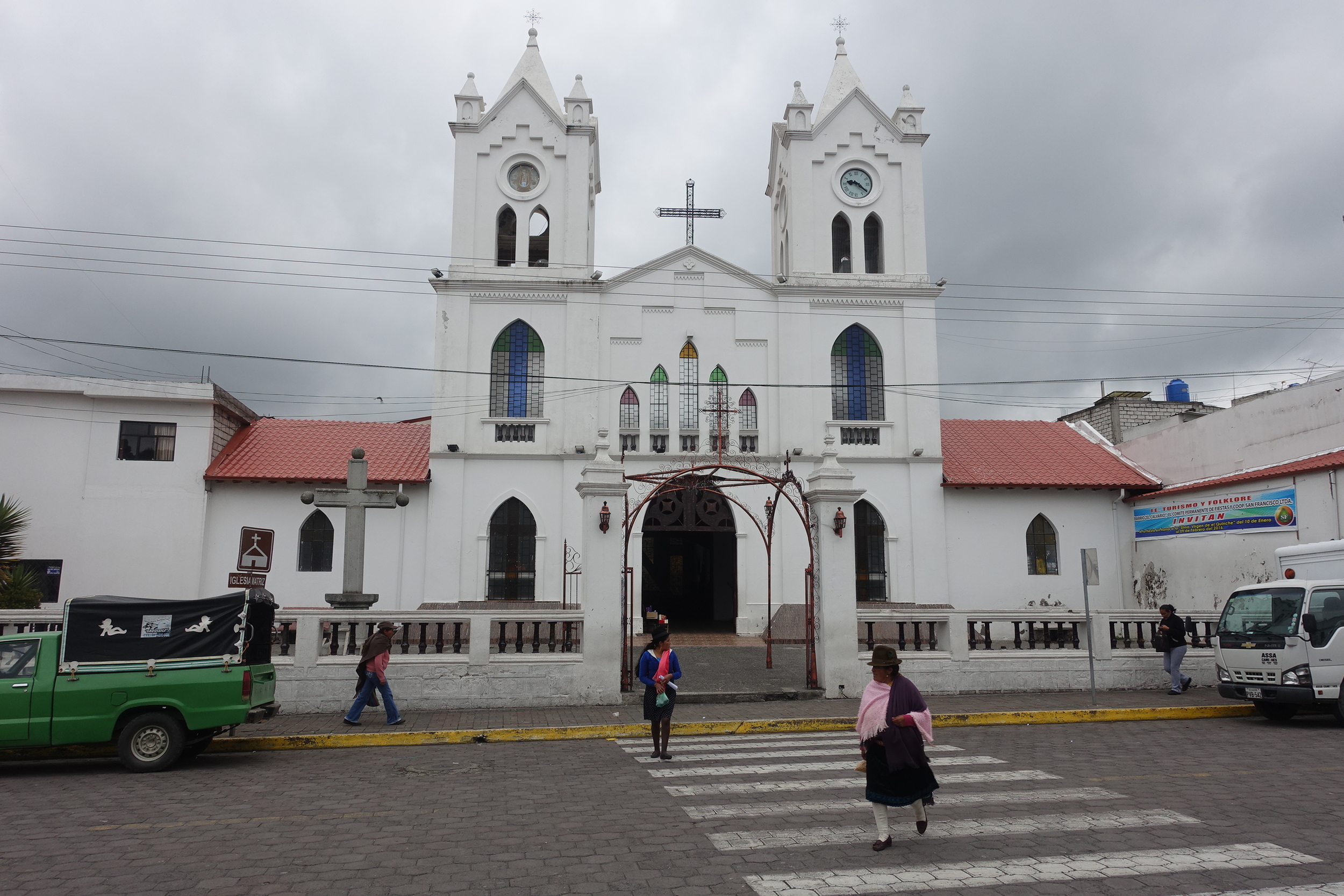
Heading back north towards Quito we set aside several days to do a trip on what is known as the 'Quilotoa Loop'. This is a circuit trip in the highlands which involves trekking, bussing or driving between some small, largely indigenous towns renowned for their spectacular mountain views and colourful markets. It can be done clockwise or anticlockwise.

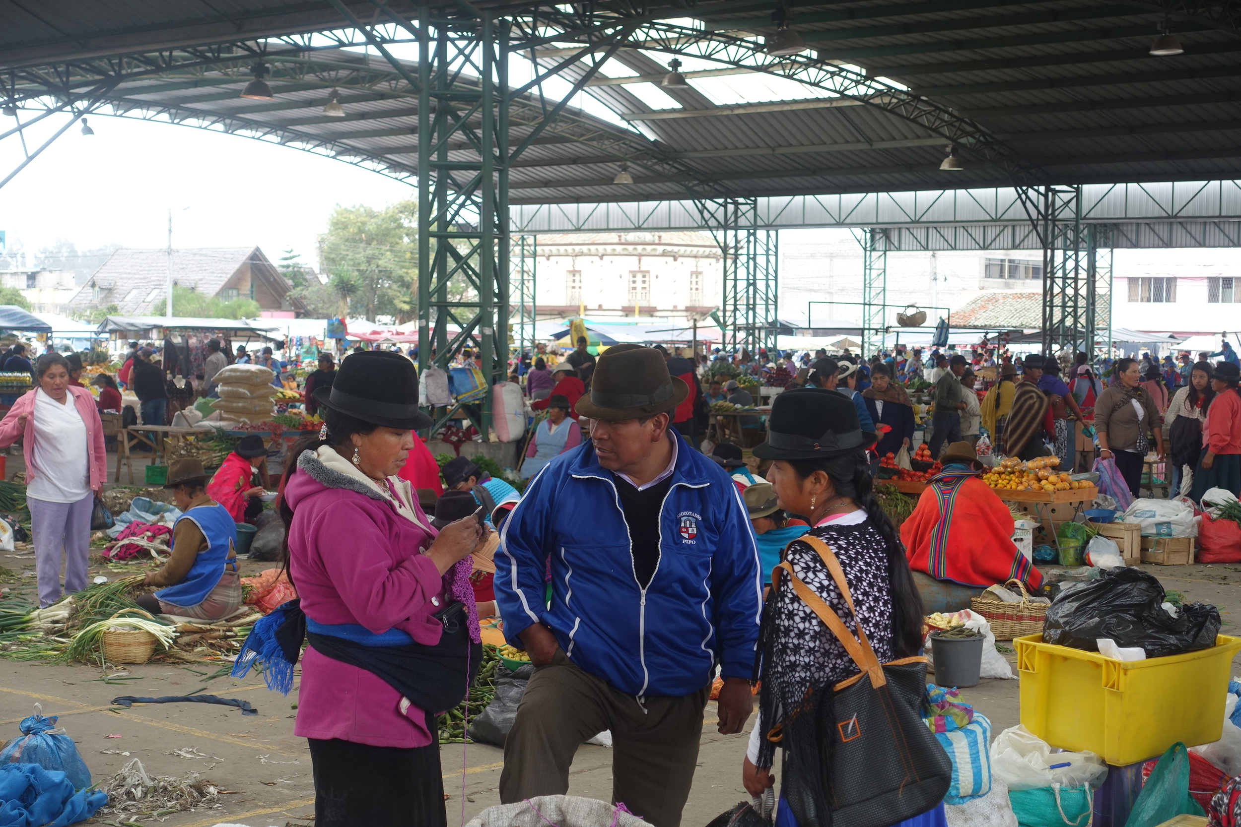
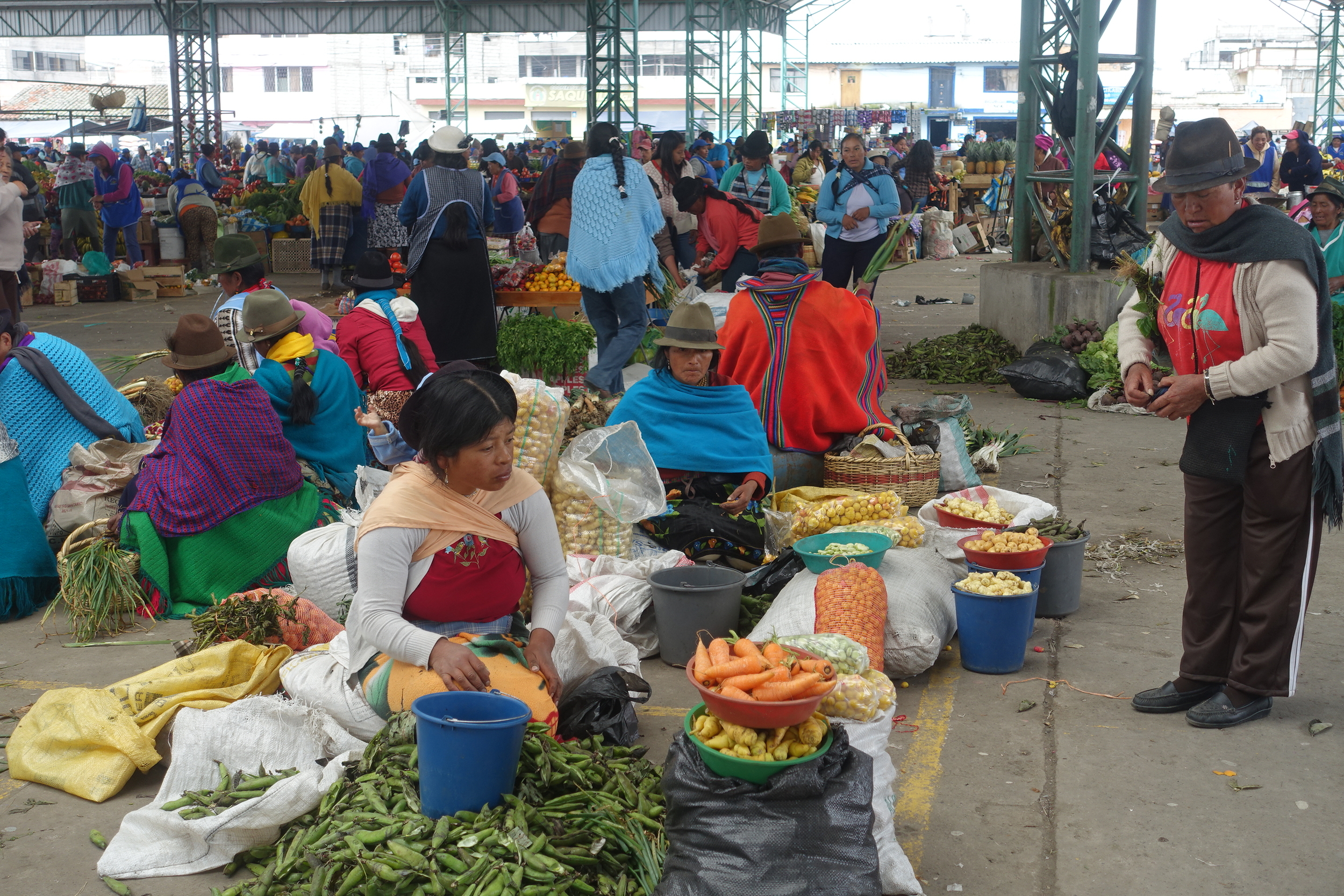
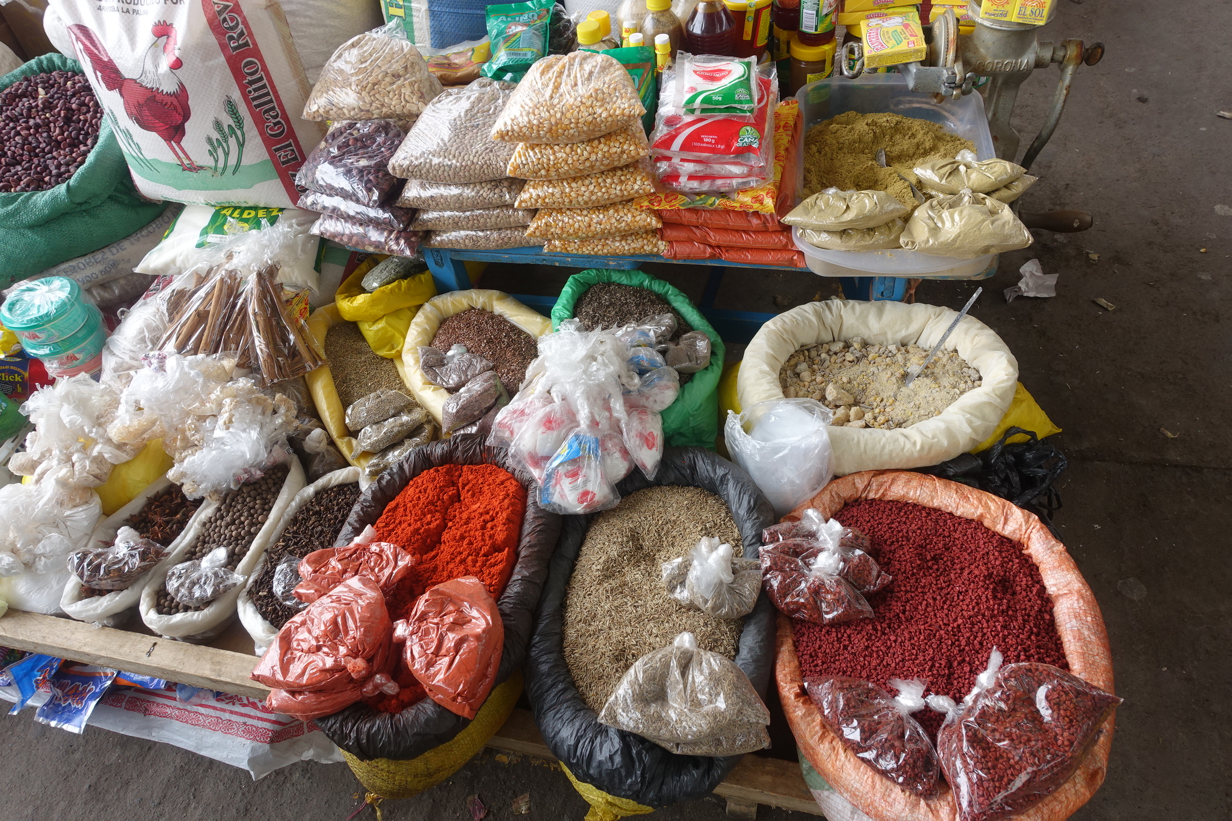
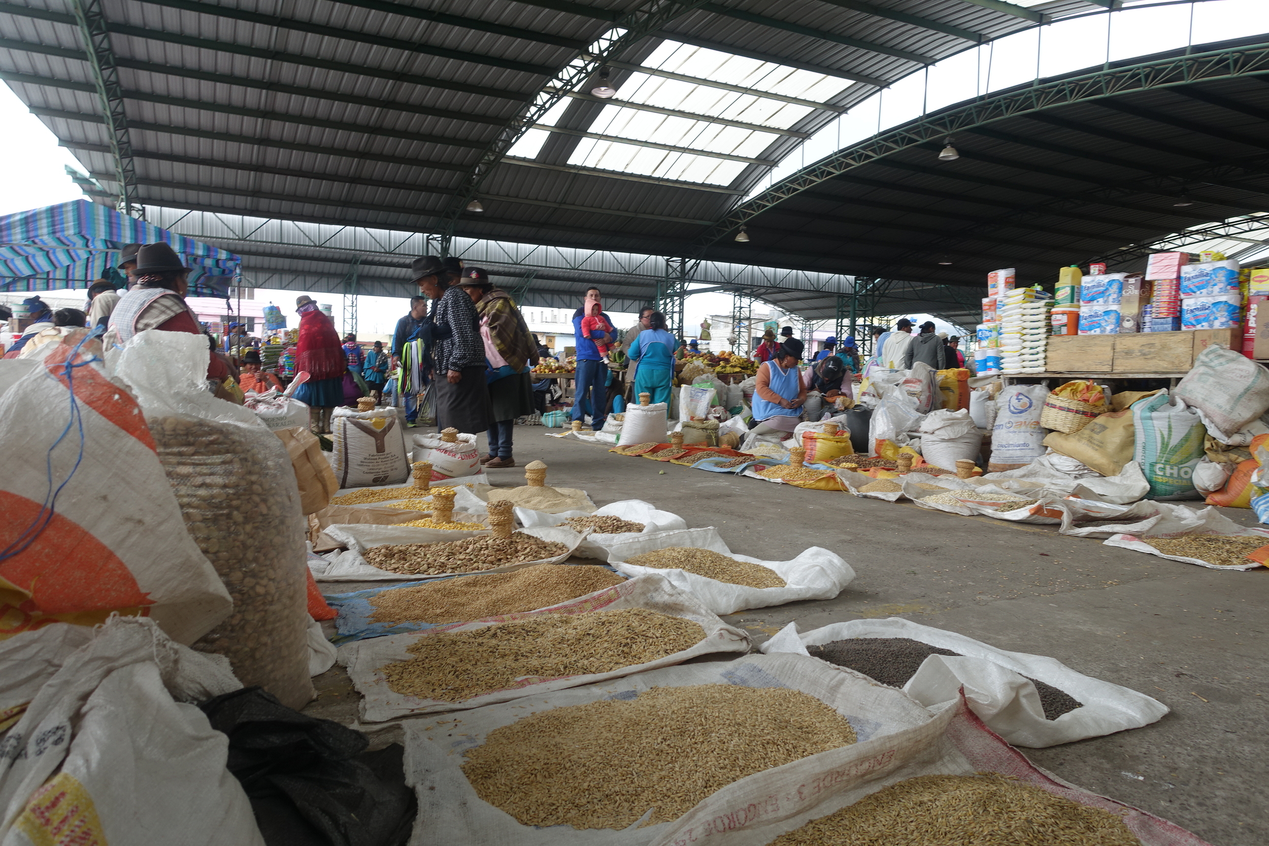
saquisili market

We started in the village of Saquisili visiting the Thursday Market.
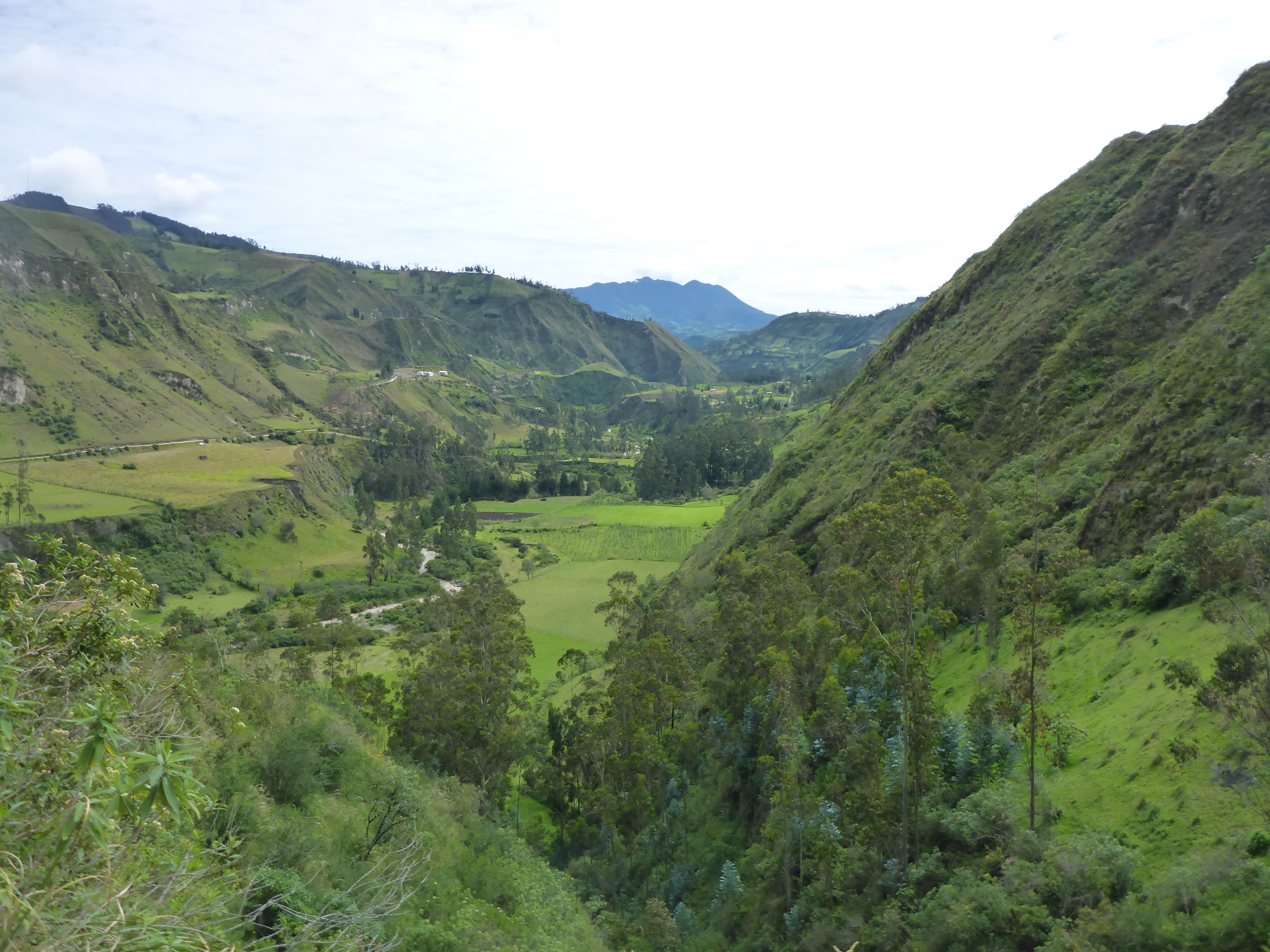
We then drove to Isinlivi via Sigchos. There we had booked for two nights at Llullu Llama Guesthouse. This was a very comfortable place with views of the mountains.
the road to isinlivi
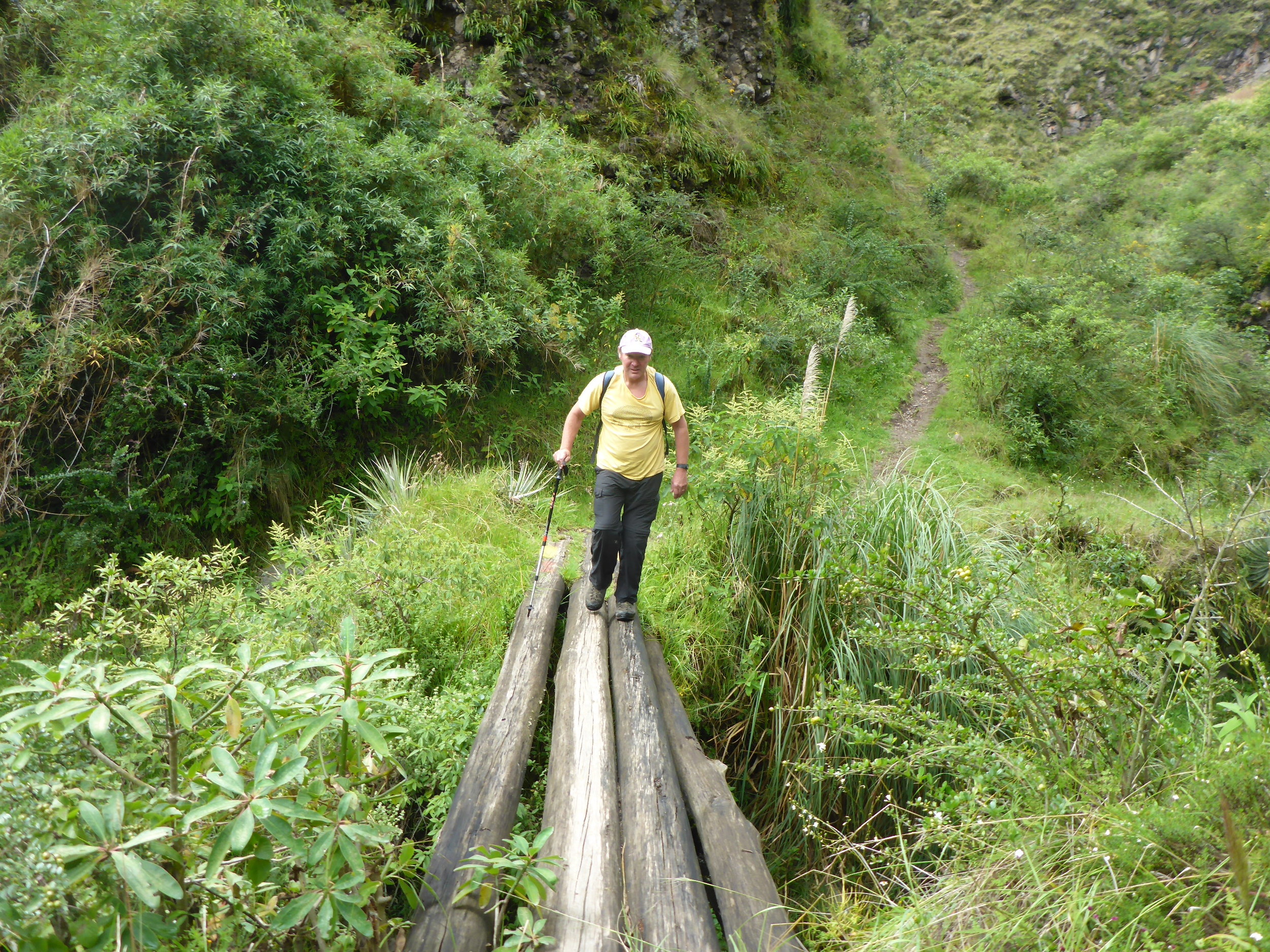
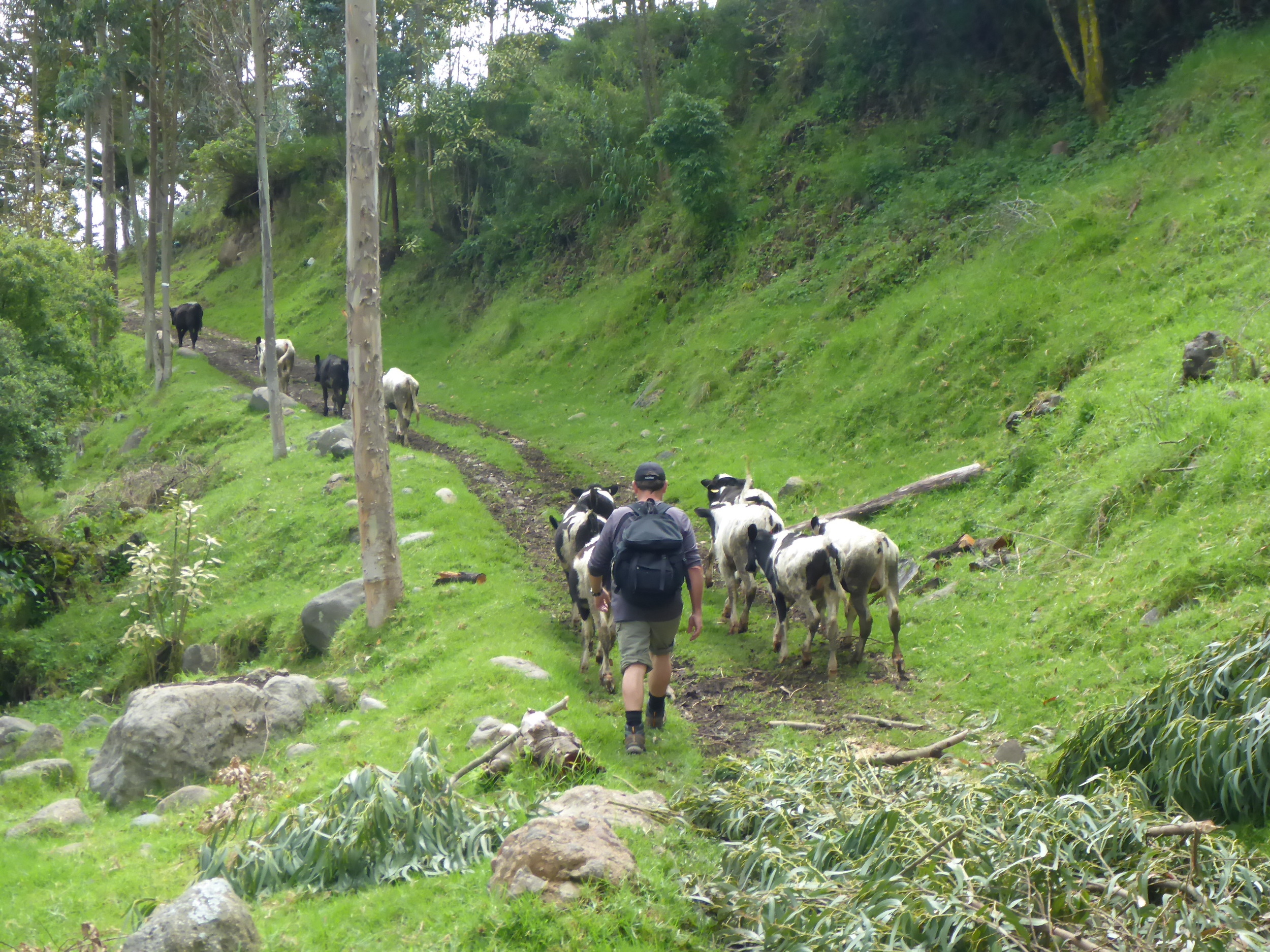
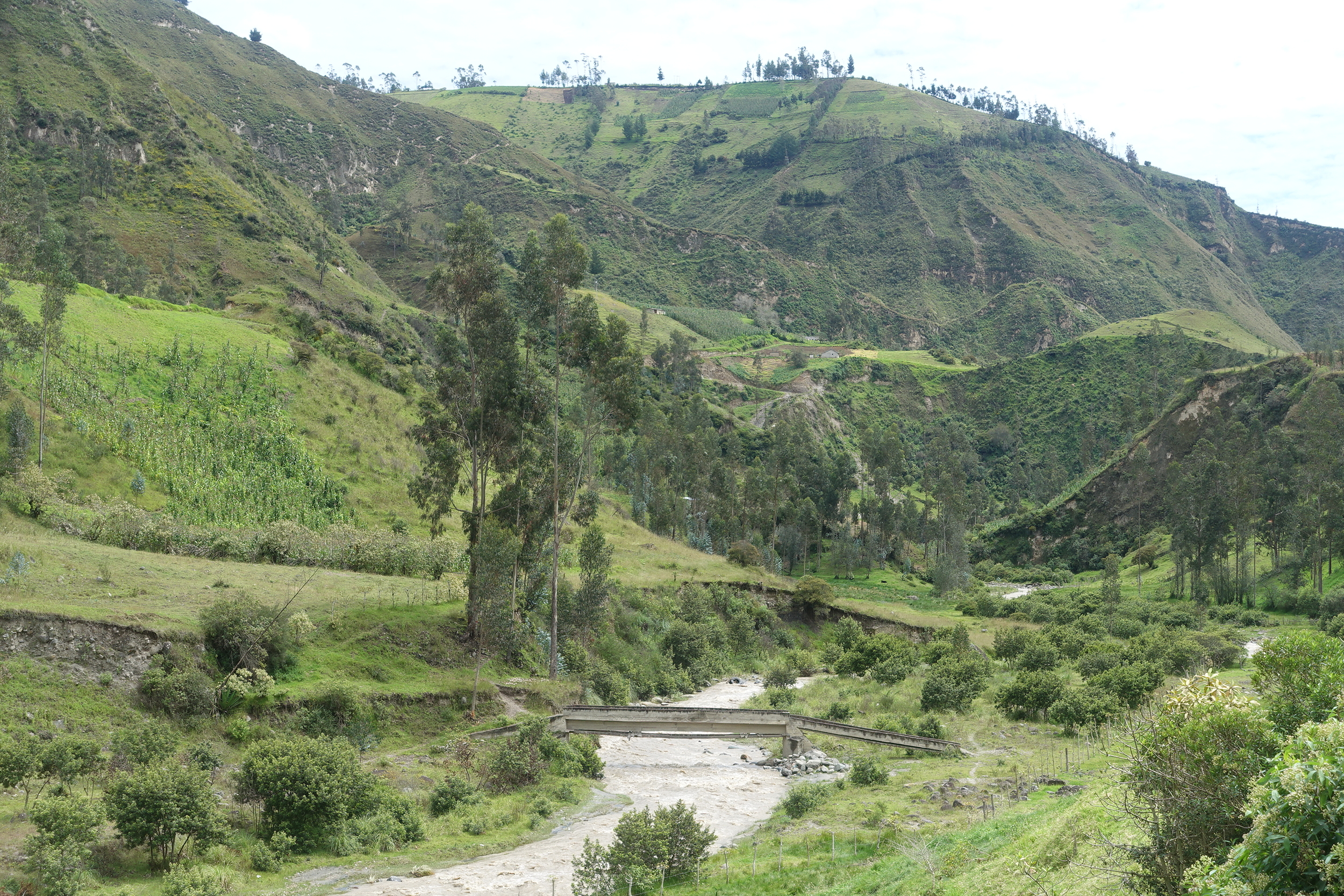
On our full day in Isinlivi we did one of a number of day walks that can be done locally. With advice and a map with notes from Llullu Llama, we chose the Cochalo Loop a 3-3.5 hr walk from our high point at the guesthouse, down into a valley, followed a river for a while, then we climbed up to the small village of Cochalo, followed by a further climb, and then a short walk back to Isinlivi.
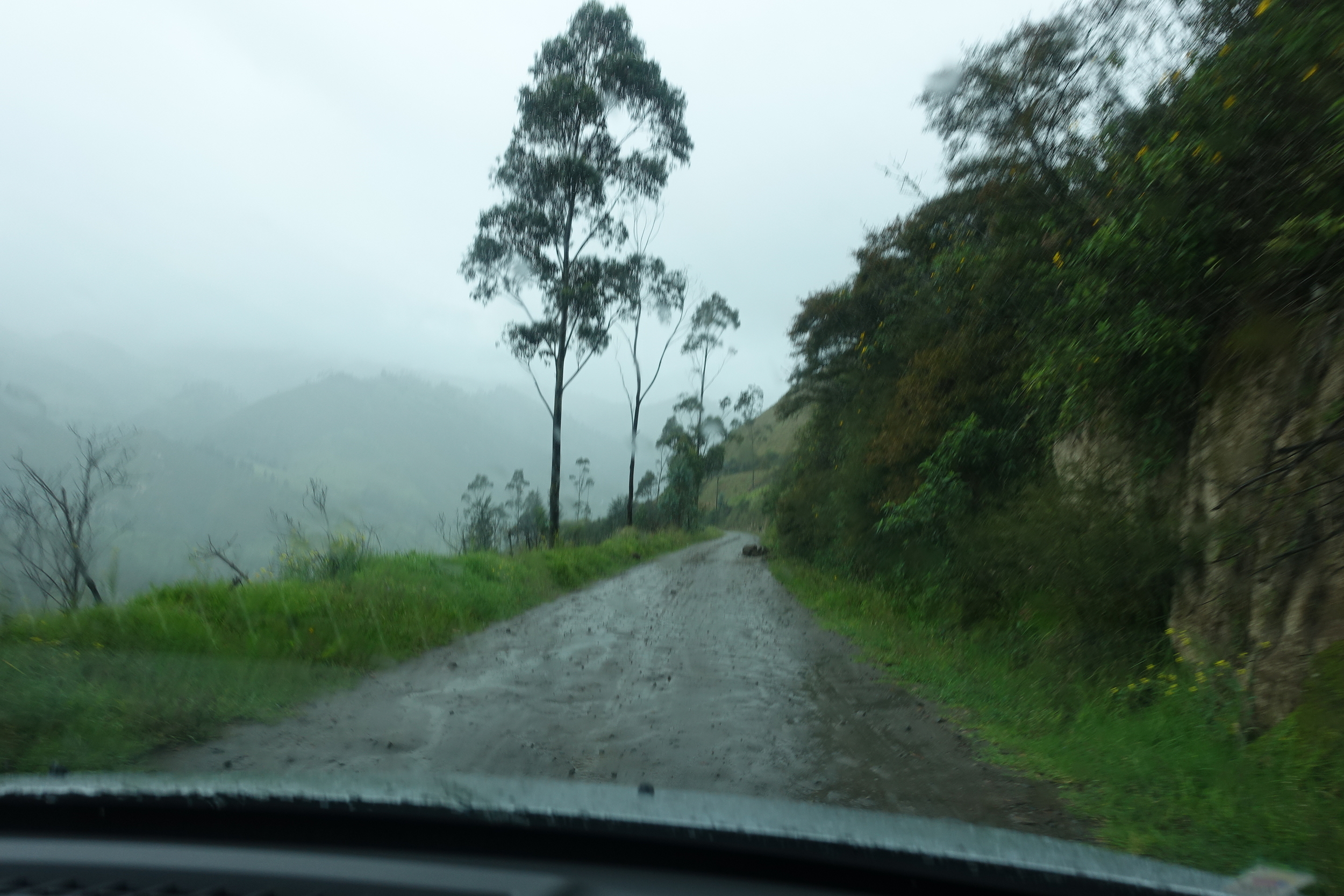
The next point on our planned circuit route was the town of Quilotoa via Chugchilan. Unfortunately it rained very heavily the night before. When we reach the Chugchilan turnoff in Sigchos we were advised by some locals that our conventional wheeled vehicle would not make it. There were two other roads. We tried them both but without success. In one case a truck was bogged which made the road unpassable on a high mountain road with a long drop to certain death for anyone who failed to get past. The second road was undrivable due to rain/mud.
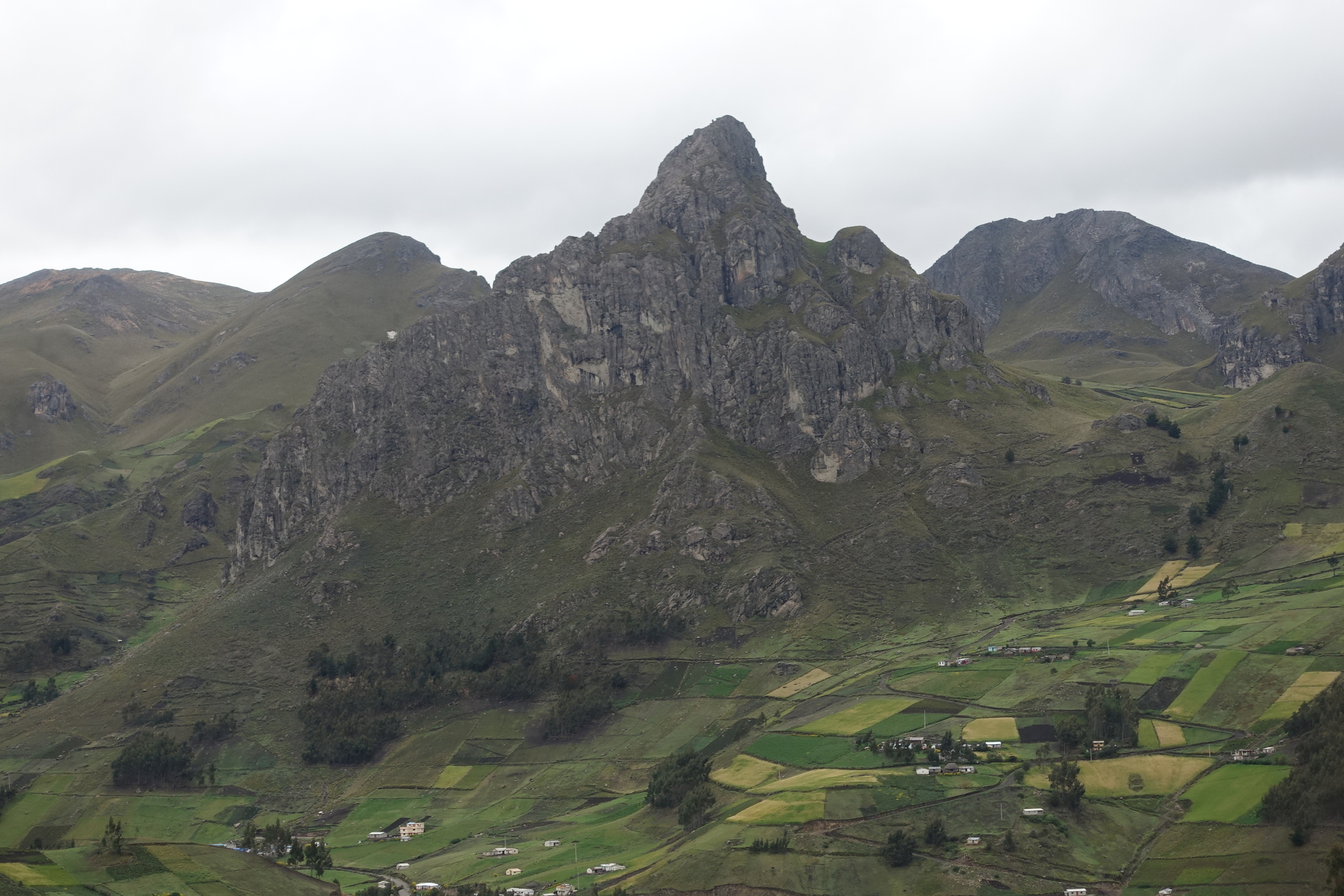
on the (GOOD) ROAD TO QUILOTOA
We had no option but to abandon our anticlockwise attempt on the Loop. Instead we backtracked to the Panamerican Highway and drove to Quilotoa clockwise on what turned out to be a very good road. It seems that the Chugchilan-Quilotoa road is the worst part of the Loop and the only part where a 4 wheeled drive might be needed if the weather has been wet.
on the road to quilotoa
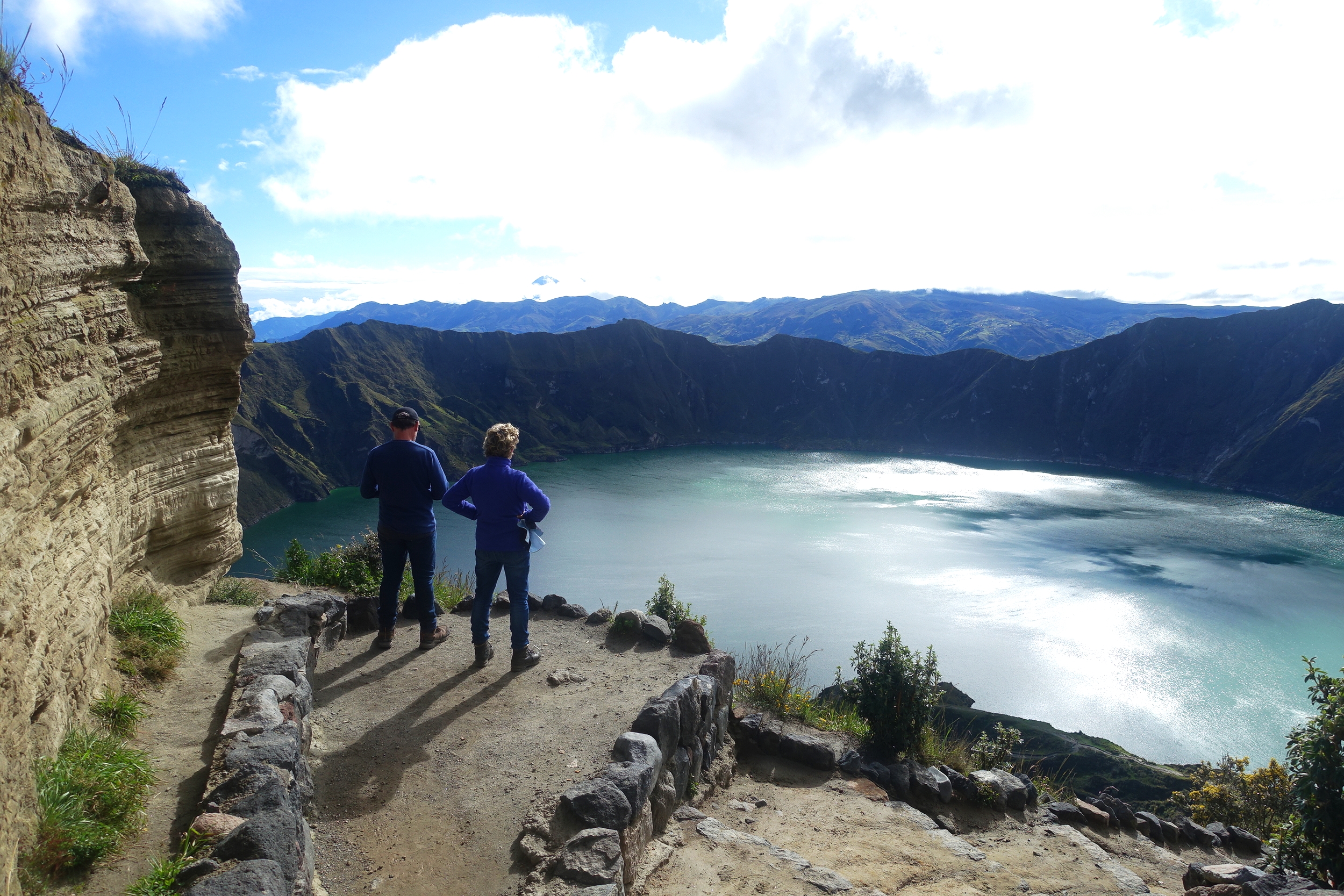
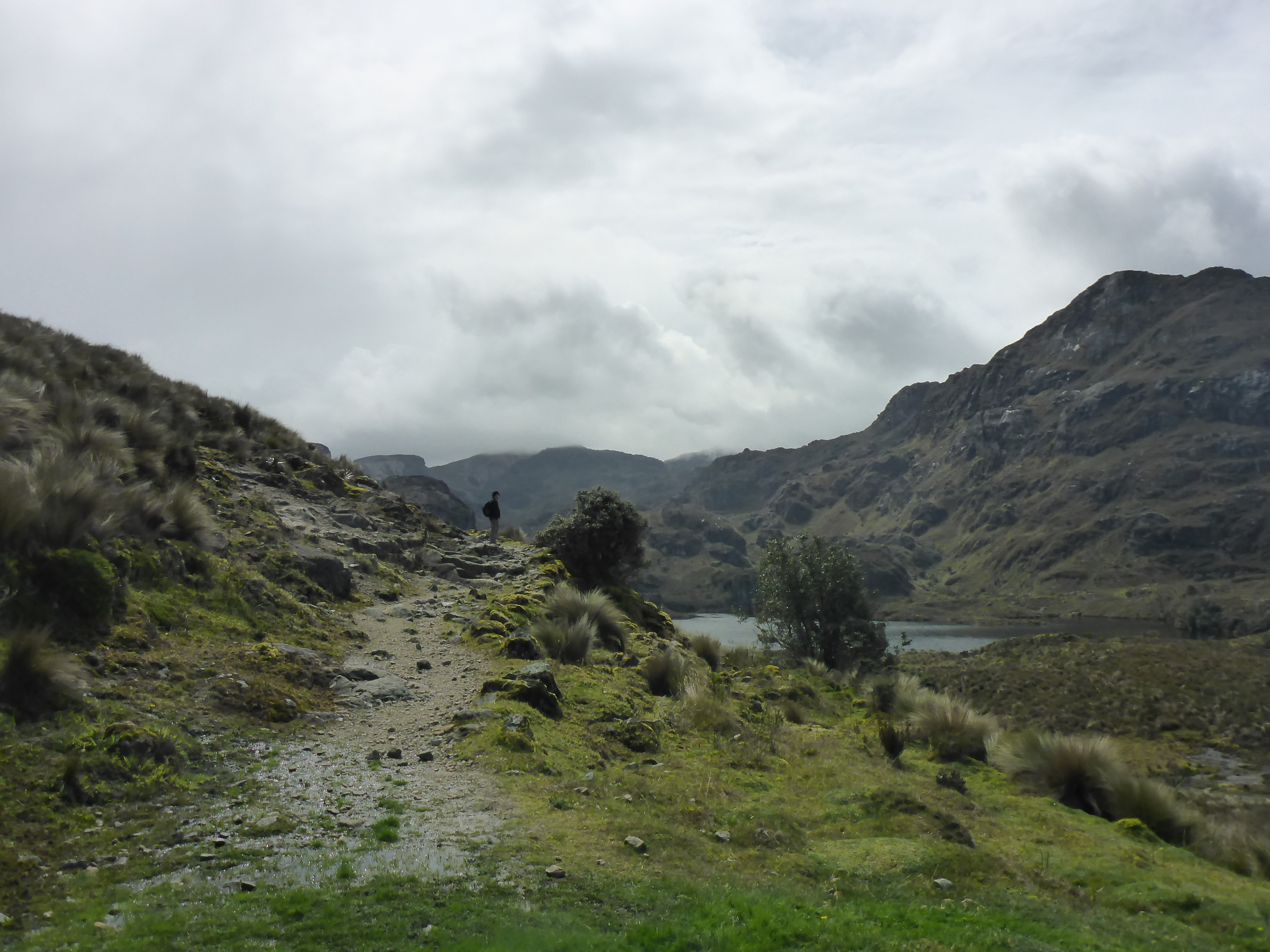
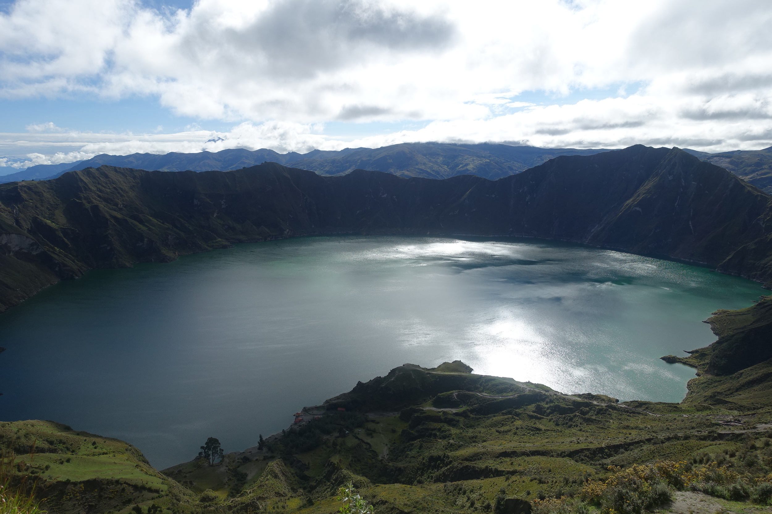
When we arrived at Quilotoa in the late afternoon it was wet and cloudy. We got some brief glimpses of the lake (Laguna Quilotoa) which is an outstanding crater lake. The long detour trip and the weather conspired to ruin our plans to do a walk around the lake.
Next morning was much brighter and we got some great views.
This was our last full day in Ecuador and we needed to end the day closer to Quito. We drove to Cotopaxi National Park, hoping to see Ecuador's second biggest mountain and most popular national park. Unfortunately the wet weather returned in the afternoon and we had to content ourselves with a walk around small Limpiopungo Lake.

limpiopungo lake. COTOPAXI is hiding in the clouds on the left - take our word for it.
We spent our final night in a guesthouse near Cotopaxi. This gave us a drive of 1.5 hours the next morning to Quito Airport. Pete flew off to Santiago, Chile and we flew to Bogota, Colombia for the next stage of our trip.

buildings painted with socialist banners and che are commonplace in the countryside.
We only experienced a small part of Ecuador – the Highlands. No opportunity to visit the Galapagos, Ecuador's biggest tourist drawcard. Ecuador also has a chunk of the Amazon which attracts many visitors, and prior to the earthquake the coast of Ecuador normally has a lot to offer, including some very good surfing.
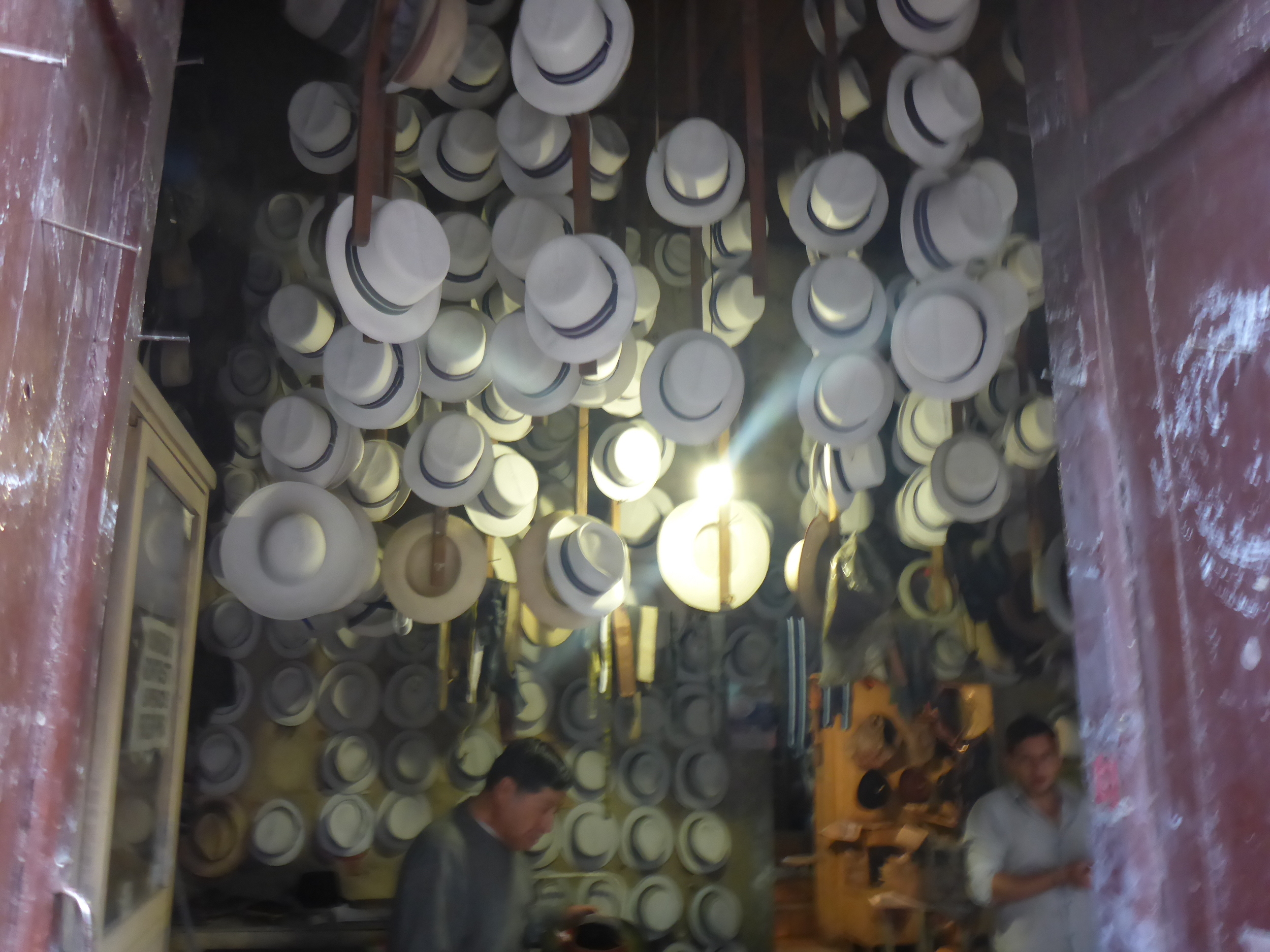
panama hats - cuenca
But, we were content with what we had seen and done and would encourage travellers to put this diverse and fascinating country on their ''must visit'' lists.
For more information on tourism in Ecuador the government website is helpful http://ecuador.travel/en
Ken and Cally
PS It was great to have Pete on the trip with us.

pete's the one on the far right.